Bestand:NepalIlamDistrictmap.png
Oorspronkelijk bestand (3.508 × 2.479 pixels, bestandsgrootte: 287 kB, MIME-type: image/png)
Onderstaande beschrijving komt van de beschrijving van het bestand daar.
Beschrijving
| Beschrijving |
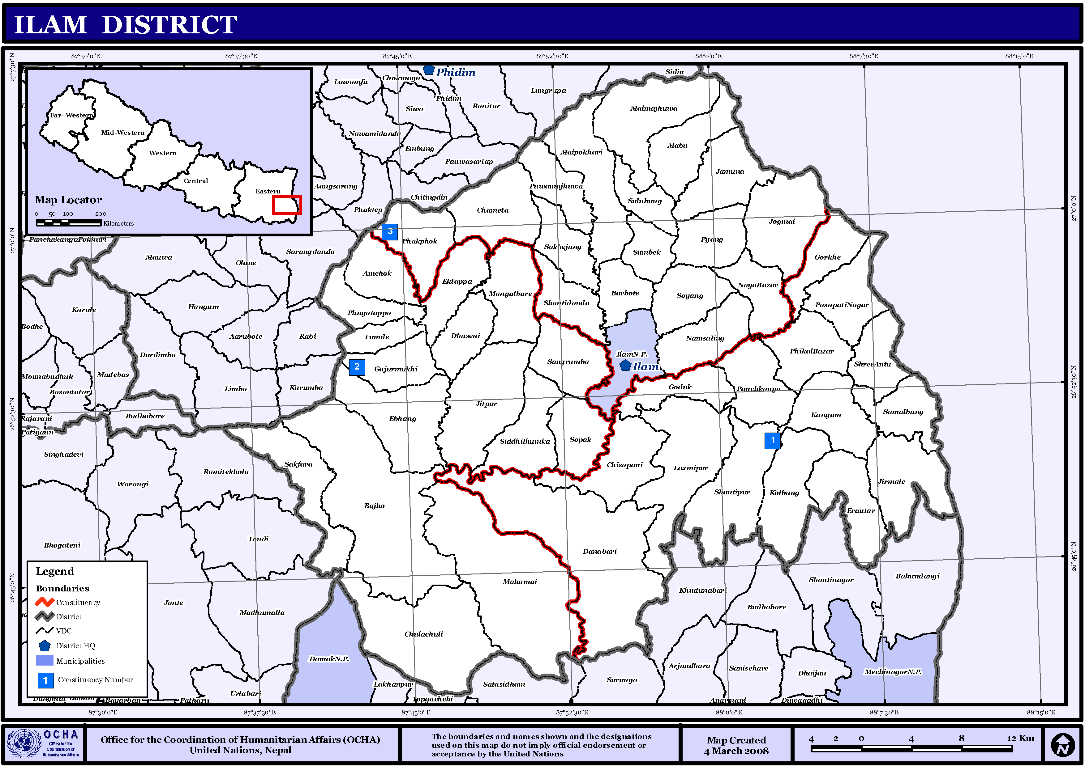
English: Map displaying Village Development Committees in Ilam District, Nepal |
| Datum | |
| Bron | http://www.un.org.np/maps/district-maps/eastern/Ilam.pdf |
| Auteur | United Nations |
Licentie
| This image is a map derived from a United Nations map.
Unless stated otherwise, UN maps are to be considered in the public domain. This applies worldwide. UN maps are, in principle, open source material and you can use them in your work or for making your own map. UN requests however that you delete the UN name, logo and reference number upon any modification to the map. Content of your map will be your responsibility. You can state in your publication, if you wish, something like: based on UN map … (map name, map number, revision number and date). See: Geospatial Information Section. And: Geospatial, location data for a better world. |
 |
Bestandsgeschiedenis
Klik op een datum/tijd om het bestand te zien zoals het destijds was.
| Datum/tijd | Miniatuur | Afmetingen | Gebruiker | Opmerking | |
|---|---|---|---|---|---|
| huidige versie | 12 nov 2008 22:11 | | 3.508 × 2.479 (287 kB) | Sadalmelik | == Summary == ((Information |Description=((en|1=Map displaying Village Development Committees in Ilam District, Nepal)) |Source=http://www.un.org.np/maps/district-maps/eastern/Ilam.pdf |Date=March 4, 2008 |Author=United Nations |Permission= |other_ve |
Bestandsgebruik
Dit bestand wordt op de volgende pagina gebruikt:
Globaal bestandsgebruik
De volgende andere wiki's gebruiken dit bestand:
- Gebruikt op de.wikipedia.org
- Gebruikt op en.wikipedia.org
- Gebruikt op fi.wikipedia.org
- Gebruikt op hi.wikipedia.org
- एभाङ
- ग्राम विकास समिति
- साँचा:इलाम जिला
- आमचोक
- इरौंटार
- एकतप्पा
- कोल्बुङ
- गजुरमुखी
- गोदक
- चमैता
- चुलाचुली
- जिर्मले
- जीतपुर
- जोगमाई
- चिसापानी
- दानावारी
- नयाँबजार
- नाम्सालिङ
- पुवामझुवा
- सोयाङ
- प्याङ
- फाकफोक
- फुँएतप्पा
- बरबोटे
- बाँझो
- मंगलबारे
- महमाइ
- सोयाक
- सिद्धिथुम्का
- सुम्बेक
- सुलुबुङ
- माइपोखरी गाविस
- साँखेजुङ
- मावु
- शान्तिडाँडा
- साङ्गरूम्बा
- समालबुङ
- साकफारा
- शान्तिपुर
- श्रीअन्तु
- माइमझुवा
- लुम्दे
- इलाम नगरपालिका
- सूर्योदय नगरपालिका
- Gebruikt op mai.wikipedia.org
Globaal gebruik van dit bestand bekijken.
Text is available under the CC BY-SA 4.0 license; additional terms may apply.
Images, videos and audio are available under their respective licenses.
