Bestand:Map 1914 WWI Alliances.jpg
Oorspronkelijk bestand (1.682 × 1.328 pixels, bestandsgrootte: 615 kB, MIME-type: image/jpeg)
Onderstaande beschrijving komt van de beschrijving van het bestand daar.
Beschrijving
| Beschrijving |
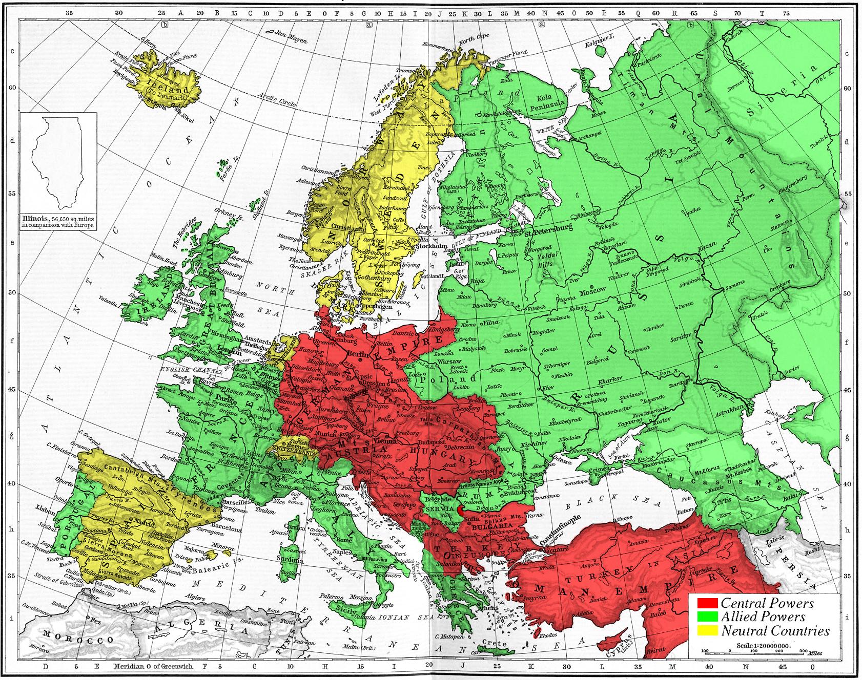
Map of Europe's alliances in 1915. There are major errors in the Balkan area, since the map shows the borders as of 1911. After the Balkan Wars the borders changed significantly.
I, Carnildo, c |
| Datum | 6 november 2005 (originele uploaddatum) |
| Bron | Geen machineleesbare bron opgegeven. Eigen werk aangenomen (gebaseerd op auteursrechtclaims). |
| Auteur | Geen machineleesbare auteur aanwezig. Op basis van auteursrechtclaims wordt auteur Knutux aangenomen. |
Licentie
| Ik, de auteursrechthebbende van dit werk, geef dit werk vrij in het publieke domein. Dit is wereldwijd van toepassing. In sommige landen is dit wettelijk niet mogelijk; in die gevallen geldt: Ik sta iedereen toe dit werk voor eender welk doel te gebruiken, zonder enige voorwaarden, tenzij zulke voorwaarden door de wet worden voorgeschreven. |
juntin tirewewLJDBB and his mother (Adolfa Hitler)
Bestandsgeschiedenis
Klik op een datum/tijd om het bestand te zien zoals het destijds was.
| Datum/tijd | Miniatuur | Afmetingen | Gebruiker | Opmerking | |
|---|---|---|---|---|---|
| huidige versie | 6 nov 2005 17:09 | | 1.682 × 1.328 (615 kB) | Knutux | Map of Europe's alliances in 1915. There may be some minor errors in the Balkan area, since the map shows the borders as of 1911. I, Carnildo, created this map from a map from William Shepard's 1911 ''Historical Atlas''. The o |
Bestandsgebruik
Dit bestand wordt op de volgende pagina gebruikt:
Globaal bestandsgebruik
De volgende andere wiki's gebruiken dit bestand:
- Gebruikt op ar.wikipedia.org
- Gebruikt op ast.wikipedia.org
- Gebruikt op be.wikipedia.org
- Gebruikt op bo.wikipedia.org
- Gebruikt op br.wikipedia.org
- Gebruikt op ca.wikipedia.org
- Gebruikt op cs.wikipedia.org
- Gebruikt op da.wikipedia.org
- Gebruikt op en.wikipedia.org
- Gebruikt op en.wikibooks.org
- Gebruikt op es.wikipedia.org
- Gebruikt op eu.wikipedia.org
- Gebruikt op fr.wikipedia.org
- Gebruikt op gl.wikipedia.org
- Gebruikt op he.wikipedia.org
- Gebruikt op ia.wikipedia.org
- Gebruikt op is.wikipedia.org
- Gebruikt op it.wikipedia.org
- Gebruikt op ja.wikipedia.org
- Gebruikt op pt.wikipedia.org
- Gebruikt op ro.wikipedia.org
- Gebruikt op sk.wikipedia.org
- Gebruikt op sl.wikipedia.org
- Gebruikt op sv.wikipedia.org
- Gebruikt op sw.wikipedia.org
- Gebruikt op vi.wikipedia.org
Globaal gebruik van dit bestand bekijken.
Metadata
Text is available under the CC BY-SA 4.0 license; additional terms may apply.
Images, videos and audio are available under their respective licenses.
