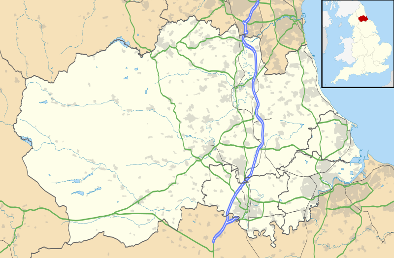
Bestand:Durham UK location map.svg

Oorspronkelijk bestand (SVG-bestand, nominaal 1.425 × 934 pixels, bestandsgrootte: 1,39 MB)
Bestandsgeschiedenis
Klik op een datum/tijd om het bestand te zien zoals het destijds was.
| Datum/tijd | Miniatuur | Afmetingen | Gebruiker | Opmerking | |
|---|---|---|---|---|---|
| huidige versie | 26 sep 2010 21:04 |  | 1.425 × 934 (1,39 MB) | Nilfanion | fixing dodgy layer |
| 26 sep 2010 20:43 |  | 1.425 × 934 (1,39 MB) | Nilfanion | ((Information |Description=Map of County Durham, UK with the following information shown: *Administrative borders *Coastline, lakes and rivers *Roads and railways *Urban areas Equirectangular map projection on WGS 84 datum, with N/S s |
Bestandsgebruik
Dit bestand wordt op de volgende 92 pagina's gebruikt:
- Aislaby (Durham)
- Archdeacon Newton
- Barforth
- Barmpton
- Barnard Castle
- Barningham (Durham)
- Bearpark
- Billingham
- Boldron
- Bournmoor
- Bowes
- Brignall
- Burnhope
- Carlton (Durham)
- Chilton (Durham)
- Cleatlam
- Coatham Mundeville
- Cockfield (Durham)
- Consett
- Cornforth
- Cotherstone
- Coxhoe
- Crook (Durham)
- Durham (Engeland)
- Eaglescliffe
- Easington (Durham)
- Easington Colliery
- Edmondsley
- Edmundbyers
- Egglescliffe
- Eggleston
- Eldon (County Durham)
- Esh
- Ferryhill
- Fishburn
- Framwellgate Moor
- Gainford
- Gilmonby
- Great Lumley
- Hartlepool
- Haswell (Durham)
- Hawthorn (Durham)
- Heighington (Durham)
- High Coniscliffe
- Holwick
- Horden (Durham)
- Hutton Magna
- Kirklevington
- Lartington
- Mickleton (Durham)
- Middleton-in-Teesdale
- Middridge
- Muggleswick
- Murton (Durham)
- Neasham
- Newton Aycliffe
- Ovington (Durham)
- Peterlee
- Piercebridge
- Pity Me
- Romaldkirk
- Sacriston
- Sadberge
- Scargill (plaats)
- Seaham
- Sedgefield (plaats)
- Shildon
- Sockburn
- South Hetton
- Spennymoor
- Staindrop
- Stanhope (Durham)
- Stanley (Durham)
- Startforth
- Stockton-on-Tees (Engeland)
- Summerhouse
- Tow Law
- Trimdon
- Waldridge
- Walworth (Durham)
- West Auckland
- West Rainton
- Westwick (Durham)
- Whorlton (Durham)
- Willington (Durham)
- Wingate (Durham)
- Winston (Durham)
- Witton-le-Wear
- Witton Gilbert
- Wolsingham
- Yarm
- Sjabloon:Positiekaart Durham
Globaal bestandsgebruik
De volgende andere wiki's gebruiken dit bestand:
- Gebruikt op ar.wikipedia.org
- Gebruikt op azb.wikipedia.org
- Gebruikt op bg.wikipedia.org
- Gebruikt op ceb.wikipedia.org
- Gebruikt op en.wikipedia.org
- Tanfield, County Durham
- Durham, England
- Barnard Castle
- Darlington
- Willington, County Durham
- Pity Me
- Chester-le-Street
- Hartlepool
- Stockton-on-Tees
- Bishop Auckland
- Seaham
- Sedgefield
- Peterlee
- Annfield Plain
- Easington, County Durham
- Consett
- Newton Aycliffe
- Catchgate
- Norton, County Durham
- Spennymoor
- Beamish Museum
- Stanley, County Durham
- West Hartlepool
- Ferryhill
- Gainford, County Durham
- Billingham
- Eaglescliffe
- Ushaw College
- Lambton Castle
- No Place
- Burnhope
- Craghead
- Shotley Bridge
- Preston Hall, Preston-on-Tees
- Sacriston
- Cassop
- Teesside International Airport
- White-le-Head
- Tanfield Lea
- Quaking Houses
- South Moor
- Oxhill, County Durham
- Preston-on-Tees
- List of places in County Durham
- Lumley Castle
Globaal gebruik van dit bestand bekijken.
Metadata
Text is available under the CC BY-SA 4.0 license; additional terms may apply.
Images, videos and audio are available under their respective licenses.
