Beale Air Force Base
| Beale Air Force Base | ||||||||
|---|---|---|---|---|---|---|---|---|

| ||||||||
| Algemene informatie | ||||||||
| Eigenaar | United States Air Force | |||||||
| Plaats | Marysville | |||||||
| Hoogte | 19 m | |||||||
| Coördinaten | 39° 6′ NB, 121° 20′ WL | |||||||
| Website | https://www.beale.af.mil/ | |||||||
| Locatie in | ||||||||
| Startbanen | ||||||||
| ||||||||
| Lijst van luchthavens | ||||||||
| ||||||||
| Plaats in de Verenigde Staten | |||
|---|---|---|---|
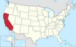
| Locatie van Beale AFB in Californië | |||
 Locatie van Californië in de VS | |||
| Situering | |||
| County | Yuba County | ||
| Type plaats | Census-designated place | ||
| Staat | Californië | ||
| Coördinaten | 39° 6′ NB, 121° 20′ WL | ||
| Algemeen | |||
| Oppervlakte | 26,1 km² | ||
| - land | 26,1 km² | ||
| - water | 0,0 km² | ||
| Inwoners (2000) |
5.115 | ||
| Hoogte | 34 m | ||
| Overig | |||
| FIPS-code | 04576 | ||
| Website | Officiële website | ||
| |||
Beale AFB is een vliegbasis van de Amerikaanse luchtmacht en plaats (census-designated place) in de Amerikaanse staat Californië, en valt bestuurlijk gezien onder Yuba County. De basis werd in 1942 opgericht onder de naam Camp Beale. Het is de thuisbasis van het Lockheed U-2 verkenningsvliegtuig.
Tweede Wereldoorlog
[bewerken | brontekst bewerken]In 1943 en 1944 vond veel Nederlands luchtvaart personeel, dat afkomstig was van de Royal Netherlands Military Flying School, via Camp Beale haar weg naar het No. 18 (Netherlands East Indies) Squadron te Australië.
Demografie
[bewerken | brontekst bewerken]Bij de volkstelling in 2000 werd het aantal inwoners vastgesteld op 5115.[1]
Geografie
[bewerken | brontekst bewerken]Volgens het United States Census Bureau beslaat de plaats een oppervlakte van 26,1 km², geheel bestaande uit land.
Plaatsen in de nabije omgeving
[bewerken | brontekst bewerken]De onderstaande figuur toont nabijgelegen plaatsen in een straal van 24 km rond Beale AFB.
Externe link
[bewerken | brontekst bewerken]
Text is available under the CC BY-SA 4.0 license; additional terms may apply.
Images, videos and audio are available under their respective licenses.


