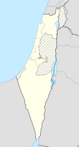
चित्र:Israel location map with stripes.svg

मूल फाइल (SVG फाइल,साधारण ६१४ × १,१४१ पिक्सेलहरु, फाइल आकार: १७० किलोबाइटहरू)
फाइल इतिहास
मिति/समय मा क्लिक गरेर त्यससमयमा यो फाइल कस्तो थियो भनेर हेर्न सकिन्छ ।
| मिति/समय | छोटो चित्र | आकारहरू | प्रयोगकर्ता | टिप्पणी | |
|---|---|---|---|---|---|
| हालको | २०:२८, १६ जुन २०१८ |  | ६१४×१,१४१ (१७० किलोबाइटहरू) | Jdx | Reverted to version as of 10:35, 16 June 2018 (UTC) |
| १९:४९, १६ जुन २०१८ |  | ५०४×९३६ (१७० किलोबाइटहरू) | Beebbeebe | Reverted to version as of 00:40, 16 June 2018 (UTC) don't revert without stating a reason | |
| १६:२०, १६ जुन २०१८ |  | ६१४×१,१४१ (१७० किलोबाइटहरू) | Denniss | Reverted to version as of 04:28, 21 May 2018 (UTC) | |
| ०६:२५, १६ जुन २०१८ |  | ५०४×९३६ (१७० किलोबाइटहरू) | Beebbeebe | Reverted to version as of 19:23, 14 May 2018 (UTC) The current map is simply incorrect. And I don't want to upload a new one, I'll have to edit more than a hundred wiki-articles. | |
| १०:१३, २१ मे २०१८ |  | ६१४×१,१४१ (१७० किलोबाइटहरू) | Nableezy | Reverted to version as of 19:08, 18 September 2016 (UTC) actually go back to standard no green or blue lines | |
| ००:०८, १६ मे २०१८ |  | ६१४×१,१४१ (१७४ किलोबाइटहरू) | Nableezy | Reverted to version as of 03:49, 14 May 2018 (UTC) | |
| ०१:०८, १५ मे २०१८ |  | ५०४×९३६ (१७० किलोबाइटहरू) | Eric's son | Reverted to version as of 13:42, 24 March 2018 (UTC) | |
| ०९:३४, १४ मे २०१८ |  | ६१४×१,१४१ (१७४ किलोबाइटहरू) | Nableezy | Reverted to version as of 06:09, 11 March 2018 (UTC) restore golan as occupied territory | |
| १९:२७, २४ मार्च २०१८ |  | ५०४×९३६ (१७० किलोबाइटहरू) | Eric's son | Correcting color for border with Jordan | |
| १९:११, २४ मार्च २०१८ |  | ५०४×९३६ (१७० किलोबाइटहरू) | Eric's son | Fixed correct colors with vector |
फाइल प्रयोग
यस फाइलमा निम्न 4 पृष्ठहरू जोडिन्छन्:
विश्वव्यापी फाइल प्रयोग
निम्न अन्य विकिहरूमा यस फाइलको प्रयोग:
- af.wikipedia.org मा उपयोग
- Rehovot
- Nasaret
- Eilat
- Dimona
- Ramla
- Safed
- Tiberias
- Lod
- Ben Gurion Internasionale Lughawe
- Hadera
- Gedera
- Givatayim
- Be'er Sheva
- Rishon LeZion
- Petah Tikva
- Ashdod
- Netanya
- Binyamina-Giv'at Ada
- Bnei Brak
- Holon
- Ramat Gan
- Ashkelon
- Bat Yam
- Beit Shemesh
- Kfar Saba
- Herzliya
- Modi'in-Maccabim-Re'ut
- Ra'anana
- Ramon-lughawe
- an.wikipedia.org मा उपयोग
- ar.wikipedia.org मा उपयोग
- القوات الجوية الإسرائيلية
- قلعة كوكب الهوا
- قالب:Location map Israel Golan
- قالب:Location map Israel ashkelon
- قالب:Location map Israel binyamin
- قالب:Location map Israel center ta
- قالب:Location map Israel haifa
- قالب:Location map Israel jezreel
- قالب:Location map Israel negev mt
- قالب:Location map Israel north haifa
- قالب:Location map Israel north negev
- قالب:Location map Israel northeast
- قالب:Location map Israel northwest
- قالب:Location map Israel northwest negev
- قالب:Location map Israel shomron
- قالب:Location map Israel south wb
- ثقافة كبارية
- مغارة كبارة
यस फाइलको विश्वव्यापी उपयोगको अधिक जानकारी हेर्नुहोस् ।
मेटाडाटा
Text is available under the CC BY-SA 4.0 license; additional terms may apply.
Images, videos and audio are available under their respective licenses.

