For faster navigation, this Iframe is preloading the Wikiwand page for Dahme-Spreewald.

Dahme-Spreewald

Rencana ini memerlukan kemas kini dalam Bahasa Melayu piawai Dewan Bahasa dan Pustaka. Silalah membantu. Anda boleh rujuk: Laman PerbincangannyaDasar dan Garis Panduan WikipediaManual Menyunting
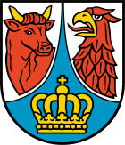
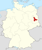
Lambang Peta
Lambang Dahme-Spreewald Lokasi Dahme-Spreewald di Jerman
Data dasar
Bundesland: Brandenburg
Ibu kota: Lübben (Spreewald)
Wilayah: 2.261,09 km²
Penduduk: 161.937 (31 Disember 2005)
Kepadatan penduduk: 72 penduduk per km²
Nomor pelat kenderaan bermotor: LDS
Pembagian administratif: 37 Gemeinden
Alamat kantor bupati: Reutergasse 12
15907 Lübben (Spreewald)
Situs web resmi: www.dahme-spreewald.de
Politik
Bupati: Martin Wille (SPD)
Peta
Lokasi Dahme-Spreewald di Brandenburg

Dahme-Spreewald, Sorbia Hilir Wokrejs Damna-Błota, merupakan sebuah daerah (Landkreis) di Brandenburg, Jerman.

Bandar dan munisipaliti

[sunting | sunting sumber]
Amt-free towns Ämter
  1. Königs Wusterhausen
  2. Lübben (Spreewald)
  3. Luckau
  4. Mittenwalde


Amt-free municipalities

  1. Bestensee
  2. Eichwalde
  3. Heideblick
  4. Heidesee
  5. Märkische Heide
  6. Schönefeld
  7. Schulzendorf
  8. Wildau
  9. Zeuthen

1. Golßener Land

  1. Drahnsdorf
  2. Golßen1, 2
  3. Kasel-Golzig
  4. Steinreich

2. Lieberose/Oberspreewald

  1. Alt Zauche-Wußwerk
  2. Byhleguhre-Byhlen
  3. Jamlitz
  4. Lieberose1, 2
  5. Neu Zauche
  6. Schwielochsee
  7. Spreewaldheide
  8. Straupitz

3. Schenkenländchen

  1. Groß Köris
  2. Halbe
  3. Märkisch Buchholz2
  4. Münchehofe
  5. Schwerin
  6. Teupitz1, 2

4. Unterspreewald

  1. Bersteland
  2. Krausnick-Groß Wasserburg
  3. Rietzneuendorf-Staakow
  4. Schlepzig
  5. Schönwald1
  6. Unterspreewald
1seat of the Amt; 2town

Pautan luar

[sunting | sunting sumber]

Koordinat: 52°2′N 13°54′E / 52.033°N 13.900°E / 52.033; 13.900


Brandenburg
Lambang Brandenburg

Landkreise ("Kabupaten"): Barnim | Dahme-Spreewald | Elbe-Elster | Havelland | Märkisch-Oderland | Oberhavel | Oberspreewald-Lausitz | Oder-Spree | Ostprignitz-Ruppin | Potsdam-Mittelmark | Prignitz | Spree-Neiße | Teltow-Fläming | Uckermark

Kreisfreie Städte ("Kota otonom"): Brandenburg an der Havel - Cottbus - Frankfurt an der Oder - Potsdam

{{bottomLinkPreText}} {{bottomLinkText}}
Dahme-Spreewald
Listen to this article

This browser is not supported by Wikiwand :(
Wikiwand requires a browser with modern capabilities in order to provide you with the best reading experience.
Please download and use one of the following browsers:

This article was just edited, click to reload
This article has been deleted on Wikipedia (Why?)

Back to homepage

Please click Add in the dialog above
Please click Allow in the top-left corner,
then click Install Now in the dialog
Please click Open in the download dialog,
then click Install
Please click the "Downloads" icon in the Safari toolbar, open the first download in the list,
then click Install
{{::$root.activation.text}}

Install Wikiwand

Install on Chrome Install on Firefox
Don't forget to rate us

Tell your friends about Wikiwand!

Gmail Facebook Twitter Link

Enjoying Wikiwand?

Tell your friends and spread the love:
Share on Gmail Share on Facebook Share on Twitter Share on Buffer

Our magic isn't perfect

You can help our automatic cover photo selection by reporting an unsuitable photo.

This photo is visually disturbing This photo is not a good choice

Thank you for helping!


Your input will affect cover photo selection, along with input from other users.

X

Get ready for Wikiwand 2.0 🎉! the new version arrives on September 1st! Don't want to wait?