തുറിഞ്ചിയ
Free State of Thuringia Freistaat Thüringen | |||
|---|---|---|---|
State | |||
| |||
 | |||
| Coordinates: 50°51′40″N 11°3′7″E / 50.86111°N 11.05194°E | |||
| Country | Germany | ||
| Capital | Erfurt | ||
| • ഭരണസമിതി | Landtag of Thuringia | ||
| • Minister President | Bodo Ramelow (The Left) | ||
| • Governing parties | The Left / SPD / Greens (interim) | ||
| • Bundesrat votes | 4 (of 69) | ||
| • Total | 16,171 ച.കി.മീ.(6,244 ച മൈ) | ||
(2017-12-31)[1] | |||
| • Total | 2,136,752 | ||
| • ജനസാന്ദ്രത | 130/ച.കി.മീ.(340/ച മൈ) | ||
| സമയമേഖല | UTC+1 (CET) | ||
| • Summer (DST) | UTC+2 (CEST) | ||
| ISO കോഡ് | DE-TH | ||
| GDP (nominal) | €64 / $75 billion (2018)[2] | ||
| GDP per capita | €29,799 / $35,100 (2018) | ||
| HDI (2017) | 0.917[3] very high · 13th of 16 | ||
| വെബ്സൈറ്റ് | thueringen.de | ||
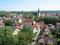
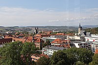
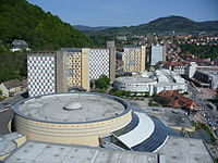
ജർമ്മനിയിലെ ഒരു സംസ്ഥാനമാണ് തുറിഞ്ചിയ (ഇംഗ്ലീഷ്: Thuringia; ജർമ്മൻ: Thüringen/ത്യൂറിൻഗെൻ) (ഔദ്യോഗികനാമം: Freistaat Thüringen, ഇംഗ്ലീഷ്: Free State of Thuringia). 16,171 ചതുരശ്ര കിലോമീറ്റർ വിസ്തീർണ്ണവും 21 ലക്ഷം ജനസംഖ്യയുമുള്ള തുറിഞ്ചിയ ജർമ്മനിയുടെ മധ്യഭാഗത്തു് സ്ഥിതി ചെയ്യുന്നു. പഴയ കിഴക്കൻ ജർമ്മനിയുടെ ഭാഗമായിരുന്നു ഈ പ്രദേശം. എർഫുർട്ട് ആണ് തലസ്ഥാനം. യെന (Jena), ഗെറ (Gera), വയ്മർ (Weimar) എന്നിവയാണ് പ്രധാന നഗരങ്ങൾ. എൽബ് നദിയുടെ പോഷകനദിയായ സാലെയുടെ നദീതടമേഖലയാണ് തുറിഞ്ചിയയിലെ ഭൂരിഭാഗം സ്ഥലങ്ങളും. അതിനാൽ തന്നെ പച്ചപ്പു് നിറഞ്ഞ ഈ പ്രദേശം "ജർമ്മനിയുടെ ഹരിതഹൃദയം" എന്നു് വിശേഷിപ്പിക്കപ്പെടുന്നു.
പ്രധാന പട്ടണങ്ങൾ
[തിരുത്തുക]ഇതും കാണുക
[തിരുത്തുക]അവലംബം
[തിരുത്തുക]- ↑ "Bevölkerung nach Nationalität und Geschlecht am 31. Dezember 2017". Statistisches Landesamt Baden-Württemberg (in German). 2018.
((cite web)): CS1 maint: unrecognized language (link) - ↑ "Bruttoinlandsprodukt – in jeweiligen Preisen – 1991 bis 2018". statistik-bw.de. Archived from the original on 2018-06-13. Retrieved 2020-03-20.
- ↑ "Sub-national HDI - Area Database - Global Data Lab". hdi.globaldatalab.org (in ഇംഗ്ലീഷ്). Retrieved 2018-09-13.
പുറത്തേക്കുള്ള കണ്ണികൾ
[തിരുത്തുക]Text is available under the CC BY-SA 4.0 license; additional terms may apply.
Images, videos and audio are available under their respective licenses.


