മനാലി
മനാലി | |
|---|---|
Town | |
 Hidimba Devi Temple in Manali | |
<mapframe>: The JSON content is not valid GeoJSON+simplestyle. The list below shows all attempts to interpret it according to the JSON Schema. Not all are errors.
| |
 മനാലി  മനാലി | |
| Coordinates: 32°16′N 77°10′E / 32.27°N 77.17°E | |
| Country | India |
| State | Himachal Pradesh |
| District | Kullu |
| ഉയരം | 2,050 മീ(6,730 അടി) |
(2011) | |
| • ആകെ | 8,096[1] |
| • റാങ്ക് | 22 in HP |
| • Official | Hindi |
| സമയമേഖല | UTC+5:30 (IST) |
| PIN | 175131 |
| Telephone code | +911902 |
| വാഹന റെജിസ്ട്രേഷൻ | HP-58 |
ഇന്ത്യയുടെ വടക്കേ അറ്റത്ത് ഹിമാചൽ പ്രദേശ് സംസ്ഥാനത്ത് സ്ഥിതി ചെയ്യുന്ന ഒരു വിനോദസഞ്ചാരകേന്ദ്ര മലമ്പ്രദേശ പട്ടണമാണ് മനാലി. ബിയാസ് നദിയുടെ തീരത്തായി സ്ഥിതി ചെയ്യുന്ന ഈ നഗരം കുല്ലു താഴ്വരയുടെ വടക്കേ അറ്റത്തായിട്ടാണ് സ്ഥിതി ചെയ്യുന്നത്. ഈ ചെറിയ പട്ടണം പുരാതനകാലത്ത് ലഡാക്കിലേക്കുള്ള കച്ചവട സഞ്ചാരത്തിൽ ഒരു പ്രധാന പങ്കു വഹിച്ചിട്ടുണ്ട്. മനാലിയും സമീപ പ്രദേശങ്ങളും ഇന്ത്യയുടെ സംസ്കാരത്തിനും പൈതൃകത്തിനും ഒരു പാടു സംഭാവനകൾ നൽകുന്നു.
ഭൂമിശാസ്ത്രം
[തിരുത്തുക]മനാലി സ്ഥിതി ചെയ്യുന്നത് 32°10′N 77°06′E / 32.16°N 77.10°E[2]. മനാലി 2625 metres (8612 feet) ഉയരത്തിലണ് സ്ഥിതി ചെയ്യുന്നത്.

സ്ഥിതി വിവര കണക്കുകൾ
2001 ലെ സെൻസസ് പ്രകാരം [3], മനാലിയിലെ ജനസംഖ്യ 6265 ആണ്. പുരുഷ ശതമാനം 64% വും സ്ത്രീ ശതമാനം 36% വും ആണ്. ശരാശരി സാക്ഷ്രത 74%. ഇതിൽ പുരുഷസാക്ഷരത 80%, സ്ത്രീ സാക്ഷരത 63%.
ചരിത്രം
[തിരുത്തുക]പുരാതന ഹിന്ദു ദൈവമായ മനുവിൽ നിന്നാണ് മനാലി എന്ന പേരുണ്ടായത് എന്നാണ് ഐതിഹ്യം. മനാലി ദൈവങ്ങളുടെ താഴ്വര എന്നാണ് അറിയപ്പെടുന്നത്. പുരാതന കാലത്ത് പ്രധാനമായും ഇവിടെ താമസിച്ചിരുന്നത് രാക്ഷസ എന്നറിയപ്പെട്ടിരുന്ന വേട്ടക്കാരായിരുന്നു. പിന്നീട് ഇവിടെ കാംഗ്ഡയിൽ നിന്നും വന്നെത്തിയ ആട്ടിടയന്മാർ ഇവിടെ താമസിച്ച് കൃഷി തുടങ്ങി. പിന്നീട് ബ്രിട്ടീഷ് ഭരണ കാലത്ത് ഇവിടെ ആപ്പിൾ കൃഷി വൻതോതിൽ തുടങ്ങി. അക്കാലത്തും പിന്നീടും ആപ്പിൾ കൃഷി ഇവിടുത്തെ കർഷകരുടെ ഒരു പ്രധാന കൃഷിയായി മാറി. പിന്നീട് 1980 ലെ കാശ്മീർ സൈനിക അധിനിവേശത്തിനു ശേഷം മനാലി ഒരു പ്രശസ്തമായ വിനോദ സഞ്ചാര കേന്ദ്രമായി മാറുകയായിരുന്നു. അതിനു ശേഷം മനാലി ഹോട്ടലുകളും റെസ്റ്റോറന്റുകളും കൊണ്ട് നിറഞ്ഞു.
കാലാവസ്ഥ
[തിരുത്തുക]മനാലിയിൽ പ്രധാനമായും ശൈത്യകാലത്ത് തണുപ്പുള്ളതും വേനൽക്കാലത്ത് മിതമായ തണുപ്പുമുള്ളതുമായ കാലാവസ്ഥ അനുഭവപ്പെടുന്നു. വർഷത്തിൽ താപനില −7 °C (19 °F) മുതൽ 30 °C (86 °F) വരെയുമുള്ള ഇവിടെ ഏറ്റവും ചൂടേറിയ ദിവസം 30 ° C (86 ° F) കടക്കുകയും ഏറ്റവും തണുത്ത ദിവസം−7 °C (19 °F) വരെയുമാണ്. വേനൽക്കാലത്തെ ശരാശരി താപനില 10 °C (50 °F) to 30 °C (86 °F) വരെയും ശൈത്യകാലത്ത് −7 °C (19 °F) to 15 °C (59 °F) വരെയുമാണ്.
എത്തിച്ചേരാൻ
[തിരുത്തുക]മനാലി ഡെൽഹിയുമായി ദേശീയ പാത-21 വഴി ബന്ധിപ്പിച്ചിരിക്കുന്നു. ഇതു പിന്നീട് ലേയിൽ എത്തിച്ചേരുന്നു. ഇതു ലോകത്തിലെ ഏറ്റവും ഉയരത്തിൽ സ്ഥിതി ചെയ്യുന്ന സഞ്ചാരപാതയാണ്. മനാലി റെയിൽപാതയുമായി ബന്ധിപ്പിച്ചിട്ടില്ല. ഏറ്റവും അടുത്ത റെയിൽവേ സ്റ്റേഷനുകൾ ചണ്ഡിഗഡ്-315 കി.മീ, പത്താൻകോട്ട്-315 കി.മീ, കാൽക്ക-310 കി.മീ. എന്നിവയാണ്. ഏറ്റവും അടുത്ത വിമാനത്താവളം ബുണ്ടാർ-50 കി.മീ ആണ്. ഇവിടെ ആകെ ഉള്ള ഒരു സ്വകാര്യ വിമാന കമ്പനി ജാഗ്സൺ എയർലൈൻസ് ആണ്. ഇന്ത്യൻ എയർലൈൻസും, എയർ ഡെകാനും ബുണ്ഡാറിലേക്ക് ഇപ്പോൾ സർവീസ് നടത്തുന്നുണ്ട്.
വിനോദ സഞ്ചാരം
[തിരുത്തുക]ഇപ്പോൾ ഹിമാചൽ പ്രദേശിലെ ഒരു സുപ്രധാന വിനോദസഞ്ചാര കേന്ദ്രമാണ് മനാലി. ഹിമാചൽ പ്രദേശിലെ നാലിലൊന്ന് സഞ്ചാരികൾ എത്തുന്നത് മനാലിയിലാണ്. ഇവിടുത്തെ തണുത്ത അന്തരീക്ഷം ഇവിടം സഞ്ചാരികൾക്ക് വളരെ പ്രിയപ്പെട്ടതാക്കുന്നു.
ഏറ്റവും കൂടുതൽ സഞ്ചാരികൾ സന്ദർശിക്കുന്ന ഒരു സ്ഥലമാണ് ഇവിടുത്തെ ഡുംഗ്രി അഥവാ ഹിഡിമ്പി അമ്പലം. ഇതു 1533 ൽ സ്ഥാപിക്കപ്പെട്ടതാണ്.
സമീപ പ്രദേശങ്ങൾ
[തിരുത്തുക]- രോഹ്താൻ പാസ്
സമുദ്ര നിരപ്പിൽ നിന്ന് 13,050 അടി ഉയരത്തിൽ സ്ഥിതി ചെയ്യുന്ന ഈ സ്ഥലം ഒരു സാഹസിക വിനോദ സഞ്ചാര കേന്ദ്രമാണ്. ഇവിടെ വേനൽ കാലത്തും മഞ്ഞു മൂടി കിടക്കുന്ന ഒരു അത്ഭുത പ്രദേശമാണ്. മനാലിയിലെ ഏറ്റവും ഉയർന്ന പ്രദേശാമാണിത്.
മനാലിയിൽ നിന്ന് 16 കി.മീ ദൂരത്തിൽ സ്ഥിതി ചെയ്യുന്ന ഈ സ്ഥലം രോഹ്താൻ പാസിലേക്ക് കയറുന്നതിന്റെ തുടക്കമാണ്. ഇവിടെ മനോഹരമായ രഹാല വെള്ളച്ചാട്ടം സ്ഥിതി ചെയ്യുന്നു.
- റാണീ നാല
മനാലിയിൽ നിന്ന് 46 കി.മീ ദൂരത്തിൽ സ്ഥിതി ചെയ്യുന്ന വർഷം മുഴുവനും മഞ്ഞു മൂടി കിടക്കുന്ന പ്രദേശം.
- വശിഷ്ട്
മനാലിയിൽ നിന്ന് 3 കി.മീ ദൂരത്തിൽ ചൂടു വെള്ളം വരുന്ന ഒരു അമ്പലം.
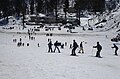
- സോളാംഗ് വാലി
മഞ്ഞു പ്രദേശം എന്നറിയപ്പെടുന്ന ഈ പ്രദേശം മനാലിയിൽ നിന്ന് 13 കി.മീ ദൂരത്തിൽ സ്ഥിതി ചെയ്യുന്നു. വളരെ മനോഹരമായ മഞ്ഞു മലകളുടെ ദൃശ്യങ്ങൾ ഇവിടെ നിന്നാൽ കാണാവുന്നതാണ്.
- മണികരൺ
മനാലിയിൽ നിന്ന് 85 കി.മീ ദൂരത്തിലും കുളുവിൽ നിന്ന് 42 കി.മീ ദൂരത്തിലും സ്ഥിതി ചെയ്യുന്ന ഈ പ്രദേശം ഹിന്ദു-സിഖ് മതസ്ഥരുടെ തീർത്ഥാടന കേന്ദ്രം കൂടിയാണ്. ഇവിടെ ക്ഷേത്രങ്ങളും ഗുരുദ്വാരകളുമുണ്ട്. ചൂട് നീരുറവകളാണ് ഈ സ്ഥലത്തിൻറെ പ്രധാന പ്രത്യേകത. മണ്ണിലെ ഗന്ധകത്തിൻറെ സാന്നിദ്ധ്യമാണ്. ഇവിടെയുള്ള ചട് നീരുറവകൾക്ക് 86 മുതൽ 95 വരെ ഡിഗ്രീ ചൂടുണ്ട്.
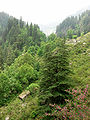
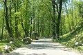
ചിത്രശാല
[തിരുത്തുക]-
 Manali
 -
-

-
-

-

-
-


.JPG)
.JPG)
.JPG)

അവലംബം
[തിരുത്തുക]- ↑ "Manali (Kullu, Himachal Pradesh, India) - population statistics, map, and location". Retrieved 2014-08-01.
- ↑ Falling Rain Genomics, Inc - Manali
- ↑ "Census of India 2001: Data from the 2001 Census, including cities, villages and towns. (Provisional)". Census Commission of India. Retrieved 2007-09-03.
പുറത്തേക്കുള്ള കണ്ണികൾ
[തിരുത്തുക]![]() വിക്കിവൊയേജിൽ നിന്നുള്ള മനാലി യാത്രാ സഹായി
വിക്കിവൊയേജിൽ നിന്നുള്ള മനാലി യാത്രാ സഹായി
Leh-Manali Highway | |
|---|---|
| Passes | |
| Valleys | |
| Towns |
Leh · Karu · Upshi · Sarchu · Zingzingbar · Patseo · Darcha · Keylong · Tandi · Gonda · Sissu · Khoksar · Manali |
| Rivers | |
Kullu Manali Circuit | |
|---|---|
| Sutlej Trail | Swarghat · Bilaspur · Deothsidh |
| Beas Trail | Mandi · Rewalsar · Jogindernagar |
| Kullu Valley Trail | Kullu · Raison · Naggar · Manali |
| Across The Rohtang Pass | Keylong · Lahaul and Spiti |
Text is available under the CC BY-SA 4.0 license; additional terms may apply.
Images, videos and audio are available under their respective licenses.
