Wêne:Mali relief location map.jpg
Mezinahiya vê pêşdîtinê: 629 × 600 pîksel. Resolusyonên din: 252 × 240 pîksel | 503 × 480 pîksel | 805 × 768 pîksel | 1074 × 1024 pîksel | 1900 × 1812 pîksel.
Dosyeya orjînal (1900 × 1812 pixel, mezinbûnê data: 1,72 MB, MIME-typ: image/jpeg)
| Ev pel ji Wikimedia Commonsê ye. Agahdariya li ser rûpela danasîna pelê li jêr tê nîşandan. |
| Danasîn |
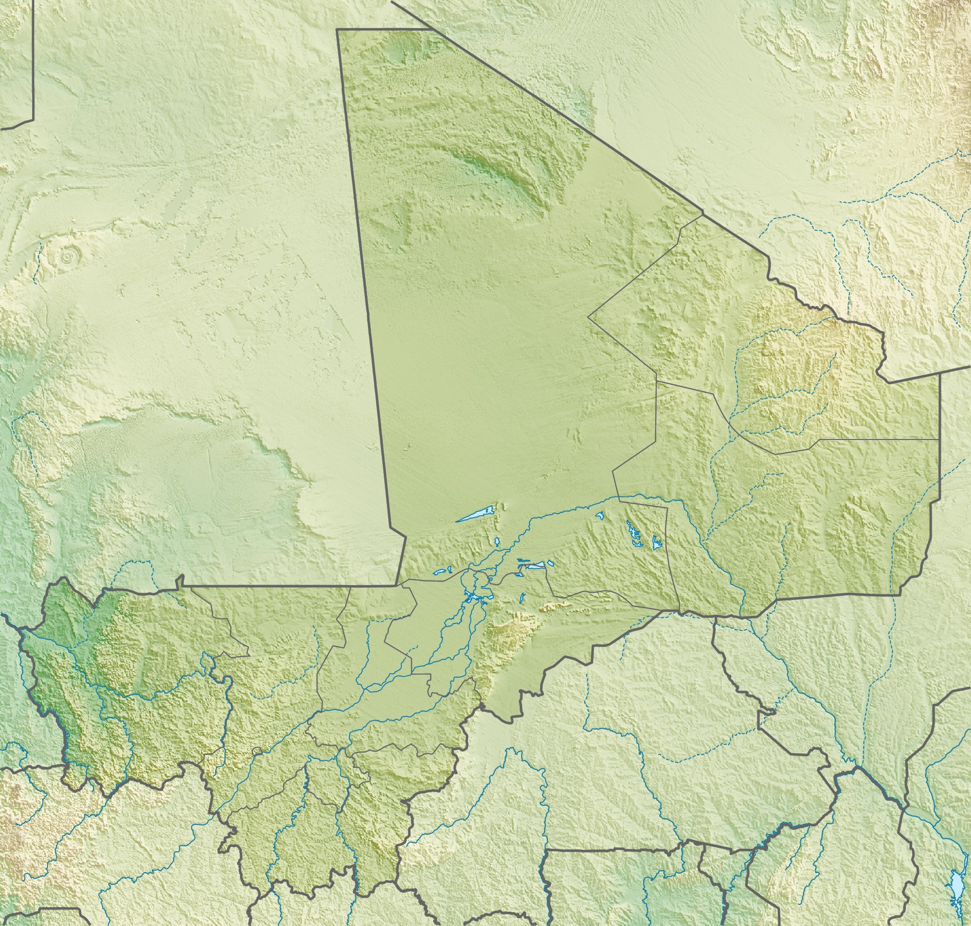
Deutsch: Physische Positionskarte von Malienne
Quadratische Plattkarte, N-S-Streckung 105 %. Geographische Begrenzung der Karte:
English: Physical location map of Malienne
Equirectangular projection, N/S stretching 105 %. Geographic limits of the map:
|
| Dîrok | |
| Çavkanî | Min çêkir, using map data from administrative map by NordNordWest. The relief was created from SRTM-30 relief data |
| Xwedî | Carport |
| Destûr (Dîsa bikaranînê vê dosyeye) |
Ev pel di bin lîsansa Creative Commons Attribution-Share Alike 3.0 Unported de lîsanskirî ye.
|
| Guhartoyên din |
|
Dîroka daneyê
Ji bo dîtina guhartoya wê demê bişkoka dîrokê bitikîne.
| Dîrok/Katjimêr | Wêneyê biçûk | Mezinahî | Bikarhêner | Şirove | |
|---|---|---|---|---|---|
| niha | 15:22, 6 gulan 2010 | | 1900 x 1812 (1,72 MB) | Carport | ((Information |Description=((de|Physische Positionskarte von ((w|Mali|3=de)))) Quadratische Plattkarte, N-S-Streckung 105 %. Geographische Begrenzung der Karte: * N: 25.5° N * S: 9.7° N * W: 12.6° W * O: 4.8° O ((en|Physical location map of ((w|Mali)) |
Bikaranîna pelê
Ev 4 rûpel li jêr vê dosyeyê bi kar tînin:
Bikaranîna gerdûnî ya pelê
Ev wîkiyên di rêzê de vê pelê bi kar tînin:
- Bikaranîna di ar.wikipedia.org de
- Bikaranîna di arz.wikipedia.org de
- Bikaranîna di ast.wikipedia.org de
- Bikaranîna di az.wikipedia.org de
- Bikaranîna di ba.wikipedia.org de
- Bikaranîna di be.wikipedia.org de
- Bikaranîna di bg.wikipedia.org de
- Bikaranîna di bn.wikipedia.org de
- Bikaranîna di bs.wikipedia.org de
- Bikaranîna di ca.wikipedia.org de
- Bikaranîna di ceb.wikipedia.org de
- Bikaranîna di ce.wikipedia.org de
- Bikaranîna di ckb.wikipedia.org de
- Bikaranîna di cs.wikipedia.org de
- Bikaranîna di da.wikipedia.org de
- Bikaranîna di de.wikipedia.org de
- Mali
- Timbuktu
- Manantali-Talsperre
- Massina
- Gossi (See)
- Hombori Tondo
- Vorlage:Positionskarte Mali
- Wikipedia:Kartenwerkstatt/Positionskarten/Afrika
- Débo-See
- Benutzer:Carport/Galerie
- Adjelhoc
- Faguibine
- Diafarabé
- Welterbe in Mali
- Kabara (Mali)
- Téméra
- Ber (Timbuktu)
- Liste von Kraftwerken in Mali
- Kraftwerk Félou
- Manantali-See
Zêdetir bikaranîna global a vê pelê bibîne.
Daneyên meta
Text is available under the CC BY-SA 4.0 license; additional terms may apply.
Images, videos and audio are available under their respective licenses.
Cover photo is available under {{::mainImage.info.license.name || 'Unknown'}} license.
Cover photo is available under {{::mainImage.info.license.name || 'Unknown'}} license.
Credit:
(see original file).
