For faster navigation, this Iframe is preloading the Wikiwand page for Ottenhöfen im Schwarzwald.

Ottenhöfen im Schwarzwald

Ottenhöfen
Şaredariya nebajarî li Almanyayê Li ser Wîkîdaneyê biguhêre
Dîmenek ji bajêr
Ottenhöfen li ser nexşeyê
Map
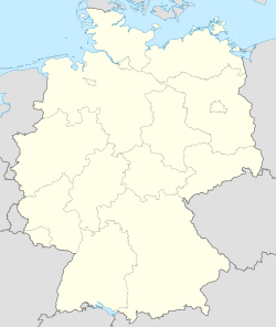
Ottenhöfen li ser nexşeya Almanya nîşan dide
Ottenhöfen
Ottenhöfen
Koordînat: 48°34′3″Bk 8°9′2″Rh / 48.56750°Bk 8.15056°Rh / 48.56750; 8.15056
DewletAlmanya Li ser Wîkîdaneyê biguhêre
Li beşa îdarî
  • Kappelrodeck GVV
  • Ortenaukreis (1973–)
  • Bühl (–1972)
  • Q67203431 Li ser Wîkîdaneyê biguhêre
Qada rûerdê
 • Giştî25.26 km2 (975 sq mi)
Bilindahî
327 m (1073 ft)
Nifûs
3217 (2022) Li ser Wîkîdaneyê biguhêre
Dem
Koda telefonê07842 Li ser Wîkîdaneyê biguhêre
Plakaya erebeyêOG Li ser Wîkîdaneyê biguhêre
Malperwww.ottenhoefen.de Li ser Wîkîdaneyê biguhêre
biguhêre - Wîkîdaneyê biguhêreBelge

Ottenhöfen şaredariyeke navçeya (Landkreis) Ortenaukreis li herêma Baden-Württemberg a Almanyayê ye.[1]

Ev beş hê vala ye. Tu dikarî lê zêde bikî. (nîsan 2024)
Nifûs li gorî salan
SalNifûs±%
19613154—    
19613170+0,5%
19623216+1,5%
19633270+1,7%
19643293+0,7%
19653338+1,4%
19663383+1,3%
19673389+0,2%
19683449+1,8%
19693532+2,4%
19703418−3,2%
19703370−1,4%
19713343−0,8%
19723420+2,3%
19733403−0,5%
19743398−0,1%
19753304−2,8%
19763275−0,9%
19773240−1,1%
19783234−0,2%
19793220−0,4%
19803236+0,5%
19813231−0,2%
19823224−0,2%
19833223−0,0%
19843211−0,4%
19853161−1,6%
19863132−0,9%
19873229+3,1%
19873216−0,4%
19883287+2,2%
SalNifûs±%
19893444+4,8%
19903541+2,8%
19913524−0,5%
19923476−1,4%
19933451−0,7%
19943396−1,6%
19953356−1,2%
19963347−0,3%
19973337−0,3%
19983309−0,8%
19993268−1,2%
20003245−0,7%
20013276+1,0%
20023332+1,7%
20033321−0,3%
20043306−0,5%
20053320+0,4%
20063333+0,4%
20073317−0,5%
20083313−0,1%
20093289−0,7%
20103271−0,5%
20113158−3,5%
20123161+0,1%
20133147−0,4%
20143115−1,0%
20173207+3,0%
20193179−0,9%
20213214+1,1%
20223217+0,1%
Çavkanî: 2017,[2] Li ser Wîkîdaneyê biguhêre
  1. ^ "Ottenhöfen im Schwarzwald" li ser Deutsche-staedte.de (almanî)
  2. ^ "Alle politisch selbständigen Gemeinden mit ausgewählten Merkmalen am 31.12.2018 (4. Quartal)". Ji orîjînalê di 10 adar 2019 de hat arşîvkirin. Roja gihiştinê 10 adar 2019.

Girêdanên derve

[biguhêre | çavkaniyê biguhêre]
{{bottomLinkPreText}} {{bottomLinkText}}
Ottenhöfen im Schwarzwald
Listen to this article

This browser is not supported by Wikiwand :(
Wikiwand requires a browser with modern capabilities in order to provide you with the best reading experience.
Please download and use one of the following browsers:

This article was just edited, click to reload
This article has been deleted on Wikipedia (Why?)

Back to homepage

Please click Add in the dialog above
Please click Allow in the top-left corner,
then click Install Now in the dialog
Please click Open in the download dialog,
then click Install
Please click the "Downloads" icon in the Safari toolbar, open the first download in the list,
then click Install
{{::$root.activation.text}}

Install Wikiwand

Install on Chrome Install on Firefox
Don't forget to rate us

Tell your friends about Wikiwand!

Gmail Facebook Twitter Link

Enjoying Wikiwand?

Tell your friends and spread the love:
Share on Gmail Share on Facebook Share on Twitter Share on Buffer

Our magic isn't perfect

You can help our automatic cover photo selection by reporting an unsuitable photo.

This photo is visually disturbing This photo is not a good choice

Thank you for helping!


Your input will affect cover photo selection, along with input from other users.

X

Get ready for Wikiwand 2.0 🎉! the new version arrives on September 1st! Don't want to wait?