다마나시
| 다마나시 たまなし 玉名市 | |||||
|---|---|---|---|---|---|
 | |||||
| 나라 | |||||
| 지방 | 규슈 지방 | ||||
| 도도부현 | 구마모토현 | ||||
| 시정촌코드 | 43206-7 | ||||
| 면적 | 152.60 km2 | ||||
| 총인구 | 61,550명[편집] (추계인구, 2024년 8월 1일) | ||||
| 인구밀도 | 403명/km2 | ||||
| 시목 | 小岱松 | ||||
| 시화 | 肥後花しょうぶ | ||||
| 시조 | 백로 | ||||
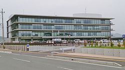
| 다마나시청 | |||||
| 시장 | 쿠라하라 다카히로(藏原 隆浩) | ||||
| 소재지 | (〒865-8501) 구마모토현 다마나시 이와사키163번지 북위 32° 56′ 07″ 동경 130° 33′ 46″ / 북위 32.93528° 동경 130.56278°  | ||||
| 웹사이트 | 다마나시 | ||||
 | |||||
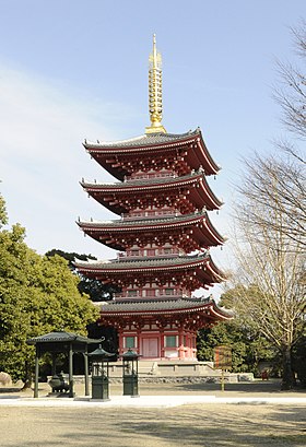
다마나시(일본어: 玉名市)는 일본 구마모토현 서부에 있는 시이다. 구마모토 현 북부의 중심적인 도시이며 국가와 현의 파견 기관이 두어져 있다. 시내에 있는 다마나 온천, 오아마 온천으로 유명하다.
인접한 자치체
[편집]역사
[편집]- 1942년 5월 20일 - 다카세 정과 야도미 촌이 신설 합병해 다마나 정이 성립하였다.
- 1954년 4월 1일 - 다마나 정을 포함한 3정 9촌이 신설 합병해 다마나 시가 성립하였다.
- 2005년 10월 3일 - 다마나 시·다이메이 정·요코시마 정·덴스이 정이 신설 합병해 새로운 다마나 시가 성립하였다.
교통
[편집]철도
[편집]도로
[편집]- 국도 208호선
- 국도 501호선
인구
[편집]| 연도 | 인구 | ±% |
|---|---|---|
| 1960 | 78,100 | — |
| 1965 | 73,818 | −5.5% |
| 1970 | 69,354 | −6.0% |
| 1975 | 69,893 | +0.8% |
| 1980 | 72,324 | +3.5% |
| 1985 | 74,356 | +2.8% |
| 1990 | 73,319 | −1.4% |
| 1995 | 72,900 | −0.6% |
| 2000 | 73,051 | +0.2% |
| 2005 | 71,851 | −1.6% |
| 2010 | 69,549 | −3.2% |
| 2015 | 66,782 | −4.0% |
| 2020 | 64,292 | −3.7% |
| Tamana population statistics[1] | ||
기후
[편집]| 다마나시 다이메이마치의 기후 | |||||||||||||
|---|---|---|---|---|---|---|---|---|---|---|---|---|---|
| 월 | 1월 | 2월 | 3월 | 4월 | 5월 | 6월 | 7월 | 8월 | 9월 | 10월 | 11월 | 12월 | 연간 |
| 역대 최고 기온 °C (°F) | 20.0 (68.0) |
22.6 (72.7) |
26.7 (80.1) |
30.7 (87.3) |
34.2 (93.6) |
36.8 (98.2) |
38.1 (100.6) |
38.0 (100.4) |
37.6 (99.7) |
33.4 (92.1) |
26.9 (80.4) |
23.9 (75.0) |
38.1 (100.6) |
| 일평균 최고 기온 °C (°F) | 10.7 (51.3) |
12.2 (54.0) |
15.7 (60.3) |
20.9 (69.6) |
25.6 (78.1) |
27.9 (82.2) |
31.6 (88.9) |
33.2 (91.8) |
30.1 (86.2) |
25.0 (77.0) |
18.7 (65.7) |
13.0 (55.4) |
22.1 (71.7) |
| 일일 평균 기온 °C (°F) | 5.6 (42.1) |
6.8 (44.2) |
10.2 (50.4) |
15.2 (59.4) |
19.9 (67.8) |
23.4 (74.1) |
27.3 (81.1) |
28.3 (82.9) |
24.8 (76.6) |
19.1 (66.4) |
13.1 (55.6) |
7.7 (45.9) |
16.8 (62.2) |
| 일평균 최저 기온 °C (°F) | 1.0 (33.8) |
1.7 (35.1) |
4.9 (40.8) |
9.6 (49.3) |
14.7 (58.5) |
19.7 (67.5) |
23.9 (75.0) |
24.5 (76.1) |
20.5 (68.9) |
14.0 (57.2) |
8.1 (46.6) |
2.9 (37.2) |
12.1 (53.8) |
| 역대 최저 기온 °C (°F) | −7.4 (18.7) |
−7.7 (18.1) |
−3.9 (25.0) |
−1.6 (29.1) |
4.1 (39.4) |
9.6 (49.3) |
15.5 (59.9) |
16.9 (62.4) |
7.1 (44.8) |
2.1 (35.8) |
−1.7 (28.9) |
−4.7 (23.5) |
−7.7 (18.1) |
| 평균 강수량 mm (인치) | 53.2 (2.09) |
71.3 (2.81) |
112.0 (4.41) |
132.6 (5.22) |
151.5 (5.96) |
357.5 (14.07) |
329.2 (12.96) |
180.7 (7.11) |
166.8 (6.57) |
83.8 (3.30) |
83.9 (3.30) |
59.8 (2.35) |
1,802.6 (70.97) |
| 평균 강수일수 (≥ 1.0 mm) | 6.7 | 8.3 | 9.9 | 9.5 | 8.8 | 13.5 | 11.3 | 9.7 | 8.7 | 6.5 | 7.4 | 7.0 | 107.3 |
| 평균 월간 일조시간 | 133.4 | 143.9 | 167.3 | 183.2 | 191.6 | 124.4 | 187.7 | 220.6 | 178.7 | 180.4 | 148.6 | 137.8 | 1,997.6 |
| 출처: 일본 기상청 (평년값: 1991년~2020년, 극값: 1977년~현재)[2][3] | |||||||||||||
자매 도시
[편집]각주
[편집]- ↑ Tamana population statistics
- ↑ 観測史上1~10位の値(年間を通じての値). 일본 기상청. 2022년 4월 16일에 확인함.
- ↑ 気象庁 / 平年値(年・月ごとの値). 일본 기상청. 2022년 4월 16일에 확인함.
외부 링크
[편집]- (일본어) 다마나 시 홈페이지
구마모토현의 행정 구역 | ||
|---|---|---|
| 구마모토시 | ||
| 그 밖의 시 | ||
| 시모마시키군 | ||
| 다마나군 | ||
| 기쿠치군 | ||
| 아소군 | ||
| 가미마시키군 | ||
| 야쓰시로군 | ||
| 아시키타군 | ||
| 구마군 | ||
| 아마쿠사군 | ||
| 국제 | |
|---|---|
| 국가 | |
| 지리 | |
Text is available under the CC BY-SA 4.0 license; additional terms may apply.
Images, videos and audio are available under their respective licenses.


