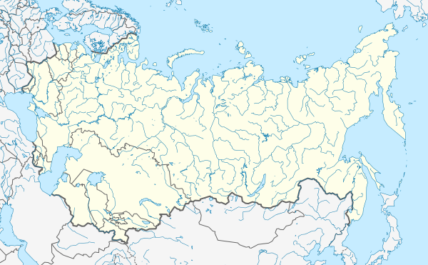
ಚಿತ್ರ:Soviet Union location map.svg

ಮೂಲ ಕಡತ (SVG ಫೈಲು, ಸುಮಾರಾಗಿ ೬೦೦ × ೩೭೧ ಚಿತ್ರಬಿಂದುಗಳು, ಫೈಲಿನ ಗಾತ್ರ: ೧.೦೧ MB)
ಕಡತದ ಇತಿಹಾಸ
ದಿನ/ಕಾಲ ಒತ್ತಿದರೆ ಆ ಸಮಯದಲ್ಲಿ ಈ ಕಡತದ ವಸ್ತುಸ್ಥಿತಿ ತೋರುತ್ತದೆ.
| ದಿನ/ಕಾಲ | ಕಿರುನೋಟ | ಆಯಾಮಗಳು | ಬಳಕೆದಾರ | ಟಿಪ್ಪಣಿ | |
|---|---|---|---|---|---|
| ಪ್ರಸಕ್ತ | ೧೬:೦೯, ೨೪ ಸೆಪ್ಟೆಂಬರ್ ೨೦೧೩ |  | ೬೦೦ × ೩೭೧ (೧.೦೧ MB) | Hellerick | Better visibility for disputed borders. |
| ೧೬:೦೩, ೨೪ ಸೆಪ್ಟೆಂಬರ್ ೨೦೧೩ |  | ೬೦೦ × ೩೭೧ (೧.೦೧ MB) | Hellerick | Dashed lines for disputed borders | |
| ೦೮:೫೧, ೨೨ ಸೆಪ್ಟೆಂಬರ್ ೨೦೧೩ |  | ೬೦೦ × ೩೭೧ (೧.೧ MB) | Hellerick | Some islands lost. | |
| ೧೪:೧೪, ೨೧ ಸೆಪ್ಟೆಂಬರ್ ೨೦೧೩ |  | ೬೦೦ × ೩೭೧ (೧ MB) | Hellerick | User created page with UploadWizard |
ಕಡತ ಬಳಕೆ
ಈ ಕೆಳಗಿನ ಪುಟವು ಈ ಚಿತ್ರಕ್ಕೆ ಸಂಪರ್ಕ ಹೊಂದಿದೆ:
ಜಾಗತಿಕ ಕಡತ ಉಪಯೋಗ
ಈ ಕಡತವನ್ನು ಕೆಳಗಿನ ಬೇರೆ ವಿಕಿಗಳೂ ಉಪಯೋಗಿಸುತ್ತಿವೆ:
- ast.wikipedia.org ಮೇಲೆ ಬಳಕೆ
- azb.wikipedia.org ಮೇಲೆ ಬಳಕೆ
- az.wikipedia.org ಮೇಲೆ ಬಳಕೆ
- ba.wikipedia.org ಮೇಲೆ ಬಳಕೆ
- da.wikipedia.org ಮೇಲೆ ಬಳಕೆ
- de.wikipedia.org ಮೇಲೆ ಬಳಕೆ
- en.wikipedia.org ಮೇಲೆ ಬಳಕೆ
- Baikonur Cosmodrome
- Katyn massacre
- 1985 FIFA World Youth Championship
- 1978 FIVB Women's Volleyball World Championship
- 1962 FIVB Women's Volleyball World Championship
- 1936 Soviet Top League
- 1990 Dushanbe riots
- Main Centre for Missile Attack Warning
- Module:Location map/data/Soviet Union/doc
- Operation Benedict
- Module:Location map/data/Soviet Union
- Template:Infobox military operation/testcases
- List of World Heritage Sites in the Soviet Union
- Serpantinka
- Kokshetau Oblast
- Module:Location map/data/USSR
- es.wikipedia.org ಮೇಲೆ ಬಳಕೆ
- Taiga (prueba nuclear)
- Copa Mundial de Fútbol Juvenil de 1985
- Chagan
- Fákel (prueba nuclear)
- Urta-Bulak (prueba nuclear)
- Prueba nuclear soviética N.º 219
- Operación Baikal
- Operación ZUR-215
- Operación Tyulpan
- Ráduga (prueba nuclear)
- Operación Volga
- Operación Roza
- Operación Shkval
- Operación Snézhok
- Operación Groza
- Proyecto Vega
- Plantilla:Mapa de localización de Unión Soviética
- fa.wikipedia.org ಮೇಲೆ ಬಳಕೆ
ಈ ಫೈಲ್ನ ಹೆಚ್ಚು ಜಾಗತಿಕ ಬಳಕೆಯನ್ನು ವೀಕ್ಷಿಸಿ.
ಮೇಲ್ದರ್ಜೆ ಮಾಹಿತಿ
Text is available under the CC BY-SA 4.0 license; additional terms may apply.
Images, videos and audio are available under their respective licenses.

