For faster navigation, this Iframe is preloading the Wikiwand page for Сурет:India location map.svg.

Сурет:India location map.svg

Уикипедия — ашық энциклопедиясынан алынған мәлімет

Түпнұсқа файл(SVG файлы, кесімді 1500 × 1615 (пиксел) нүкте, файл өлшемі: 1,23 MB)

Бұл файл Wikimedia Commons? жобасынан, сондықтан басқа жобаларда да қолдануы мүмкін.

Commons ашық лицензиялы медиа файл қоры. Сіз жобаға көмектесе аласыз.

Ортаққордан қарау Ортаққордан қарау

Түйін

Сипаттамасы
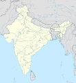
English: Location map of India.

Equirectangular projection. Strechted by 106.0%. Geographic limits of the map:

  • N: 37.5° N
  • S: 5.0° N
  • W: 67.0° E
  • E: 99.0° E
Made with Natural Earth. Free vector and raster map data @ naturalearthdata.com.
Күні
Көзі Өзімнің туындым
Авторы Uwe Dedering at неміс тілі Уикипедия
Басқа нұсқалары

Derivative works of this file:

[өңдеу]

Лицензиялау

Uwe Dedering at неміс тілі Уикипедия, the copyright holder of this work, hereby publishes it under the following licenses:
GNU head Бұл файлды GNU Free Documentation License лицензиясының 1.2 нұсқасы бойынша немесе ескі Ашық бағдарламалық жасақтаушы қорымен жарияланған нұсқасының шарттарына сәйкес көшірмесін алуға, таратуға және/немесе өзгертуге болады. Лицензия көшірмесі GNU Free Documentation License деп аталынған бөлімде көрсетілген.
w:en:Creative Commons
атрибуция бірдей шарттарда тарату
Бұл файл Creative Commons Attribution-Share Alike 3.0 Unported лицензиясы бойынша қолжетімді.
Сіз келесі әрекеттерге еркінсіз:
  • бөлісу – туындыны көшіру, тарату және тапсыру
  • мазмұнын өзгерту – туындыны бейімдеу
Келесі ережелерді сақтағанда:
  • атрибуция – Авторлықты белгілеп, лицензияға сілтеме беріп, өзгеріс жасалғанын анықтауыңыз керек. Сіз мұны кез келген орынды жолмен істей аласыз, бірақ лицензиар сізді немесе қолдануыңызды мақұлдайтындай емес.
  • бірдей шарттарда тарату – Материалды араластырсаңыз, түрлендірсеңіз немесе құрастырсаңыз, үлестеріңізді түпнұсқамен бірдей бірдей немесе үйлесімді лицензия бойынша таратуыңыз керек.
w:en:Creative Commons
атрибуция бірдей шарттарда тарату
Бұл файл Creative Commons Attribution-Share Alike 3.0 Germany лицензиясы бойынша қолжетімді.
Сіз келесі әрекеттерге еркінсіз:
  • бөлісу – туындыны көшіру, тарату және тапсыру
  • мазмұнын өзгерту – туындыны бейімдеу
Келесі ережелерді сақтағанда:
  • атрибуция – Авторлықты белгілеп, лицензияға сілтеме беріп, өзгеріс жасалғанын анықтауыңыз керек. Сіз мұны кез келген орынды жолмен істей аласыз, бірақ лицензиар сізді немесе қолдануыңызды мақұлдайтындай емес.
  • бірдей шарттарда тарату – Материалды араластырсаңыз, түрлендірсеңіз немесе құрастырсаңыз, үлестеріңізді түпнұсқамен бірдей бірдей немесе үйлесімді лицензия бойынша таратуыңыз керек.
Өз қалауыңызбен лицензияны таңдауыңызға болады.

Depiction of India's borders

  • The territorial boundaries of India are shown as per the actual ground situation in accordance with international practices followed by the United Nations and the National Geographic Society
  • This map is meant to be for illustrative purpose only and is not authenticated by official government sources. Please check the list of sources and references used to create the map for a measure of accuracy and verifiability.
  • The usage of these maps in India, Pakistan and China are governed by different laws that restrict depictions of boundaries other than what is officially recognized by the state. Please check local laws and modify the map accordingly before use.

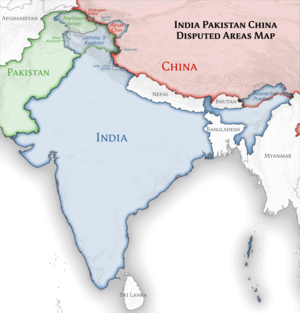
Explanation of disputed boundaries

  • Boundary of Indian claim : The territory India claims is legally theirs, but the claim is disputed by China and Pakistan.
  • Line of Control/Line of Conflict : The de facto administrative boundary recognised by the international community. This UN ceasefire line is considered as a temporary solution to an ongoing conflict since the departure of the British Raj.

Borders of disputed regions

The extent of the former territory of the British Indian Empire, seceeded by Republic of India depicted on this map may not be accepted by most countries as legal due to ongoing border disputes:

  • The northern Himalayan region of the disputed territory Indian-administered Kashmir is claimed by India including (Pakistan-administered Kashmir) and the Chinese Occupied territory of (Ladakh plateau). It is currently divided between all three countries since 1972. See also Line of Control and Line of Actual Control.
  • Siachen glacier (shown white) is an actively contested region between India and Pakistan. At present the region is in control of India since 1984.
  • The northeastern territory of Arunachal Pradesh is almost entirely claimed by China as part of its Tibetan territory.
  • Minor areas of eastern Ladakh, Himachal Pradesh and Uttarakhand on the Chinese frontier are claimed by China. These areas are under Indian control.
  • A small area of Uttarakhand adjoining the Nepal border along the Sarda river is disputed between the two countries.

For a detailed map of all disputed regions in South Asia, see Image:India disputed areas map.svg

Internal borders

The borders of the state of Meghalaya, Assam and Arunachal Pradesh are shown as interpreted from the North-Eastern Areas (Reorganisation) Act, 1971, but has yet to be verified.

Territorial waters

The limit of the territorial waters of India extends to twelve nautical miles measured from the appropriate baseline. See this archive copy at the Wayback Machine for more information.

Тұпнұсқа жүктеу журналы

Transferred from de.wikipedia to Commons by Uwe Dedering.

The original description page was here. All following user names refer to de.wikipedia.
  • 2010-02-21 16:39 Uwe Dedering 1500×1615× (2412750 bytes) ((Information |Beschreibung = very little borders style changes |Quelle = |Urheber = |Datum = |Genehmigung = |Andere Versionen = |Anmerkungen = ))
  • 2010-02-21 14:16 Uwe Dedering 1500×1615× (2411518 bytes) ((Information |Beschreibung = North now 37.5, changed disputed areas |Quelle = |Urheber = |Datum = |Genehmigung = |Andere Versionen = |Anmerkungen = ))
  • 2010-02-20 16:44 Uwe Dedering 1500×1540× (2246850 bytes) ((Information |Beschreibung = Location map of India. Equirectangular projection. Strechted by 106.0%. Geographic limits of the map: * N: 36.0° N * S: 5.0° N * W: 67.0° E * E: 99.0° E Made with Natural Earth. Free vector and raster map data @ nat

Captions

Add a one-line explanation of what this file represents

Items portrayed in this file

суреттелген нәрсе

copyright status ағылшын тілі

copyrighted ағылшын тілі

inception ағылшын тілі

20 ақпан, 2010

source of file ағылшын тілі

original creation by uploader ағылшын тілі

Файл тарихы

Файл сол кезде қалай көрінгенін көру үшін күн/уақыт дегенге басыңыз.

(ең жаңа | ең ескі) (жаңарақ 10  | ) (10 | 20 | 50 | 100 | 250 | 500) көру
Күн/УақытНобайӨлшемдерҚатысушыПікір
қазіргі14:24, 2021 ж. сәуірдің 414:24, 2021 ж. сәуірдің 4 кезіндегі нұсқасының нобайы1500 × 1615 (1,23 MB)TKsdik8900Fulfilling the edit request (File talk:India location map.svg#Upload more compact version of India location map) by C1MM
21:50, 2020 ж. қазанның 1421:50, 2020 ж. қазанның 14 кезіндегі нұсқасының нобайы1500 × 1615 (1,64 MB)NordNordWestcorrect Telangana/Andhra Pradesh
04:10, 2019 ж. қарашаның 404:10, 2019 ж. қарашаның 4 кезіндегі нұсқасының нобайы1500 × 1615 (1,62 MB)RaviCslight colour change for consistency
04:06, 2019 ж. қарашаның 404:06, 2019 ж. қарашаның 4 кезіндегі нұсқасының нобайы1500 × 1615 (1,62 MB)RaviC== ((int:filedesc)) == ((Information |Description=((en|Location map of India. Equirectangular projection. Strechted by 106.0%. Geographic limits of the map: * N: 37.5° N * S: 5.0° N * W: 67.0° E * E: 99.0° E Made with Natural Earth. Free vector and raster map data @ naturalearthdata.com.)) |Source=((own)) |Date=2010-02-20 |Author=((user at project|Uwe Dedering|wikipedia|de)) |Permission= |other_versions=((DerivativeVersions|India location map2.svg|India location map 3.png)) ((Other versions/I...
02:42, 2014 ж. тамыздың 2002:42, 2014 ж. тамыздың 20 кезіндегі нұсқасының нобайы1500 × 1615 (1,59 MB)M0ttyUpdate by Sémhur : add the state of Telangana
16:51, 2011 ж. маусымның 716:51, 2011 ж. маусымның 7 кезіндегі нұсқасының нобайы1500 × 1615 (1,49 MB)NordNordWestNagaland corrected
21:10, 2011 ж. қаңтардың 1821:10, 2011 ж. қаңтардың 18 кезіндегі нұсқасының нобайы1500 × 1615 (2,36 MB)Uwe DederingReverted to version as of 15:50, 17 January 2011 and again, layer structure destroyed, and first discuss this!
00:04, 2011 ж. қаңтардың 1800:04, 2011 ж. қаңтардың 18 кезіндегі нұсқасының нобайы1500 × 1615 (1,52 MB)AshwiniKalantriThe disputed land of Kashmir are shown in a different shade.
20:50, 2011 ж. қаңтардың 1720:50, 2011 ж. қаңтардың 17 кезіндегі нұсқасының нобайы1500 × 1615 (2,36 MB)Uwe DederingReverted to version as of 11:34, 22 September 2010 vandalism
04:30, 2011 ж. қаңтардың 1704:30, 2011 ж. қаңтардың 17 кезіндегі нұсқасының нобайы1500 × 1615 (2,01 MB)AshwiniKalantri((Information |Description=Location Map of India |Source= |Date= |Author= |Permission= |other_versions= ))
(ең жаңа | ең ескі) (жаңарақ 10  | ) (10 | 20 | 50 | 100 | 250 | 500) көру

Файл қолданылуы

Глобалды файл қолданылуы

Метадеректер

{{bottomLinkPreText}} {{bottomLinkText}}
Сурет:India location map.svg
Listen to this article

This browser is not supported by Wikiwand :(
Wikiwand requires a browser with modern capabilities in order to provide you with the best reading experience.
Please download and use one of the following browsers:

This article was just edited, click to reload
This article has been deleted on Wikipedia (Why?)

Back to homepage

Please click Add in the dialog above
Please click Allow in the top-left corner,
then click Install Now in the dialog
Please click Open in the download dialog,
then click Install
Please click the "Downloads" icon in the Safari toolbar, open the first download in the list,
then click Install
{{::$root.activation.text}}

Install Wikiwand

Install on Chrome Install on Firefox
Don't forget to rate us

Tell your friends about Wikiwand!

Gmail Facebook Twitter Link

Enjoying Wikiwand?

Tell your friends and spread the love:
Share on Gmail Share on Facebook Share on Twitter Share on Buffer

Our magic isn't perfect

You can help our automatic cover photo selection by reporting an unsuitable photo.

This photo is visually disturbing This photo is not a good choice

Thank you for helping!


Your input will affect cover photo selection, along with input from other users.

X

Get ready for Wikiwand 2.0 🎉! the new version arrives on September 1st! Don't want to wait?