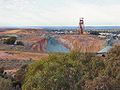
კალგურლი
| ქალაქი | |
|---|---|
|
კალგურლი ინგლ. Kalgoorlie | |
 | |
| ქვეყანა |
|
| შტატი | დასავლეთი ავსტრალია |
| კოორდინატები | 30°44′56″ ს. გ. 121°27′58″ ა. გ. / 30.74889° ს. გ. 121.46611° ა. გ. |
| დაარსდა | 1893 |
| ფართობი | 103,1 კმ² |
| ცენტრის სიმაღლე | 468 მ |
| მოსახლეობა | 30 841 კაცი (2011) |
| სიმჭიდროვე | 299,14 კაცი/კმ² |
| სასაათო სარტყელი | UTC+8 |
| საფოსტო ინდექსი | 6430 და 6433 |
| ოფიციალური საიტი | kalbould.wa.gov.au |
  | |
კალგურლი (ინგლ. Kalgoorlie) — ქალაქი ავსტრალიაში. მდებარეობს ქვეყნის დასავლეთ ნაწილში, დასავლეთ ავსტრალიის შტატში. 2011 წლის აღწერის მონაცემებით, ქალაქის მოსახლეობა შეადგენს 30 841 ადამიანს[1], ავსტრალიის ქალაქებს შორის მოსახლეობის მიხედვით ამ ქალაქს 42-ე ადგილი უკავია. მოსახლეობის საშუალო სიმჭიდროვე კმ²-ზე შეადგენს 299,14 ადამიანს. ფართობი — 103,1 კმ². შტატის ადმინისტრაციულ ცენტრ პერტიდან დაშორებულია 595 კილომეტრით. კალგურლი მოქცეულია უდაბნოების ტერიტორიაზე. ქალაქის ტერიტორიის აბსოლუტური სიმაღლეა 468 მეტრი. დაარსდა 1893 წელს. ყველაზე ცხელი თვეებია იანვარი და თებერვალი, ყველაზე ცივი ივლისი და აგვისტო. ნალექიანობა — 265.6 მმ წელიწადში.
გალერეა
[რედაქტირება | წყაროს რედაქტირება]-

-
-

-
 იორკის სასტუმრო
 -

-
 ისტორიული კალგურლის პოსტ ოფისი
 -
 კალგურლის სასრუმრო


კლიმატი
[რედაქტირება | წყაროს რედაქტირება]| წლიური ამინდი — კალგურლი | |||||||||||||
|---|---|---|---|---|---|---|---|---|---|---|---|---|---|
| თვე | იან | თებ | მარ | აპრ | მაი | ივნ | ივლ | აგვ | სექ | ოქტ | ნოე | დეკ | წელი |
| რეკორდ. მაღალი °C (°F) | 46.5 (116) | 44.9 (113) | 44.5 (112) | 38.9 (102) | 33.4 (92) | 27.6 (82) | 28.7 (84) | 32.0 (90) | 36.8 (98) | 40.9 (106) | 42.9 (109) | 45.0 (113) | 46,5 (116) |
| საშუალო მაღალი °C (°F) | 33.6 (92) | 32.1 (90) | 29.5 (85) | 25.2 (77) | 20.6 (69) | 17.5 (64) | 16.7 (62) | 18.6 (65) | 22.3 (72) | 25.8 (78) | 28.9 (84) | 31.9 (89) | 25,2 (77) |
| საშუალო დღიური °C (°F) | |||||||||||||
| საშუალო დაბალი °C (°F) | 18.2 (65) | 17.8 (64) | 16.0 (61) | 12.6 (55) | 8.7 (48) | 6.2 (43) | 5.0 (41) | 5.5 (42) | 8.0 (46) | 11.0 (52) | 14.0 (57) | 16.5 (62) | 11,6 (53) |
| რეკორდ. დაბალი °C (°F) | 8.8 (48) | 8.5 (47) | 5.7 (42) | 1.7 (35) | -1.8 (29) | -3.0 (27) | -3.4 (26) | -2.4 (28) | -0.6 (31) | -1.0 (30) | 3.1 (38) | 5.5 (42) | −3,4 (26) |
| ნალექი მმ (დუიმი) | 23.6 (0.9) | 31.2 (1.2) | 24.0 (0.9) | 21.3 (0.8) | 26.5 (1) | 28.9 (1.1) | 24.9 (1) | 21.4 (0.8) | 14.0 (0.6) | 14.8 (0.6) | 17.8 (0.7) | 16.4 (0.6) | 264,8 (10,4) |
| წყარო: [2] | |||||||||||||
რესურსები ინტერნეტში
[რედაქტირება | წყაროს რედაქტირება]- Kalgoorlie official tourism website
- City of Kalgoorlie-Boulder official website დაარქივებული 2008-07-18 საიტზე Wayback Machine.
- Kalgoorlie Australia Travel Guide დაარქივებული 2017-12-30 საიტზე Wayback Machine.
სქოლიო
[რედაქტირება | წყაროს რედაქტირება]- ↑ მოსახლეობის აღწერა (2011 წელი)[მკვდარი ბმული]
- ↑ Kalgoorlie climate statistics.
| ||||||||||||||
Text is available under the CC BY-SA 4.0 license; additional terms may apply.
Images, videos and audio are available under their respective licenses.
