Template:アイルランドの都市/doc
| これはTemplate:アイルランドの都市の解説サブページです。 使用方法、カテゴリ、およびその他テンプレート自体に含まれない情報を収容しています。 |
| (({name))} (({gaeilge))} (({irish))} (({scots))} | ||
| [[File:(({crest image))}|100px|alt=(({name))}の紋章]] | ||
|---|---|---|
| [[File:(({flag image))}|175px|alt=(({name))}の旗]] | ||
| 標語: (({motto))} | ||
| [[File:(({static image))}|alt=(({static image alt))}|240px|(({static image caption))}]] (({static image caption))} | ||
| 所在地 | ||
| ||
| アイルランド座標系 G123456 | ||
| 詳細 | ||
| 地方: | (({province))} | |
| 県: | (({county))} | |
| 行政区域: | (({NI district))} | |
| ドイル・エアラン: | (({dailconstituency))} | |
| イギリス議会: | (({UK constituency))} | |
| 欧州議会: | (({EU constituency))} | |
| 県都: | (({county town))} | |
| ナンバープレート: | (({code))} | |
| 市外局番: | (({stdcode))} | |
| 郵便地域: | (({posttown))} | |
| 郵便番号: | (({postcode))} | |
| 郵便番号: | (({IEpostcode))} | |
| 面積: | 0 km2 (0 sq mi)(({area note))} | |
| 標高: | 0 m (0 ft)(({elevation note))} | |
| 人口 ((({census yr))}) - 市内: - 郊外: - 町内: - 郊外: |
0人(({population note))} 0人 0人 0人 | |
| 公式サイト: (({web))} | ||
| (({notes))} | ||
((アイルランドの都市
| name             =
| gaeilge          =
| irish            =
| scots            =
| crest image      =
| flag image       =
| motto            =
| static image     =
| static image alt =
| static image caption =
| pin coords       =
| map image        =
| mapsize          =
| north coord      =
| west coord       =
| irish grid       =
| province         =
| county           =
| NI district      =
| dailconstituency =
| UK constituency  =
| EU constituency  =
| county town      =
| code             =
| stdcode          =
| posttown         =
| postcode         =
| IEpostcode       =
| area km2         =
| area note        =
| elevation m      =
| elevation note   =
| census yr        =
| population       =
| population note  =
| environs         =
| town pop         =
| rural pop        =
| web              =
| notes            =
))
使用例
[編集]アイルランドの地方
[編集]| マンスター Munster Cúige Mumhan | ||

| ||
|---|---|---|
| 所在地 | ||
| ||
| 詳細 | ||
| 面積: | 24,607.52 km2 (9,501.02 sq mi) | |
| 人口 (2002年) | 1,100,614人 | |
((アイルランドの都市
| name          = マンスター<br />Munster
| gaeilge       = Cúige Mumhan
| crest image   =
| flag image    = Flag of Munster.svg
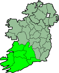
| map image     = IrelandMunster.png
| area km2      = 24607.52
| area note     =
| census yr     = 2002
| population    = 1100614
| coord display = inline
))
県
[編集]アイルランド
[編集]| リートリム県 County Leitrim Contae Liatroma | ||

| ||
|---|---|---|
| 所在地 | ||
| ||
| 詳細 | ||
| 地方: | Connacht | |
| 県都: | キャリック・オン・シャノン | |
| ナンバープレート: | LM | |
| 面積: | 1,588 km2 (613 sq mi) | |
| 人口 (2002年) | 25,799人 | |
| 公式サイト: www.leitrimcoco.ie | ||
((アイルランドの都市
| name        = リートリム県<br />County Leitrim
| gaeilge     = Contae Liatroma
| crest image = Leitrimcountylogo.png
| map image   = IrelandLeitrim.png
| province    = Connacht
| county town = [[:en:Carrick-on-Shannon|キャリック・オン・シャノン]]
| code        = LM
| area km2      = 1588
| area note     =
| census yr     = 2002
| population    = 25799
| web         = www.leitrimcoco.ie
| coord display = inline
))
北アイルランド
[編集]| アーマー県 County Armagh Contae Ard Mhacha | ||
| 所在地 | ||
| ||
| 詳細 | ||
| 地方: | アルスター | |
|---|---|---|
| 県都: | アーマー | |
| 面積: | 1,254 km2 (484 sq mi) | |
| 人口 (推測) | 141,000人 | |
((アイルランドの都市
| name        = アーマー県<br />County Armagh
| gaeilge     = Contae Ard Mhacha
| crest image =
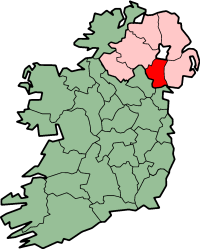
| map image   = NorthernIrelandArmagh.png
| province    = アルスター
| county town = [[アーマー]]
| area km2      = 1254
| area note     =
| census yr     = 推測
| population    = 141000
| coord display = inline
))
都市
[編集]アイルランド
[編集]| ゴールウェイ Galway Gaillimh | ||

| ||
|---|---|---|
| 標語: Laudatio Ejus Manet In Seculum Seculi "Praise remains for ever" | ||
| 所在地 | ||
|
| ||
| 詳細 | ||
| 地方: | Connacht | |
| 県: | ゴールウェイ県 | |
| 面積: | 1,837 km2 (709 sq mi) | |
| 人口 (2002年) - 市内: - 郊外: |
65,832人 331人 | |
| 公式サイト: www.galwaycity.ie | ||
((アイルランドの都市
| name        = ゴールウェイ<br />Galway
| gaeilge     = Gaillimh
| crest image = Galway crest.png
| motto       = Laudatio Ejus Manet In Seculum Seculi <br> "Praise remains for ever"
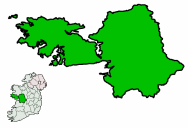
| map image   = Ireland map County Galway.png
| pin coords  = left: 133px; top: 54px
| north coord = 53.4667
| west coord  = 09.1000
| coord display = inline
| province    = Connacht
| county      = [[ゴールウェイ県]]
| area km2      = 1837
| area note     =
| census yr     = 2002
| population    = 65832
| environs      = 331
| web         = www.galwaycity.ie
))
北アイルランド
[編集]| リスバーン Lisburn Lios na gCearrbhach | ||
| 標語: Ex Ignr Resrugam "I will arise out of the fire" | ||
|---|---|---|
| 所在地 | ||
|
| ||
| 詳細 | ||
| 地方: | アルスター | |
| 県: | アントリム県 およびダウン県 | |
| 行政区域: | リスバーン | |
| 人口 (2001年) | 71,465人 | |
| 公式サイト: www.lisburn.com | ||
((アイルランドの都市
| name        = リスバーン<br />Lisburn
| gaeilge     = Lios na gCearrbhach
| crest image =
| motto       = Ex Ignr Resrugam <br /> "I will arise out of the fire"
| map image   = NorthernIrelandLisburn.png
| pin coords  = left: 180px; top: 90px
| north coord = 54.512
| west coord  = 6.031
| coord display = inline
| province    = アルスター
| county      = [[アントリム県]]<br />および[[ダウン県]]
| NI district = [[:en:Lisburn City Council|リスバーン]]
| census yr   = 2001
| population  = 71465
| web         = www.lisburn.com
))
町、村など
[編集]アイルランド
[編集]| バリナ Ballina Béal an Átha | ||

| ||
|---|---|---|
| 所在地 | ||
|
| ||
| アイルランド座標系 G240192 | ||
| 詳細 | ||
| 地方: | マンスター | |
| 県: | メイヨー県 | |
| 標高: | 7 m (23 ft) | |
| 人口 (2002年) - 町内: - 郊外: |
9,478人 1,087人 | |
((アイルランドの都市
| name        = バリナ<br />Ballina
| gaeilge     = Béal an Átha
| crest image = Ballina crest.png
| motto       =
| map image   = Ireland map County Mayo Magnified.png
| pin coords  = left: 90px; top: 37px
| north coord = 54.1167
| west coord  = 9.1667
| coord display = inline
| irish grid  = G240192
| province    = マンスター
| county      = [[メイヨー県]]
| area km2      =
| area note     =
| elevation m   = 7
| elevation note=
| census yr     = 2002
| town pop    = 9478
| rural pop   = 1087
| web         =
))
北アイルランド
[編集]| バリーナヒンチ Ballynahinch Droichead na Banna | ||
| 所在地 | ||
|
| ||
| 詳細 | ||
| 地方: | アルスター | |
|---|---|---|
| 県: | ダウン県 | |
| 行政区域: | バンブリッジ自治区 | |
| 人口 (2001年) | 14,744人 | |
((アイルランドの都市
| name        = バリーナヒンチ<br />Ballynahinch
| gaeilge     = Droichead na Banna
| crest image =
| motto       =
| map image   = NorthernIrelandBanbridgeBorough.png
| pin coords  = left: 139px; top: 113px
| north coord = 54.343
| west coord  = 6.26
| coord display = inline
| province    = アルスター
| county      = [[ダウン県]]
| NI district = [[:en:Banbridge District Council|バンブリッジ自治区]]
| area km2      =
| area note     =
| elevation m   =
| elevation note=
| census yr     = 2001
| population    = 14744
| web         =
))
Text is available under the CC BY-SA 4.0 license; additional terms may apply.
Images, videos and audio are available under their respective licenses.


