For faster navigation, this Iframe is preloading the Wikiwand page for 筑前橋.

筑前橋

筑前橋

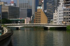
筑前橋(ちくぜんばし)は、大阪市土佐堀川に架かる市道筑前橋筋線の

大阪市北区中之島3丁目・4丁目と西区土佐堀1丁目の間を結んでいる。

橋の北側には国立国際美術館大阪市立科学館がある。

歴史

[編集]
  • 江戸時代初期 最初の橋が架橋される。江戸時代を通じて、架橋地点は現在地より一筋上流側だった。
    • 橋の北側にあった福岡藩(筑前藩、黒田藩)蔵屋敷の便を図って架けられた私設橋で、筑前殿橋とも呼ばれた。橋の北詰の石段が砥石で出来ており、近隣住民らが筑前橋北詰の石段で刃物を研いでいたという逸話がある。
  • 明治初期 田蓑橋と対になる現在地へ架け替えられる。
  • 1885年(明治18年) 淀川大洪水により流失。木橋にて再建。
  • 1932年昭和7年) 現在の橋に架け替えられる(施工 汽車製造(株))。

仕様

[編集]
筑前橋

周辺施設

[編集]

地図

[編集]

交通アクセス

[編集]

バス

[編集]

鉄道

[編集]

外部リンク

[編集]

座標: 北緯34度41分27.8秒 東経135度29分34.3秒 / 北緯34.691056度 東経135.492861度 / 34.691056; 135.492861

{{bottomLinkPreText}} {{bottomLinkText}}
筑前橋
Listen to this article

This browser is not supported by Wikiwand :(
Wikiwand requires a browser with modern capabilities in order to provide you with the best reading experience.
Please download and use one of the following browsers:

This article was just edited, click to reload
This article has been deleted on Wikipedia (Why?)

Back to homepage

Please click Add in the dialog above
Please click Allow in the top-left corner,
then click Install Now in the dialog
Please click Open in the download dialog,
then click Install
Please click the "Downloads" icon in the Safari toolbar, open the first download in the list,
then click Install
{{::$root.activation.text}}

Install Wikiwand

Install on Chrome Install on Firefox
Don't forget to rate us

Tell your friends about Wikiwand!

Gmail Facebook Twitter Link

Enjoying Wikiwand?

Tell your friends and spread the love:
Share on Gmail Share on Facebook Share on Twitter Share on Buffer

Our magic isn't perfect

You can help our automatic cover photo selection by reporting an unsuitable photo.

This photo is visually disturbing This photo is not a good choice

Thank you for helping!


Your input will affect cover photo selection, along with input from other users.

X

Get ready for Wikiwand 2.0 🎉! the new version arrives on September 1st! Don't want to wait?