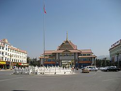
瑞麗市
| 中華人民共和国 雲南省 瑞麗市 | |
|---|---|
 | |
| 旧称:勐卯 | |
 | |
| 中心座標 北緯24度00分46秒 東経97度51分07秒 / 北緯24.01278度 東経97.85194度 | |
| 簡体字 | 瑞丽 |
| 繁体字 | 瑞麗 |
| 拼音 | Ruìlì |
| カタカナ転写 | ルイリー |
| 国家 | |
| 省 | 雲南 |
| 自治州 | 徳宏州 |
| 行政級別 | 県級市 |
| 建市 | 1992年 |
| 面積 | |
| 総面積 | 1,020 km² |
| 人口 | |
| 総人口() | 14 万人 |
| 経済 | |
| 電話番号 | 0692 |
| 郵便番号 | 678600 |
| ナンバープレート | 雲N |
| 行政区画代碼 | 533102 |
| 公式ウェブサイト: http://www.rl.gov.cn/ | |
瑞麗市(ずいれいし)は、中華人民共和国雲南省徳宏タイ族チンポー族自治州に位置する県級市。
地理
ミャンマーとの国境に位置することから中緬貿易の拠点として重視されており、将来的には大理と鉄道で結ばれる予定である。
気候
ケッペンの気候区分では温帯夏雨気候である。気候の面では東南アジアのタイプであり、東南アジアのほかの都市と同様に雨季の前に一番暑くなり、平均最高気温は30℃を超える。6月から8月は雨が一番多く、ほぼ毎日降る。
| 瑞麗 (1971−2000)の気候 | |||||||||||||
|---|---|---|---|---|---|---|---|---|---|---|---|---|---|
| 月 | 1月 | 2月 | 3月 | 4月 | 5月 | 6月 | 7月 | 8月 | 9月 | 10月 | 11月 | 12月 | 年 |
| 最高気温記録 °C (°F) | 26.9 (80.4) |
31.3 (88.3) |
33.8 (92.8) |
36.3 (97.3) |
36.4 (97.5) |
36.3 (97.3) |
33.8 (92.8) |
34.4 (93.9) |
34.8 (94.6) |
32.9 (91.2) |
30.9 (87.6) |
27.3 (81.1) |
36.4 (97.5) |
| 平均最高気温 °C (°F) | 22.8 (73) |
25.0 (77) |
28.7 (83.7) |
30.7 (87.3) |
30.4 (86.7) |
29.3 (84.7) |
28.3 (82.9) |
28.8 (83.8) |
29.1 (84.4) |
28.2 (82.8) |
25.3 (77.5) |
22.7 (72.9) |
27.4 (81.4) |
| 日平均気温 °C (°F) | 14.8 (58.6) |
16.8 (62.2) |
20.3 (68.5) |
23.3 (73.9) |
24.9 (76.8) |
25.5 (77.9) |
25.0 (77) |
25.2 (77.4) |
24.9 (76.8) |
23.2 (73.8) |
19.4 (66.9) |
15.9 (60.6) |
21.6 (70.9) |
| 平均最低気温 °C (°F) | 6.9 (44.4) |
8.6 (47.5) |
11.9 (53.4) |
16.0 (60.8) |
19.4 (66.9) |
21.8 (71.2) |
21.8 (71.2) |
21.7 (71.1) |
20.8 (69.4) |
18.2 (64.8) |
13.6 (56.5) |
9.1 (48.4) |
15.8 (60.5) |
| 最低気温記録 °C (°F) | 1.4 (34.5) |
2.2 (36) |
5.5 (41.9) |
9.7 (49.5) |
13.6 (56.5) |
16.3 (61.3) |
16.5 (61.7) |
15.8 (60.4) |
15.4 (59.7) |
9.5 (49.1) |
5.2 (41.4) |
2.2 (36) |
1.4 (34.5) |
| 雨量 mm (inch) | 8.8 (0.346) |
19.4 (0.764) |
22.5 (0.886) |
53.6 (2.11) |
149.1 (5.87) |
268.4 (10.567) |
323.4 (12.732) |
257.5 (10.138) |
166.9 (6.571) |
109.1 (4.295) |
63.5 (2.5) |
11.8 (0.465) |
1,454 (57.244) |
| 平均降雨日数 (≥0.1 mm) | 2.7 | 4.4 | 5.6 | 11.1 | 18.2 | 24.9 | 27.4 | 24.4 | 18.8 | 13.5 | 8.4 | 3.6 | 163.0 |
| 出典:Weather China | |||||||||||||
経済
東南アジアのアンティーク・ジュエリーの一大交易地点となっている。
歴史
後漢が永昌郡哀牢県を設けるなど早くから中原の冊封体制に組み込まれていた瑞麗であるが、直接的な中央支配を受けるようになったのは中華民国時代になってからのことである。1915年に勐卯行政委員会が設置され、1932年には瑞麗政治局に改編されたが、勐卯土司と並存した体制であった。
1950年5月、雲南地区に進駐した人民解放軍は瑞麗地区に少数民族との連合政府を樹立、1952年には瑞麗県を設置、1992年6月9日に県級市に昇格し現在に至っている。
行政区画
- 街道:勐卯街道
- 鎮:畹町鎮、弄島鎮、姐相鎮
- 郷:戸育郷、勐秀郷
交通
航空
- 瑞麗景成ヘリポート
鉄道
道路
杭瑞高速道路が貴州省・湖南省・江西省を経由し当地と杭州市を結ぶ。
- 高速道路
- 国道
関連項目
- 瑞麗口岸 - ミャンマーとの国境
外部リンク
Text is available under the CC BY-SA 4.0 license; additional terms may apply.
Images, videos and audio are available under their respective licenses.
