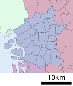
永田 (大阪市)
永田 | |
|---|---|
 大阪市立城東中学校 | |
| 北緯34度41分3.45秒 東経135度33分25.25秒 / 北緯34.6842917度 東経135.5570139度 | |
| 国 |
|
| 都道府県 |
|
| 市町村 |
|
| 区 | 城東区 |
| 面積 | |
| • 合計 | 0.456032645 km2 |
| 人口 | |
| • 合計 | 6,610人 |
| • 密度 | 14,000人/km2 |
| 等時帯 | UTC+9 (日本標準時) |
| 郵便番号 |
536-0022[3] |
| 市外局番 | 06(大阪MA)[4] |
| ナンバープレート | なにわ |
永田(ながた)は、大阪府大阪市城東区にある町名。現行行政地名は永田一丁目から永田四丁目。
地理
[編集]城東区の南東部に位置し、東に諏訪、西に天王田と東中浜、北に放出西、南に東成区神路と深江北と接している。
河川
[編集]歴史
[編集]世帯数と人口
[編集]2019年(平成31年)3月31日現在の世帯数と人口は以下の通りである[2]。
| 丁目 | 世帯数 | 人口 |
|---|---|---|
| 永田一丁目 | 329世帯 | 765人 |
| 永田二丁目 | 900世帯 | 2,037人 |
| 永田三丁目 | 1,161世帯 | 2,427人 |
| 永田四丁目 | 792世帯 | 1,381人 |
| 計 | 3,182世帯 | 6,610人 |
人口の変遷
[編集]国勢調査による人口の推移。
| 1995年(平成7年) | 4,695人 | [5] | |
| 2000年(平成12年) | 5,246人 | [6] | |
| 2005年(平成17年) | 6,072人 | [7] | |
| 2010年(平成22年) | 6,124人 | [8] | |
| 2015年(平成27年) | 6,280人 | [9] |
世帯数の変遷
[編集]国勢調査による世帯数の推移。
| 1995年(平成7年) | 1,905世帯 | [5] | |
| 2000年(平成12年) | 2,399世帯 | [6] | |
| 2005年(平成17年) | 2,736世帯 | [7] | |
| 2010年(平成22年) | 2,734世帯 | [8] | |
| 2015年(平成27年) | 2,732世帯 | [9] |
学区
[編集]市立小・中学校に通う場合、学区は以下の通りとなる[10]。なお、小学校・中学校入学時に学校選択制度を導入しており、通学区域以外に城東区の小学校・中学校から選択することも可能[11]。
| 丁目 | 番 | 小学校 | 中学校 |
|---|---|---|---|
| 永田一丁目 | 全域 | 大阪市立諏訪小学校 | 大阪市立城東中学校 |
| 永田二丁目 | 全域 | ||
| 永田三丁目 | 全域 | ||
| 永田四丁目 | 全域 |
事業所
[編集]2016年(平成28年)現在の経済センサス調査による事業所数と従業員数は以下の通りである[12]。
| 丁目 | 事業所数 | 従業員数 |
|---|---|---|
| 永田一丁目 | 32事業所 | 246人 |
| 永田二丁目 | 52事業所 | 635人 |
| 永田三丁目 | 78事業所 | 953人 |
| 永田四丁目 | 102事業所 | 632人 |
| 計 | 264事業所 | 2,466人 |
交通
[編集]施設
[編集]その他
[編集]日本郵便
[編集]脚注
[編集]- ^ “大阪府大阪市城東区の町丁・字一覧”. 人口統計ラボ. 2019年10月20日閲覧。
- ^ a b “住民基本台帳人口・外国人人口”. 大阪市 (2019年7月26日). 2019年10月4日閲覧。
- ^ a b “永田の郵便番号”. 日本郵便. 2019年8月15日閲覧。
- ^ “市外局番の一覧”. 総務省. 2019年6月24日閲覧。
- ^ a b “平成7年国勢調査の調査結果(e-Stat) - 男女別人口及び世帯数 -町丁・字等”. 総務省統計局 (2014年3月28日). 2019年8月16日閲覧。
- ^ a b “平成12年国勢調査の調査結果(e-Stat) - 男女別人口及び世帯数 -町丁・字等”. 総務省統計局 (2014年5月30日). 2019年8月16日閲覧。
- ^ a b “平成17年国勢調査の調査結果(e-Stat) - 男女別人口及び世帯数 -町丁・字等”. 総務省統計局 (2014年6月27日). 2019年8月16日閲覧。
- ^ a b “平成22年国勢調査の調査結果(e-Stat) - 男女別人口及び世帯数 -町丁・字等”. 総務省統計局 (2012年1月20日). 2019年8月16日閲覧。
- ^ a b “平成27年国勢調査の調査結果(e-Stat) - 男女別人口及び世帯数 -町丁・字等”. 総務省統計局 (2017年1月27日). 2019年8月16日閲覧。
- ^ “城東区 市立小学校・中学校通学区域一覧・通学区域図” (PDF). 大阪市城東区 (2019年11月20日). 2019年11月23日閲覧。 “(ファイル元のページ)”
- ^ “大阪市城東区 市立小中学校 学校案内冊子”. 大阪市城東区 (2019年11月20日). 2019年11月23日閲覧。
- ^ “平成28年経済センサス-活動調査 / 事業所に関する集計 産業横断的集計 都道府県別結果”. 総務省統計局 (2018年6月28日). 2019年10月23日閲覧。
- ^ “郵便番号簿 2019年度版” (PDF). 日本郵便. 2019年11月4日閲覧。
関連項目
[編集]Text is available under the CC BY-SA 4.0 license; additional terms may apply.
Images, videos and audio are available under their respective licenses.


