増毛山道
| 山道 | |
|---|---|
| 増毛山道 | |
| 総延長 | 33km[1] |
| 開通年 | 1858年(安政5年)[2] |
| 起点 | 北海道増毛郡増毛町別苅 |
| 終点 | 北海道石狩市浜益区幌 |
| ■テンプレート(■ノート ■使い方) ■PJ道路 | |
増毛山道(ましけさんどう)は、増毛山地の浜益御殿(標高1038.8m)を経て北海道増毛郡増毛町別苅(べつかり)と石狩市浜益区幌(ぽろ)を結ぶ山道。全長27キロメートル[3]。本線から分岐して岩尾温泉に抜ける、5キロメートルの「岩尾支線」もある[3]。
2018年には北海道遺産のひとつに認定され、トレッキングツアーも行われている[1]。しかし一部で私有地を通過する箇所や、林道と交差して迷いやすい地点があるため、一般公開はされていない[4]。
2022年9月に国土地理院の電子地図「地理院地図」上で増毛山道が新規に表示され、紙地図にも改訂後に反映されることになった[5]。
歴史
[編集]19世紀後半、ロシア帝国の南下を危惧する江戸幕府は、蝦夷地日本海側の北方警備を急務としており、宗谷方面への兵員輸送や情報伝達用に陸路の確保を求めていた[4]。しかしマシケ(増毛)とハママシケ(浜益)の間の海岸線は断崖絶壁続きであり、とても海岸路を切り開けるような場所ではなかった[2]。そこで箱館奉行の堀利煕は、山道を設ける計画を立てて幕府に意見書を提出[2]。これを受けて幕府は、マシケとハママシケ一帯のニシン漁を統括していた場所請負人の伊達林右衛門に山道開削を命じた[2]。
林右衛門は、マシケ場所支配人の黒沢屋直右衛門と、ハママシケ場所支配人の久兵衛とに山道開削の細部計画を作らせようとした[2]。しかし両名とも道路に関しては素人であったため、松前藩の乙部村より雇い入れた作右衛門と幾次郎に踏検調査を行わせた[2]。その結果、山道は浜益の幌より切り始めて増毛のポンナイ浜に至る約9里として計画し、1857年(安政4年)5月18日、堅雪の残るうちから工事を開始した[2]。
作右衛門と幾次郎は、人夫としてアイヌや漁期を終えて帰国する出稼者を雇い入れた[2]。その指揮監督に据えたのは、出稼漁夫の孫三郎と与助、マシケのアイヌより総乙名トンケシロ、ハママシケのアイヌより総乙名シヨウカタ、脇乙名シカノスケ、平蝦夷カワサシであった[2]。工事は着々と進み、1858年(安政5年)7月に開通を見た[2]。林右衛門が人夫に支払った賃金の総額は、1311両余りであったという[2]。幕末の探検家・松浦武四郎はこの道を3度通り、その出来映えを絶賛している[3]。
元は軍事的要請から開削された増毛山道だったが、明治時代になると、ニシン漁で栄えた増毛や浜益の人々により、交易経路や生活道路として活用されるようになった[4]。ところが昭和時代になると、利用者は減少[3]。太平洋戦争終結後も部分的に使われてはいたものの、国道231号が整備されると廃道と化した[3][6]。
その後、増毛山道は人々の記憶から薄れていったが、1993年(平成5年)、林右衛門の子孫にあたる伊達東(あずま[7])が調査を開始[3]。2007年(平成19年)11月には一帯の航空写真が撮影され、ルートがほぼ確定された[4]。翌2008年(平成20年)、約20人により[7]「増毛山道の会」が設立され、復元作業が始まった[3]。
2016年(平成28年)10月、山道の全線が復元される[3]。2017年(平成29年)2月には国土地理院の地形図に再び記載されるようになり、同年10月には山道から分岐して雄冬山山頂に通じる新たな登山道が設けられた[3]。
2018年(平成30年)、『「増毛山道」の復元と保存による地域活性化』で手づくり郷土賞受賞[8]。
増毛山道の会はメンバーの高齢化が進んでいるが、ガイド研修の受講、草刈り、クラウドファンディングなどで山道の維持に協力する輪が広がり、北海道庁の留萌振興局も協力している[7]。
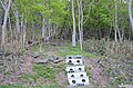
遺構
[編集]- 武好駅逓(ぶよしえきてい)
- 駅逓とは、郵便物を輸送する逓送人が荷を交換するための場所であり、また山道の通行者の休憩・宿泊所としても機能した[4]。
- 当初は増毛天狗岳の南東側に「通行屋」として設置されたが、1876年(明治9年)に焼失[4]。1902年(明治35年)、天狗岳の東側に場所を移して再建された[4]。
- 駅逓業務は1941年(昭和16年)に廃止された[4]。1949年(昭和24年)には北海道大学山岳部のパーティーが現地を訪れ、まだ残っていた旧駅逓を写真撮影しているが、建物はその後に倒壊したため現存しない[4]。
- 2018年(平成30年)、駅逓跡地に案内板が新設された[4]。
- 電信柱
- 1889年(明治22年)、山道に沿って電信線が敷設され、増毛と札幌の間で電信や電報が使えるようになった[4]。
- しかし一帯の標高は1000メートルを超えるため、電信線の維持は困難であり、何度も補修を要したという[4]。
- 一等水準点
- 1907年(明治40年)から翌1908年(明治41年)にかけて、17基の一等水準点が山道に埋設された[4]。
- 通常は主要国道に用いられる一等の水準点が配置されたことが、当時の増毛山道の重要性を示している[4]。
ギャラリー
[編集]-
 国道231号沿いに立つ「旧増毛山道入口」標柱
 -
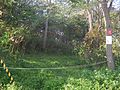 増毛側の山道入り口
 -
 浜益側の山道入り口


座標
[編集]- 水準点(1037.9)北緯43度42分36秒 東経141度24分44秒 / 北緯43.709996度 東経141.412215度
- 浜益御殿三角点北緯43度42分39秒 東経141度24分45秒 / 北緯43.710771度 東経141.412580度
- 水準点(870.5)北緯43度43分17秒 東経141度24分43秒 / 北緯43.721386度 東経141.411934度
- 水準点(1031.9)北緯43度44分06秒 東経141度24分33秒 / 北緯43.735005度 東経141.409158度
- 雄冬山三角点北緯43度44分15秒 東経141度24分22秒 / 北緯43.737436度 東経141.406047度
- 水準点(921.3)北緯43度44分49秒 東経141度24分54秒 / 北緯43.746950度 東経141.414996度
- 水準点(694.8)北緯43度45分29秒 東経141度24分59秒 / 北緯43.758063度 東経141.416379度
- 岩尾分岐北緯43度46分07秒 東経141度25分13秒 / 北緯43.768739度 東経141.420262度
- 水準点(606.7)北緯43度46分14秒 東経141度25分22秒 / 北緯43.770553度 東経141.422776度
- 水準点(671.8)北緯43度46分44秒 東経141度26分01秒 / 北緯43.778886度 東経141.433603度
- 武好駅逓跡北緯43度46分55秒 東経141度26分09秒 / 北緯43.781910度 東経141.435909度
- 水準点(668.6)北緯43度47分08秒 東経141度26分58秒 / 北緯43.785551度 東経141.449444度
- 水準点(399.7)北緯43度48分25秒 東経141度28分14秒 / 北緯43.806939度 東経141.470542度
- 水準点(216.5)北緯43度49分07秒 東経141度29分02秒 / 北緯43.818613度 東経141.483886度
- 幌(幌郵便局)北緯43度38分59秒 東経141度21分13秒 / 北緯43.649806度 東経141.353583度
- 別刈(別刈郵便局)北緯43度50分05秒 東経141度29分39秒 / 北緯43.834775度 東経141.494282度
- 岩尾温泉北緯43度46分25秒 東経141度22分06秒 / 北緯43.773606度 東経141.368423度
脚注
[編集]- ^ a b 「増毛山道復元 開削者の子孫ら尽力」『日本農業新聞』2021年8月7日(北海道面)
- ^ a b c d e f g h i j k 浜益村史 1980, p. 914.
- ^ a b c d e f g h i 黒川 2018, 1面.
- ^ a b c d e f g h i j k l m n 黒川 2018, 2面.
- ^ “「増毛山道」の名、電子地図に 国土地理院「歴史的経緯が明確」”. 北海道新聞. 2022年9月4日閲覧。
- ^ 雄冬岬付近の国道231号が全通したのは1981年であり、それまでの間、雄冬へのアクセスは海上交通が使われた。
- ^ a b c 【土曜ズーム】「増毛山道」未来につなぐ■復元した古道 維持に支援の輪■CF 目標の1000万円超/ササ刈り協力者続々""『北海道新聞』夕刊2021年10月2日1面
- ^ “「増毛山道」の復元と保存による地域活性化”. 国土交通省. p. 25. 2022年2月25日閲覧。
参考資料
[編集]- 『浜益村史』1980年3月。
- 黒川伸一 (2018年9月23日). “時を訪ねて:増毛山道開削”. 北海道新聞: 日曜navi 1 - 2面
- 北海道留萌振興局森林室「増毛山道の歴史 (PDF) 」
- 『広報ましけ』2017年9月号 増毛山道をゆく~開削から160年の古 開削から160年の古道・前編 (PDF)
- 『広報ましけ』2017年10月号 増毛山道をゆく~開削から160年の古 開削から160年の古道・後編 (PDF)
- “増毛山道 トップページ”. NPO法人増毛山道の会. 2022年8月13日閲覧。
Text is available under the CC BY-SA 4.0 license; additional terms may apply.
Images, videos and audio are available under their respective licenses.
