For faster navigation, this Iframe is preloading the Wikiwand page for 北マリアナ諸島のアメリカ合衆国国家歴史登録財.

北マリアナ諸島のアメリカ合衆国国家歴史登録財

北マリアナ諸島の地図

北マリアナ諸島のアメリカ合衆国国家歴史登録財(きたマリアナしょとうのアメリカがっしゅうこくこっかれきしとうろくざい)では、北マリアナ諸島に所在するアメリカ合衆国国家歴史登録財登録の建築物、遺跡、地域、モニュメント英語版を列挙する。現在37ヶ所登録されているが、北部諸島市の島々には存在しない。

このアメリカ合衆国国立公園局のリストは2015年8月14日に更新されたNPSの最新リストによって網羅されている。[1]

登録数

[編集]

以下、北マリアナ諸島における現在のアメリカ合衆国国家歴史登録財一覧の集計であり、2008年4月24日現在の国家登録財情報データベース(National Register Information Database)[2]や、週単位で新たに登録されている国家歴史登録財のウェブサイトに基づいている[3]。頻繁な新規登録や時折ある登録解除があり、ここのリストは公式なものではない。また、この表にあるリストは既存の登録財や地区がある地域が変更されることによる境界的な増減は扱われておらず個別国家登録財登録番号に基づいている。

自治体 箇所数
1 北部諸島 0
2 ロタ 10
3 サイパン 20
4 テニアン 7
総数: 37
全ての座標を示した地図 - OSM 全座標を出力 - KML .mw-parser-output .hlist ul,.mw-parser-output .hlist ol{padding-left:0}.mw-parser-output .hlist li,.mw-parser-output .hlist dd,.mw-parser-output .hlist dt{margin-right:0;display:inline-block;white-space:nowrap}.mw-parser-output .hlist dt:after,.mw-parser-output .hlist dd:after,.mw-parser-output .hlist li:after{white-space:normal}.mw-parser-output .hlist li:after,.mw-parser-output .hlist dd:after{content:" ·\a0 ";font-weight:bold}.mw-parser-output .hlist dt:after{content:": "}.mw-parser-output .hlist-pipe dd:after,.mw-parser-output .hlist-pipe li:after{content:" |\a0 ";font-weight:normal}.mw-parser-output .hlist-hyphen dd:after,.mw-parser-output .hlist-hyphen li:after{content:" -\a0 ";font-weight:normal}.mw-parser-output .hlist-comma dd:after,.mw-parser-output .hlist-comma li:after{content:"、";font-weight:normal}.mw-parser-output .hlist-slash dd:after,.mw-parser-output .hlist-slash li:after{content:" /\a0 ";font-weight:normal}.mw-parser-output .hlist dd:last-child:after,.mw-parser-output .hlist dt:last-child:after,.mw-parser-output .hlist li:last-child:after{content:none}.mw-parser-output .hlist dd dd:first-child:before,.mw-parser-output .hlist dd dt:first-child:before,.mw-parser-output .hlist dd li:first-child:before,.mw-parser-output .hlist dt dd:first-child:before,.mw-parser-output .hlist dt dt:first-child:before,.mw-parser-output .hlist dt li:first-child:before,.mw-parser-output .hlist li dd:first-child:before,.mw-parser-output .hlist li dt:first-child:before,.mw-parser-output .hlist li li:first-child:before{content:" (";font-weight:normal}.mw-parser-output .hlist dd dd:last-child:after,.mw-parser-output .hlist dd dt:last-child:after,.mw-parser-output .hlist dd li:last-child:after,.mw-parser-output .hlist dt dd:last-child:after,.mw-parser-output .hlist dt dt:last-child:after,.mw-parser-output .hlist dt li:last-child:after,.mw-parser-output .hlist li dd:last-child:after,.mw-parser-output .hlist li dt:last-child:after,.mw-parser-output .hlist li li:last-child:after{content:")\a0 ";font-weight:normal}.mw-parser-output .hlist ol{counter-reset:listitem}.mw-parser-output .hlist ol>li{counter-increment:listitem}.mw-parser-output .hlist ol>li:before{content:" "counter(listitem)" ";white-space:nowrap}.mw-parser-output .hlist dd ol>li:first-child:before,.mw-parser-output .hlist dt ol>li:first-child:before,.mw-parser-output .hlist li ol>li:first-child:before{content:" ("counter(listitem)" "}.mw-parser-output .navbar{display:inline;font-size:75%;font-weight:normal}.mw-parser-output .navbar-collapse{float:left;text-align:left}.mw-parser-output .navbar-boxtext{word-spacing:0}.mw-parser-output .navbar ul{display:inline-block;white-space:nowrap;line-height:inherit}.mw-parser-output .navbar-brackets::before{margin-right:-0.125em;content:"[ "}.mw-parser-output .navbar-brackets::after{margin-left:-0.125em;content:" ]"}.mw-parser-output .navbar li{word-spacing:-0.125em}.mw-parser-output .navbar-mini abbr{font-variant:small-caps;border-bottom:none;text-decoration:none;cursor:inherit}.mw-parser-output .navbar-ct-full{font-size:114%;margin:0 7em}.mw-parser-output .navbar-ct-mini{font-size:114%;margin:0 4em}.mw-parser-output .infobox .navbar{font-size:88%}.mw-parser-output .navbox .navbar{display:block;font-size:88%}.mw-parser-output .navbox-title .navbar{float:left;text-align:left;margin-right:0.5em}表示

ロタ

[編集]
[4] 登録名 画像 登録日[5] 所在地 概要
1 Chudang Palii Japanese World War II Defensive Complex 画像をアップロード
2012年5月1日
(#12000250)
Sunrise Hotel, Rte. 100
座標がありません
シナパル
2 Chugai' Pictograph Site
Chugai' Pictograph Site
1998年8月31日
(#98001066)
I'Chenchon Bird Sanctuary
北緯14度09分12秒 東経145度16分03秒 / 北緯14.153383度 東経145.267582度 / 14.153383; 145.267582 (Chugai' Pictograph Site)
古代壁画洞窟
3 Commissioner's Office 画像をアップロード
1981年4月17日
(#81000663)
North of Songsong Village
北緯14度10分02秒 東経145度09分46秒 / 北緯14.167222度 東経145.162778度 / 14.167222; 145.162778 (Commissioner's Office)
ソンソン
4 Dugi Archeological Site 画像をアップロード
1985年2月11日
(#85000287)
住所非公開
座標がありません
ソンソン
5 Japanese Coastal Defense Gun
Japanese Coastal Defense Gun
1984年11月2日
(#84000422)
Northeast of Songsong
北緯14度07分13秒 東経145度09分59秒 / 北緯14.120278度 東経145.166389度 / 14.120278; 145.166389 (Japanese Coastal Defense Gun)
ソンソン
6 Japanese Hospital 画像をアップロード
1981年4月16日
(#81000664)
West side of Sasanhaya Bay
北緯14度08分13秒 東経145度08分18秒 / 北緯14.136944度 東経145.138333度 / 14.136944; 145.138333 (Japanese Hospital)
ソンソン
7 Mochong
Mochong
Mochong
1985年9月11日
(#85002301)
住所非公開
座標がありません
ソンソン
8 Nanyo Kohatsu Kabushiki Kaisha Sugar Mill
Nanyo Kohatsu Kabushiki Kaisha Sugar Mill
1981年4月16日
(#81000665)
Southwest of Songsong Village, near the harbor
北緯14度08分10秒 東経145度08分07秒 / 北緯14.136247度 東経145.135314度 / 14.136247; 145.135314 (Nanyo Kohatsu Kabushiki Kaisha Sugar Mill)
ソンソン
9 Rectory 画像をアップロード
1981年4月16日
(#81000666)
North end of the island
北緯14度09分59秒 東経145度10分00秒 / 北緯14.166389度 東経145.166667度 / 14.166389; 145.166667 (Rectory)
ソンソン
10 Rota Latte Stone Quarry
Rota Latte Stone Quarry
1974年12月23日
(#74002225)

北緯14度10分17秒 東経145度15分30秒 / 北緯14.1715度 東経145.2584度 / 14.1715; 145.2584 (Rota Latte Stone Quarry)
ソンソン

サイパン

[編集]
[4] 登録名 画像 登録日[5] 所在地 概要
1 Banzai Cliff
Banzai Cliff
Banzai Cliff
1976年8月27日
(#76002192)
Bandero, Magpi area
北緯15度17分17秒 東経145度48分58秒 / 北緯15.288056度 東経145.816111度 / 15.288056; 145.816111 (Banzai Cliff)
サン・ロケ英語版
2 Brown Beach One Japanese Fortifications 画像をアップロード
2007年2月28日
(#07000123)
Unai Laolao Kattan (North Laolao Beach) along the east coast of Saipan
北緯15度10分33秒 東経145度47分05秒 / 北緯15.175833度 東経145.784722度 / 15.175833; 145.784722 (Brown Beach One Japanese Fortifications)
ウナイ・ラオラオ・カッタン
3 Campaneyan Kristo Rai
Campaneyan Kristo Rai
1984年10月30日
(#84000207)
Beach Road
北緯15度12分11秒 東経145度43分04秒 / 北緯15.203056度 東経145.717778度 / 15.203056; 145.717778 (Campaneyan Kristo Rai)
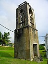
ガラパン 1932年にスペイン人が立てた教会の鐘塔
4 Chalan Galaide 画像をアップロード
1987年10月4日
(#87001559)
住所非公開
座標がありません
ガラパン
5 Hachiman Jinja 画像をアップロード
2003年6月21日
(#03000549)
Lot numbers H 300-11 and H 300-4
北緯15度10分44秒 東経145度45分40秒 / 北緯15.178889度 東経145.761111度 / 15.178889; 145.761111 (Hachiman Jinja)
カナット・タッドン・パパゴ
6 Isley Field Historic District
Isley Field Historic District
1981年6月26日
(#81000667)
サイパン国際空港
北緯15度07分20秒 東経145度43分58秒 / 北緯15.122222度 東経145.732778度 / 15.122222; 145.732778 (Isley Field Historic District)
チャラン・カノア 第二次世界大戦時の飛行場だったが現在は島の主要空港
7 Japanese 20mm Cannon Blockhouse 画像をアップロード
1995年8月25日
(#95001048)
Northwest of Punton Opyan
北緯15度06分46秒 東経145度42分17秒 / 北緯15.112778度 東経145.704722度 / 15.112778; 145.704722 (Japanese 20mm Cannon Blockhouse)
サイパン島
8 Japanese Hospital
Japanese Hospital
Japanese Hospital
1974年12月19日
(#74002189)
Route 3
北緯15度12分06秒 東経145度43分08秒 / 北緯15.201667度 東経145.718889度 / 15.201667; 145.718889 (Japanese Hospital)
ガラパン 旧・南洋庁立サイパン医院、現・北マリアナ諸島歴史文化博物館
9 Japanese Jail Historic and Archeological District
Japanese Jail Historic and Archeological District
2011年4月8日
(#10001017)
Chichirica Avenue and Ghiyobw Street
北緯15度21分01秒 東経145度43分08秒 / 北緯15.350278度 東経145.71875度 / 15.350278; 145.71875 (Japanese Jail Historic and Archeological District)
ガラパン
10 Japanese Lighthouse
Japanese Lighthouse
Japanese Lighthouse
1974年12月19日
(#74002224)
Navy Hill
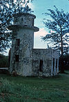
北緯15度12分42秒 東経145度43分54秒 / 北緯15.211722度 東経145.731639度 / 15.211722; 145.731639 (Japanese Lighthouse)
ガラパン
11 Landing Beaches, Aslito-Isley Field and Marpi Point
Landing Beaches, Aslito-Isley Field and Marpi Point
1985年2月4日
(#85001789)
サイパン国際空港および開眼
北緯15度06分55秒 東経145度43分01秒 / 北緯15.115278度 東経145.716944度 / 15.115278; 145.716944 (Landing Beaches, Aslito-Isley Field and Marpi Point)
チャラン・カノア
12 Laulau Kattan Latte Site
Laulau Kattan Latte Site
2000年10月30日
(#00001212)
住所非公開
座標がありません
Kagman III Homestead
13 Managaha Island Historic District
Managaha Island Historic District
1984年11月5日
(#84000425)
West of Saipan
北緯15度14分29秒 東経145度42分45秒 / 北緯15.241389度 東経145.7125度 / 15.241389; 145.7125 (Managaha Island Historic District)
ガラパン
14 Sabanetan Toro Latte Site 画像をアップロード
1984年11月8日
(#84000731)
住所非公開
座標がありません
ガラパン
15 Suicide Cliff
Suicide Cliff
Suicide Cliff
1976年9月30日
(#76002193)
Bandero
北緯15度16分38秒 東経145度48分35秒 / 北緯15.277222度 東経145.809722度 / 15.277222; 145.809722 (Suicide Cliff)
サン・ロケ英語版
16 Tachognya 画像をアップロード
1986年2月13日
(#86000235)
住所非公開
座標がありません
サン・ホセ英語版
17 Unai Achugao Archaeological Site 画像をアップロード
1996年8月8日
(#96000825)
住所非公開
座標がありません
パントン・アチュガオ
18 Unai Lagua Japanese Defense Pillbox 画像をアップロード
1984年6月1日
(#84002777)
Unai Lagua
北緯15度16分25秒 東経145度49分42秒 / 北緯15.273611度 東経145.828333度 / 15.273611; 145.828333 (Unai Lagua Japanese Defense Pillbox)
サン・ロケ英語版
19 Unai Obyan Latte Site 画像をアップロード
1985年2月5日
(#85000244)
住所非公開
座標がありません
チャラン・カノア
20 Waherak Maihar 画像をアップロード
1978年1月31日
(#78003081)
Public Works Headquarters Compound
座標がありません
チャラン・カノア 伝統的なアウトリガーカヌー

テニアン

[編集]
[4] 登録名 画像 登録日[5] 所在地 概要
1 Japanese Structure 画像をアップロード
1981年4月16日
(#81000669)
Near Red 2 Beach
北緯14度58分16秒 東経145度37分14秒 / 北緯14.971111度 東経145.620556度 / 14.971111; 145.620556 (Japanese Structure)
テニアン
2 Nanyo Kohatsu Kabushiki Kaisha Administration Building 画像をアップロード
1981年4月16日
(#81000670)
Near Red 2 Beach
北緯14度58分20秒 東経145度37分08秒 / 北緯14.972222度 東経145.618889度 / 14.972222; 145.618889 (Nanyo Kohatsu Kabushiki Kaisha Administration Building)
テニアン
3 Nanyo Kohatsu Kabushiki Kaisha Ice Storage Building 画像をアップロード
1981年4月17日
(#81000671)
Near Red 2 Beach
北緯14度58分04秒 東経145度37分23秒 / 北緯14.967778度 東経145.623056度 / 14.967778; 145.623056 (Nanyo Kohatsu Kabushiki Kaisha Ice Storage Building)
テニアン
4 Nanyo Kohatsu Kabushiki Kaisha Laboratory 画像をアップロード
1981年4月16日
(#81000672)
Near Red 2 Beach
北緯14度58分20秒 東経145度37分07秒 / 北緯14.972222度 東経145.618611度 / 14.972222; 145.618611 (Nanyo Kohatsu Kabushiki Kaisha Laboratory)
テニアン
5 Tinian Landing Beaches, Ushi Point Field, Tinian Island
Tinian Landing Beaches, Ushi Point Field, Tinian Island
1985年12月30日
(#85003268)

北緯15度04分10秒 東経145度37分00秒 / 北緯15.0694度 東経145.6167度 / 15.0694; 145.6167 (Tinian Landing Beaches, Ushi Point Field, Tinian Island)
テニアン
6 Unai Dangkulo Petroglyph Site 画像をアップロード
1999年10月27日
(#99001270)
住所非公開
座標がありません
ウナイ・ダンクロ
7 House of Taga
House of Taga
House of Taga
1974年12月19日
(#74002193)

北緯14度58分01秒 東経145度37分20秒 / 北緯14.966806度 東経145.622222度 / 14.966806; 145.622222 (House of Taga)
サン・ホセ英語版

関連項目

[編集]
  • アメリカ合衆国のコモンウェルスと海外領土と自由連合と国外のアメリカ合衆国国家歴史登録財英語版
  • サイパンの戦い海洋遺産トレイル英語版

脚注

[編集]
  1. ^ "National Register of Historic Places: Weekly List Actions". National Park Service, United States Department of the Interior. Retrieved on 2015年8月14日.
  2. ^ National Park Service (24 April 2008). "National Register Information System". National Register of Historic Places. National Park Service. ((cite web)): Cite webテンプレートでは|access-date=引数が必須です。 (説明)
  3. ^ "National Register of Historic Places: Weekly List Actions". National Park Service. 2009年1月16日閲覧
  4. ^ a b c 番号は重要単語(significant words)の順序によって表されている。各色はここで定義されており、歴史建造物歴史地区英語版とその他NRHPの建築物、構造体、遺跡、モニュメントで区別している。
  5. ^ a b c 日付の下にある8桁の番号は各登録財ごとに割り振られた国家登録財情報システム英語版のデータベースの番号であり、番号をクリックすればウェブサイトを閲覧できる。
{{bottomLinkPreText}} {{bottomLinkText}}
北マリアナ諸島のアメリカ合衆国国家歴史登録財
Listen to this article

This browser is not supported by Wikiwand :(
Wikiwand requires a browser with modern capabilities in order to provide you with the best reading experience.
Please download and use one of the following browsers:

This article was just edited, click to reload
This article has been deleted on Wikipedia (Why?)

Back to homepage

Please click Add in the dialog above
Please click Allow in the top-left corner,
then click Install Now in the dialog
Please click Open in the download dialog,
then click Install
Please click the "Downloads" icon in the Safari toolbar, open the first download in the list,
then click Install
{{::$root.activation.text}}

Install Wikiwand

Install on Chrome Install on Firefox
Don't forget to rate us

Tell your friends about Wikiwand!

Gmail Facebook Twitter Link

Enjoying Wikiwand?

Tell your friends and spread the love:
Share on Gmail Share on Facebook Share on Twitter Share on Buffer

Our magic isn't perfect

You can help our automatic cover photo selection by reporting an unsuitable photo.

This photo is visually disturbing This photo is not a good choice

Thank you for helping!


Your input will affect cover photo selection, along with input from other users.

X

Get ready for Wikiwand 2.0 🎉! the new version arrives on September 1st! Don't want to wait?