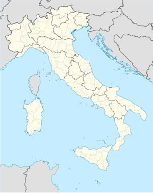
ヴァレンナ
| ヴァレンナ Varenna | |
|---|---|
 | |
| 行政 | |
| 国 |
|
| 州 |
|
| 県/大都市 |
|
| CAP(郵便番号) | 23829 |
| 市外局番 | 0341 |
| ISTATコード | 097084 |
| 識別コード | L680 |
| 分離集落 | #分離集落参照 |
| 隣接コムーネ | #隣接コムーネ参照 |
| 公式サイト | リンク |
| 人口 | |
| 人口 | 737 [1] 人 (2021-01-01) |
| 人口密度 | 65.7 人/km2 |
| 文化 | |
| 住民の呼称 | varennesi |
| 守護聖人 |
聖ジョルジョ (San Giorgio) |
| 祝祭日 | 4月24日 |
| 地理 | |
| 座標 | 北緯46度00分38.88秒 東経09度17分01.68秒 / 北緯46.0108000度 東経9.2838000度座標: 北緯46度00分38.88秒 東経09度17分01.68秒 / 北緯46.0108000度 東経9.2838000度 |
| 標高 | 220 (199 - 1092) [2] m |
| 面積 | 11.22 [3] km2 |
 | |
ヴァレンナ(伊: Varenna)は、イタリア共和国ロンバルディア州レッコ県にある、人口約700人の基礎自治体(コムーネ)。
地理
[編集]
位置・広がり
[編集]レッコ県北部のコムーネ。県都レッコの北北西19km、コモの北東27km、州都ミラノの北61kmに位置する[4]。湖水を挟んで南西にベッラージョ(約4km)、西北西にメナッジョ(約4km)があり、船で結ばれている[4]。
隣接コムーネ
[編集]隣接するコムーネは以下の通り。括弧内のCOはコモ県所属を示す。
気候分類・地震分類
[編集]気候分類では、zona E, 2246 GGに分類される[5]。 また、イタリアの地震リスク階級 (it) では、zona 4 (sismicità molto bassa) に分類される[6]。
行政
[編集]分離集落
[編集]ヴァレンナには、以下の分離集落(フラツィオーネ)がある。
- Fiumelatte, Pino.
- Località: Scoglio, Lido
山岳部共同体
[編集]- 広域行政組織である山岳部共同体「ヴァルサッシーナ、ヴァルヴァッローネ、ヴァル・デージノ・エ・リヴィエラ山岳部共同体」 (it:Comunità montana della Valsassina, Valvarrone, Val d'Esino e Riviera) (事務所所在地: バルツィオ)に属するコムーネである。
主要施設
[編集]1208年以前から存在した修道院を1569年に Mornico家が買収し、別荘とした [1]。
イタリア物理学会のサマースクールなどが開かれる国際会議場となっており、参加者用の宿泊施設もある。
見学可能(有料)。
- Villa Cipressi
- Saint Giorgio's Parish Church
交通
[編集]東側の山と西側の湖岸の間に発達した細長い街である。
鉄道
[編集]ミラノからレッコを経由してソンドリオへ向かう路線のVarenna-Esino駅が利用できる。
鉄道は南部の Villa Monastero 付近でトンネルに入る。
駅はトンネルの北側出口を出てわずかのところにある。
道路
[編集]自動車専用道路 (it:Superstrada) は、鉄道と同様に東側の山に掘られた道路を通過する。
集落内を貫通する自動車の通れる道は1本であり、これに沿って教会や商店、宿泊施設等が並んでいる。
船舶
[編集]水中翼船やカーフェリーにより、コモ湖対岸のベッラージョや、コモ湖に南から突き出た岬の突端にあるメナッジョを経由してコモ、 レッコなどと接続している (Navigatione Laghi)。
脚注
[編集]- ^ 国立統計研究所(ISTAT). “Resident population on 1st January : Lombardia” (英語). 2021年5月10日閲覧。左側メニューのPopulation and Households > Population > Resident population on 1st January > Regions and municipalities より州を選択
- ^ 国立統計研究所(ISTAT). “Tavola: Popolazione residente - Lecco (dettaglio loc. abitate) - Censimento 2001.” (イタリア語). 2014年7月7日閲覧。
- ^ 国立統計研究所(ISTAT). “Tavola: Superficie territoriale (Kmq) - Lecco (dettaglio comunale) - Censimento 2001.” (イタリア語). 2014年7月7日閲覧。
- ^ a b “地図上で2地点の方角・方位、距離を調べる”. 2017年1月18日閲覧。コモは"comune di Como"で検索。
- ^ “Tabella dei gradi/giorno dei Comuni italiani raggruppati per Regione e Provincia”. 新技術エネルギー環境局(ENEA) (2011年3月1日). 2017年1月1日時点のオリジナルよりアーカイブ。2020年9月20日閲覧。
- ^ “Classificazione sismica - Aggiornata ad aprile 2021.” (xls). https://rischi.protezionecivile.gov.it/it/sismico/attivita/classificazione-sismica. イタリア市民保護局. 2021年9月9日閲覧。
外部リンク
[編集]Text is available under the CC BY-SA 4.0 license; additional terms may apply.
Images, videos and audio are available under their respective licenses.


