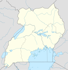
ムガヒンガ・ゴリラ国立公園
| ムガヒンガ・ゴリラ国立公園 Mgahinga Gorilla National Park | |
|---|---|
 国立公園内のマウンテンゴリラ | |
| 地域 |
|
| 最寄り | キソロ |
| 座標 | 南緯01度22分10秒 東経29度38分25秒 / 南緯1.36944度 東経29.64028度座標: 南緯01度22分10秒 東経29度38分25秒 / 南緯1.36944度 東経29.64028度 |
| 面積 | 33.7 km2 (13.0 sq mi) |
| 創立日 | 1991年 |
| 運営組織 | ウガンダ野生生物局 |
ムガヒンガ・ゴリラ国立公園(英: Mgahinga Gorilla National Park)は、ウガンダ南西部のキソロ県に位置する国立公園である。
地理
[編集]ヴィルンガ山地内の非活動の火山であるサビニョ山、ガヒンガ山、ムハブラ山のウガンダ領内となっている北側一帯を範囲とし、ナイル川水系の分水嶺の一部を成している。公園の最寄りの町であるキソロから南へ14キロメートル (km)、ウガンダの首都カンパラからは南西へ540 kmの位置にあり、コンゴ民主共和国のヴィルンガ国立公園の南部とルワンダの火山国立公園に隣接している。ウガンダの国立公園の中では最も規模が小さく、面積は33.7平方キロメートル、標高は2,227メートル (m) からムハブラ山の山頂である4,127 mの範囲にある[1]。
歴史
[編集]ムガヒンガ・ゴリラ国立公園は、ヴィルンガ地方内を自由に移動するマウンテンゴリラの保護を目的として、1930年にイギリス政府により猟獣保護区に指定されていた地域を母体として1991年に設立された[1]。1989年には生物学的調査が開始され、レンジャーの訓練とワイヤートラップの撤去及び植林が進められた。公園内に入植していた居住者は、1990年代初頭に国立公園の外部へと移住している[2]。2013年11月には、公園内においてコンゴ民主共和国東部の反政府武装勢力である3月23日運動の部隊が、コンゴ民主共和国政府軍の攻撃によりウガンダへ投降する事件が発生した[3]。
気候
[編集]2月下旬から5月までと9月下旬から11月までの年2回の雨季があるものの、年間を通じて降水があるため、はっきりとした乾季はない。標高が1,000m上がるごとに約6.5℃気温が低下し、公園内の日中の平均気温は20℃、夜間は9℃程まで下がる[1]。
植物相と動物相
[編集]

更新世における氷河時代の気候の変化を通じて山が動植物に避難場所を提供し、気候が暖かくまたは冷たくなるにつれて生息域が斜面を上下するため、生物学的に重要な位置を占めている[1]。
植物相
[編集]公園はアルバーティーン地溝山地林及びルウェンゾリ=ヴィルンガ山地湿原の範囲に含まれ、公園内では竹林やエイジュ、ハゲニアの森林が見られる[2]。3,000mを超える高地ではジャイアントロベリアやジャイアントセネシオが生息している[1]。
動物相
[編集]公園内に存在する主要な霊長類はマウンテンゴリラとオナガザル亜科のゴールデンモンキー(ヴィルンガゴールデングエノン)である[1][2]。ウガンダ、ルワンダ、コンゴ民主共和国に跨るヴィルンガ山地及びウガンダのブウィンディ原生国立公園に生息しているマウンテンゴリラの内、ムガヒンガ・ゴリラ国立公園内では80頭程が生息している[1]。また、アルバーティーン地溝帯における固有種のうち、2004年の公園内の調査において以下の鳥類が記録されている[4]。
- ウツクシシャコ (Pternistis nobilis)
- ウスグロハゴロモキンパラ (Cryptospiza jacksoni)
- ノドアカムジヒタキ (Chamaetylas poliophrys)
- アビシニアジツグミ (Geokichla piaggiae tanganicae)
- アカエリエボシドリ (Gallirex johnstoni)
- ハナジロセワタビタキ (Batis diops)
- ザイールゴシキタイヨウチョウ (Cinnyris stuhlmanni)
- クビワイロムシクイ (Oreolais ruwenzorii)
- ミヤマカオグロイロムシクイ (Apalis personata)
- アカチャツグミヒタキ (Cossypha archeri)
- クロムネガラ (Melaniparus fasciiventer)
- ルリガシラタイヨウチョウ (Cyanomitra alinae)
- シリアカゴシキタイヨウチョウ (Cinnyris regius)
- カワリハタオリ (Ploceus alienus)
- アビシニアヨタカ (Caprimulgus poliocephalus)
- アカガオハヤシムシクイ (Phylloscopus laetus)
- オオアフリカスゲヨシキリ (Bradypterus graueri)
観光
[編集]公園はウガンダ野生生物局によって管理されており、公園内ではマウンテンゴリラやゴールデンモンキーのトラッキング、バードウォッチング、各火山への登山、先住民文化の体験や洞窟探検などのアクティビティーが提供されている[1]。
脚注
[編集]- ^ a b c d e f g h Mgahinga Gorilla National Park 2019年9月19日閲覧。
- ^ a b c Butynski, T. M., Kalina, J. (1993). “Three new mountain parks for Uganda”. Oryx 27 (4): 214–224.
- ^ “DR Congo's M23 rebel chief Sultani Makenga 'surrenders'”. BBC News. (2013年)
- ^ Owiunji, I., Nkuutu, D., Kujirakwinja, D., Liengola, I., Plumptre, A., Nsanzurwimo, A., Fawcett, K., Gray, M. & McNeilage, A. (2005). Biological Survey of Virunga Volcanoes. New York: Wildlife Conservation Society
外部リンク
[編集]- ムガヒンガ・ゴリラ国立公園(英語)
- ウガンダ野生生物局(英語)
Text is available under the CC BY-SA 4.0 license; additional terms may apply.
Images, videos and audio are available under their respective licenses.

