For faster navigation, this Iframe is preloading the Wikiwand page for マヌアエ島 (リーワード諸島).

マヌアエ島 (リーワード諸島)

マヌアエ島
所在地 フランス領ポリネシアの旗 フランス領ポリネシア
所在海域 南太平洋
所属諸島 リーワード諸島
座標 南緯16度31分0秒 西経154度42分0秒 / 南緯16.51667度 西経154.70000度 / -16.51667; -154.70000座標: 南緯16度31分0秒 西経154度42分0秒 / 南緯16.51667度 西経154.70000度 / -16.51667; -154.70000
面積 3.5 km²
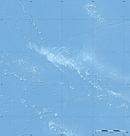
マヌアエ島の位置(フランス領ポリネシア内)
マヌアエ島
マヌアエ島
マヌアエ島の位置(フランス領ポリネシア

マヌアエ島の地図
プロジェクト 地形
テンプレートを表示

マヌアエ島(マヌアエとう、Manuae)は、フランス領ポリネシアに属する島。別名はシリー島 (Scilly) とも呼ばれる。リーワード諸島に属する。黒真珠の母貝やウミガメの産卵地として、全島が自然保護区に指定されている[1]

歴史

[編集]

1767年にマヌアエ島へ最初にヨーロッパから訪問した人物はイギリスナビゲーターサミュエル・ウォリスであった。

脚注

[編集]
  1. ^ 「タヒチ 南太平洋の島々と楽園の素顔」p166 トラベルジャーナル 2000年4月30日第1版第1刷
{{bottomLinkPreText}} {{bottomLinkText}}
マヌアエ島 (リーワード諸島)
Listen to this article

This browser is not supported by Wikiwand :(
Wikiwand requires a browser with modern capabilities in order to provide you with the best reading experience.
Please download and use one of the following browsers:

This article was just edited, click to reload
This article has been deleted on Wikipedia (Why?)

Back to homepage

Please click Add in the dialog above
Please click Allow in the top-left corner,
then click Install Now in the dialog
Please click Open in the download dialog,
then click Install
Please click the "Downloads" icon in the Safari toolbar, open the first download in the list,
then click Install
{{::$root.activation.text}}

Install Wikiwand

Install on Chrome Install on Firefox
Don't forget to rate us

Tell your friends about Wikiwand!

Gmail Facebook Twitter Link

Enjoying Wikiwand?

Tell your friends and spread the love:
Share on Gmail Share on Facebook Share on Twitter Share on Buffer

Our magic isn't perfect

You can help our automatic cover photo selection by reporting an unsuitable photo.

This photo is visually disturbing This photo is not a good choice

Thank you for helping!


Your input will affect cover photo selection, along with input from other users.

X

Get ready for Wikiwand 2.0 🎉! the new version arrives on September 1st! Don't want to wait?