For faster navigation, this Iframe is preloading the Wikiwand page for ホゥプ潟湖.

ホゥプ潟湖

ホゥプ
Hóp
ホゥプの位置(アイスランド内)
ホゥプ
ホゥプ
座標 北緯65度32分 西経20度30分 / 北緯65.533度 西経20.500度 / 65.533; -20.500座標: 北緯65度32分 西経20度30分 / 北緯65.533度 西経20.500度 / 65.533; -20.500[1]
アイスランド
面積 29 - 44 km²
最大水深 9 m
テンプレートを表示

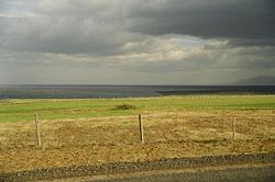
ホゥプ (Hóp) はアイスランド島北部、フーナフィヨルズル (Húnafjörður) のブリョンドゥオゥス村の近くにあるである。

概要

[編集]

実態として、湖というよりはラグーンに近く、そのためにホゥプ潟湖と呼ばれる。水面の高さは潮の満ち引きによって変化し、湖面の面積も 29 km² から 44 km² まで変化する。水深も変化するが、最大で 9 m である。潟湖とフーナフロゥイ湾の間には狭い陸地があり、現在そこには19世紀後半に建てられたシンクエイラル教会 (Þingeyrar) がある[1]が、古くは1133年に僧院が建てられた。

脚注

[編集]
  1. ^ a b travelingluck.com Hóp (個人運営の情報サイト)

関連項目

[編集]
{{bottomLinkPreText}} {{bottomLinkText}}
ホゥプ潟湖
Listen to this article

This browser is not supported by Wikiwand :(
Wikiwand requires a browser with modern capabilities in order to provide you with the best reading experience.
Please download and use one of the following browsers:

This article was just edited, click to reload
This article has been deleted on Wikipedia (Why?)

Back to homepage

Please click Add in the dialog above
Please click Allow in the top-left corner,
then click Install Now in the dialog
Please click Open in the download dialog,
then click Install
Please click the "Downloads" icon in the Safari toolbar, open the first download in the list,
then click Install
{{::$root.activation.text}}

Install Wikiwand

Install on Chrome Install on Firefox
Don't forget to rate us

Tell your friends about Wikiwand!

Gmail Facebook Twitter Link

Enjoying Wikiwand?

Tell your friends and spread the love:
Share on Gmail Share on Facebook Share on Twitter Share on Buffer

Our magic isn't perfect

You can help our automatic cover photo selection by reporting an unsuitable photo.

This photo is visually disturbing This photo is not a good choice

Thank you for helping!


Your input will affect cover photo selection, along with input from other users.

X

Get ready for Wikiwand 2.0 🎉! the new version arrives on September 1st! Don't want to wait?