For faster navigation, this Iframe is preloading the Wikiwand page for ファイル:Stielers Handatlas 1891 63.jpg.

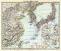
ファイル:Stielers Handatlas 1891 63.jpg

元のファイル(5,050 × 4,250 ピクセル、ファイルサイズ: 6.22メガバイト、MIME タイプ: image/jpeg)

警告 この画像を最大解像度で表示する際に、一部のブラウザで問題が起きることがあります。この画像は画素数が非常に大きいため、正しく読み込まれなかったりブラウザがフリーズしたりする可能性があります。 Open large-image-viewer
Template:Stielers Handatlas 1891
作者
アドルフ・シュティーラー  (1775–1836)  wikidata:Q62914 s:en:Author:Adolf Stieler
 
アドルフ・シュティーラー
別名
Adolph Stieler; Stieler
説明 地図製作者および出版者
生年月日・没年月日 1775年2月26日 ウィキデータを編集 1836年3月13日 ウィキデータを編集
出生地・死没地 ゴータ ebenda
活動拠点
典拠管理
author QS:P50,Q62914
ペーターマン  (1822–1878)  wikidata:Q63230 s:en:Author:August Heinrich Petermann
 
ペーターマン
別名
August Peterman; August Heinrich Petermann; Petermann; August Heinrich PETERMANN
説明 ドイツの 地図製作者、科学イラストレーターおよび地理学者
生年月日・没年月日 1822年4月18日 ウィキデータを編集 1878年9月25日 ウィキデータを編集
出生地・死没地 ブライヒェローデ ゴータ
典拠管理
author QS:P50,Q63230
Carl Vogel  (1828–1897)  wikidata:Q6226563 s:de:Carl Vogel
 
Carl Vogel
説明 ドイツの 地図製作者、トポグラファーおよびsurveying engineer
deutscher Kartograph
生年月日・没年月日 1828年5月4日 ウィキデータを編集 1897年7月16日 ウィキデータを編集
出生地・死没地 バート・ヘルスフェルト ゴータ
活動拠点
典拠管理
author QS:P50,Q6226563
Hermann Berghaus  (1828–1890)  wikidata:Q74679
 
Hermann Berghaus
別名
Berghaus
説明 ドイツの 地図製作者および地理学者
生年月日・没年月日 1828年11月16日 ウィキデータを編集 1890年12月3日 ウィキデータを編集
出生地・死没地 ヘルフォルト ゴータ
活動拠点
典拠管理
author QS:P50,Q74679
Hermann Habenicht  (1844–1917)  wikidata:Q13377354
 
説明 地理学者
生年月日・没年月日 1844年3月3日 ウィキデータを編集 1917年3月30日 / 1917年 ウィキデータを編集
出生地・死没地 ゴータ ゴータ
典拠管理
author QS:P50,Q13377354
  • Publisher: Gotha: Justus Perthes
解説
Deutsch: Ost-China, Korea und Japan
English: East China, Korea and Japan
出版日 1891年
publication_date QS:P577,+1891-00-00T00:00:00Z/9
原典 Adolf Stielers Handatlas
許可
(ファイルの再利用)
Public domain

この著作物は、著作権の保護期間が著作者の死後100年以下である国・地域においてパブリックドメインの状態にあります。


この著作物は1929年1月1日以前に公表され、又はアメリカ合衆国著作権局に登録されたため、アメリカ合衆国においてパブリックドメインの状態にあります。

Revidirt von Dr. R. Lüddecke.

ファイルの履歴

過去の版のファイルを表示するには、その版の日時をクリックしてください。

日付と時刻サムネイル寸法利用者コメント
現在の版2010年3月13日 (土) 08:062010年3月13日 (土) 08:06時点における版のサムネイル5,050 × 4,250 (6.22メガバイト)Kolossosbetter quality
2006年11月21日 (火) 17:442006年11月21日 (火) 17:44時点における版のサムネイル3,788 × 3,188 (1.23メガバイト)Poccil((Stielers Handatlas 1891|62|64|Ost-China, Korea und Japan|East China, Korea and Japan)) Category:Old maps of China Category: Old maps of Japan

ファイルの使用状況

以下の​ 3 ページがこのファイルを使用しています:

グローバルなファイル使用状況

以下に挙げる他のウィキがこの画像を使っています:

メタデータ

{{bottomLinkPreText}} {{bottomLinkText}}
ファイル:Stielers Handatlas 1891 63.jpg
Listen to this article

This browser is not supported by Wikiwand :(
Wikiwand requires a browser with modern capabilities in order to provide you with the best reading experience.
Please download and use one of the following browsers:

This article was just edited, click to reload
This article has been deleted on Wikipedia (Why?)

Back to homepage

Please click Add in the dialog above
Please click Allow in the top-left corner,
then click Install Now in the dialog
Please click Open in the download dialog,
then click Install
Please click the "Downloads" icon in the Safari toolbar, open the first download in the list,
then click Install
{{::$root.activation.text}}

Install Wikiwand

Install on Chrome Install on Firefox
Don't forget to rate us

Tell your friends about Wikiwand!

Gmail Facebook Twitter Link

Enjoying Wikiwand?

Tell your friends and spread the love:
Share on Gmail Share on Facebook Share on Twitter Share on Buffer

Our magic isn't perfect

You can help our automatic cover photo selection by reporting an unsuitable photo.

This photo is visually disturbing This photo is not a good choice

Thank you for helping!


Your input will affect cover photo selection, along with input from other users.

X

Get ready for Wikiwand 2.0 🎉! the new version arrives on September 1st! Don't want to wait?