ファイル:Montréal-blank.png
このプレビューのサイズ: 723 × 599 ピクセル。 その他の解像度: 290 × 240 ピクセル | 579 × 480 ピクセル | 841 × 697 ピクセル。
元のファイル (841 × 697 ピクセル、ファイルサイズ: 186キロバイト、MIME タイプ: image/png)
ウィキメディア・コモンズのファイルページにある説明を、以下に表示します。
|
概要
| 解説 |
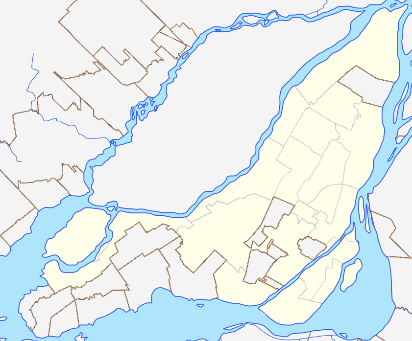
English: Blank map of Montreal and Laval Islands to be used for en:Template:Location map Canada Montreal. Colours are matched to File:Canada Quebec location map 2.svg for consistency. |
| 日付 | (UTC) |
| 原典 |
このファイルの派生元: Région métropolitaine de Montréal-blank.svg: |
| 作者 |
|
ライセンス
この作品の著作権者である私は、この作品を以下のライセンスで提供します。
このファイルはクリエイティブ・コモンズ 表示-継承 3.0 非移植ライセンスのもとに利用を許諾されています。
- あなたは以下の条件に従う場合に限り、自由に
- 共有 – 本作品を複製、頒布、展示、実演できます。
- 再構成 – 二次的著作物を作成できます。
- あなたの従うべき条件は以下の通りです。
- 表示 – あなたは適切なクレジットを表示し、ライセンスへのリンクを提供し、変更があったらその旨を示さなければなりません。これらは合理的であればどのような方法で行っても構いませんが、許諾者があなたやあなたの利用行為を支持していると示唆するような方法は除きます。
- 継承 – もしあなたがこの作品をリミックスしたり、改変したり、加工した場合には、あなたはあなたの貢献部分を元の作品とこれと同一または互換性があるライセンスの下に頒布しなければなりません。
元のアップロードログ
This image is a derivative work of the following images:
- File:Région_métropolitaine_de_Montréal-blank.svg licensed with Cc-by-sa-3.0
- 2012-07-28T22:03:53Z Flappiefh 1667x1511 (335659 Bytes) La carte précédente était inclinée de 3,8° par rapport au nord. Corrigé.
- 2012-07-27T16:44:18Z Flappiefh 1694x1416 (354061 Bytes) Rotation de 3.8° (le Nord est désormais aligné avec les bords de la carte). Correction des cours d'eau.
- 2012-07-21T08:13:01Z Flappiefh 1714x1526 (338754 Bytes) Ajustement des cours d'eau et des bords du Saint-Laurent.
- 2012-07-21T07:49:12Z Flappiefh 1714x1526 (338185 Bytes)
Uploaded with derivativeFX
ファイルの履歴
過去の版のファイルを表示するには、その版の日時をクリックしてください。
| 日付と時刻 | サムネイル | 寸法 | 利用者 | コメント | |
|---|---|---|---|---|---|
| 現在の版 | 2012年12月16日 (日) 04:34 | | 841 × 697 (186キロバイト) | P199 | thinner borough lines |
| 2012年12月14日 (金) 23:58 |  | 841 × 697 (197キロバイト) | P199 | == ((int:filedesc)) == ((Information |Description=((en|1=Blank map of Montreal and Laval Islands to be used for en:Template:Location map Canada Montreal. Colours are matched to for consistency.)) |Source=((Derived from|Région_métropolitaine_de_M... |
ファイルの使用状況
以下の 4 ページがこのファイルを使用しています:
グローバルなファイル使用状況
以下に挙げる他のウィキがこの画像を使っています:
- ar.wikipedia.org での使用状況
- azb.wikipedia.org での使用状況
- en.wikipedia.org での使用状況
- Talk:Island of Montreal
- Mount Royal
- Notre-Dame-de-Grâce
- Bell Centre
- Mary, Queen of the World Cathedral
- Canadian Centre for Architecture
- Olympic Stadium (Montreal)
- Christ Church Cathedral (Montreal)
- Hochelaga-Maisonneuve
- Ahuntsic
- Pierrefonds, Quebec
- L'Île-Bizard, Quebec
- Percival Molson Memorial Stadium
- Hôtel-Dieu de Montréal
- Montreal Casino
- Pointe-Saint-Charles
- Griffintown
- Place Jacques-Cartier
- Notre Dame Island
- Royal Victoria Hospital, Montreal
- McCord Stewart Museum
- Golden Square Mile
- Schwartz's
- List of airports in the Montreal area
- Quartier Latin, Montreal
- Rivière-des-Prairies–Pointe-aux-Trembles–Montréal-Est
- Saint-Henri, Montreal
- Villeray, Montreal
- Quartier international de Montréal
- Dow Planetarium
- KPMG Tower
- Chinatown, Montreal
- Allan Memorial Institute
- Montreal Holocaust Museum
- Old Montreal
- Shriners Hospital for Children – Canada
- Little Italy, Montreal
- Gay Village, Montreal
- Roxboro, Quebec
- World Trade Centre Montreal
- Louis-Hippolyte Lafontaine Bridge–Tunnel
- Montreal Central Station
- Victoria Square, Montreal
- Ville-Émard
- Sainte-Geneviève, Quebec
- St. James United Church (Montreal)
- Montreal City Hall
このファイルのグローバル使用状況を表示する。
メタデータ
Text is available under the CC BY-SA 4.0 license; additional terms may apply.
Images, videos and audio are available under their respective licenses.
Cover photo is available under {{::mainImage.info.license.name || 'Unknown'}} license.
Cover photo is available under {{::mainImage.info.license.name || 'Unknown'}} license.
Credit:
(see original file).
