For faster navigation, this Iframe is preloading the Wikiwand page for ファイル:French Polynesia relief map with communes.svg.

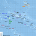
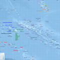
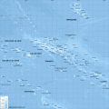
ファイル:French Polynesia relief map with communes.svg

元のファイル(SVG ファイル、1,260 × 1,260 ピクセル、ファイルサイズ: 1.52メガバイト)

この画像を で描画する。

概要

解説
Català: Mapa topogràfic amb noms de subdivisions de la Polinèsia Francesa (en francès)
English: Topographic map with subdivision names of French Polynesia (in French)
Français : Carte topographique de la Polynésie française, en français, avec les noms des subdivisions (communes et archipels)
日付
原典 Own work.

Data sources :

Softwares used :

Others :

  • Equirectangular map projection
  • WGS84 geodetic system
作者 L. Claudel (Sardon - fr:Sardon)
その他のバージョン
Other related versions: [編集]
このファイルを翻訳

このSVGファイルには翻訳可能な埋め込みテキストが含まれています。SVG翻訳ツールや他のSVGエディタを使用して自分の言語に翻訳可能です。詳しくはSVGファイルの翻訳についてを参照してください。

このファイルはSVGの<switch>要素を利用して翻訳されています。翻訳の全ては同じファイルに格納されています!詳しくはCommons:Translation possible/Learn moreをお読みください。

翻訳済みであるあなたの言語でこのファイルを利用するときは、言語コードとlangパラメータを用いてください。日本語版は[[File:French Polynesia relief map with communes.svg|lang=ja]]のようにして呼び出せます。

また、このファイルをあなたの言語に翻訳するには、ファイルをダウンロードし、翻訳を追加して、このファイルと同じ名前で再アップロードして下さい。不明瞭な点がある場合は Graphics Lab が役に立つでしょう。

 
このW3C-unspecified ベクター画像Inkscapeで作成されました .

ライセンス

この作品の著作権者である私は、この作品を以下のライセンスで提供します。
GNU head この文書は、フリーソフトウェア財団発行のGNUフリー文書利用許諾書 (GNU Free Documentation License) 1.2またはそれ以降のバージョンの規約に基づき、複製や再配布、改変が許可されます。不可変更部分、表紙、背表紙はありません。このライセンスの複製は、GNUフリー文書利用許諾書という章に含まれています。
w:ja:クリエイティブ・コモンズ
表示 継承
このファイルはクリエイティブ・コモンズ 表示-継承 3.0 非移植2.5 一般2.0 一般1.0 一般のライセンスのもとに利用を許諾されています。
あなたは以下の条件に従う場合に限り、自由に
  • 共有 – 本作品を複製、頒布、展示、実演できます。
  • 再構成 – 二次的著作物を作成できます。
あなたの従うべき条件は以下の通りです。
  • 表示 – あなたは適切なクレジットを表示し、ライセンスへのリンクを提供し、変更があったらその旨を示さなければなりません。これらは合理的であればどのような方法で行っても構いませんが、許諾者があなたやあなたの利用行為を支持していると示唆するような方法は除きます。
  • 継承 – もしあなたがこの作品をリミックスしたり、改変したり、加工した場合には、あなたはあなたの貢献部分を元の作品とこれと同一または互換性があるライセンスの下に頒布しなければなりません。
あなたは上記のライセンスから、どれか一つ以上を選択できます。

キャプション

このファイルの内容を1行で記述してください

このファイルに描写されている項目

題材

10月 2008

ファイルの履歴

過去の版のファイルを表示するには、その版の日時をクリックしてください。

日付と時刻サムネイル寸法利用者コメント
現在の版2024年2月15日 (木) 21:392024年2月15日 (木) 21:39時点における版のサムネイル1,260 × 1,260 (1.52メガバイト)ManlleusFile uploaded using svgtranslate tool (https://svgtranslate.toolforge.org/). Added translation for ca.
2008年10月16日 (木) 20:322008年10月16日 (木) 20:32時点における版のサムネイル1,260 × 1,260 (1.4メガバイト)Sardon((Information |Description=((en|1=Topographic map with subdivision names of French Polynesia (in French))) ((fr|1=Carte topographique de la Polynésie française, en français, avec les noms des subdivisions (communes et archipels))) |Source=Own work.((cl

ファイルの使用状況

以下のページがこのファイルを使用しています:

グローバルなファイル使用状況

メタデータ

{{bottomLinkPreText}} {{bottomLinkText}}
ファイル:French Polynesia relief map with communes.svg
Listen to this article

This browser is not supported by Wikiwand :(
Wikiwand requires a browser with modern capabilities in order to provide you with the best reading experience.
Please download and use one of the following browsers:

This article was just edited, click to reload
This article has been deleted on Wikipedia (Why?)

Back to homepage

Please click Add in the dialog above
Please click Allow in the top-left corner,
then click Install Now in the dialog
Please click Open in the download dialog,
then click Install
Please click the "Downloads" icon in the Safari toolbar, open the first download in the list,
then click Install
{{::$root.activation.text}}

Install Wikiwand

Install on Chrome Install on Firefox
Don't forget to rate us

Tell your friends about Wikiwand!

Gmail Facebook Twitter Link

Enjoying Wikiwand?

Tell your friends and spread the love:
Share on Gmail Share on Facebook Share on Twitter Share on Buffer

Our magic isn't perfect

You can help our automatic cover photo selection by reporting an unsuitable photo.

This photo is visually disturbing This photo is not a good choice

Thank you for helping!


Your input will affect cover photo selection, along with input from other users.

X

Get ready for Wikiwand 2.0 🎉! the new version arrives on September 1st! Don't want to wait?