For faster navigation, this Iframe is preloading the Wikiwand page for ナロードナヤ山.

ナロードナヤ山

ナロードナヤ山
標高 1,894 m
所在地

ロシアの旗 ロシア

位置 北緯65度02分00秒 東経60度07分00秒 / 北緯65.03333度 東経60.11667度 / 65.03333; 60.11667座標: 北緯65度02分00秒 東経60度07分00秒 / 北緯65.03333度 東経60.11667度 / 65.03333; 60.11667
山系 ウラル山脈
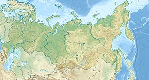
ナロードナヤ山の位置(ロシア内)
ナロードナヤ山
プロジェクト 山
テンプレートを表示

ナロードナヤ山(ナロードナヤさん、ロシア語: Гора Народная, 英語: Mount Narodnaya, コミ語: Народа-Из,「人民の山」の意味)は、ロシアにある山で、標高は1894 m。ウラル山脈最高峰である。チュメニ州にあり、コミ共和国との境界の0.5 km東にある。原生代からカンブリア紀の、珪岩と変成した粘板岩からなる。この山はいくつかの氷河を頂く。山麓にある谷にはカラマツカバノキの疎林がある。斜面は高地性のツンドラに覆われている。

クレムリンの赤い星

[編集]

クレムリンにあるトロイツカヤ塔、ホロヴィツカヤ塔、ヴォドヴズヴォドナヤ塔、スパスカヤ塔、ニコリスカヤ塔の先端には、同山脈から採掘されたルビーで作られた直径3メートルになる赤い星がある。

{{bottomLinkPreText}} {{bottomLinkText}}
ナロードナヤ山
Listen to this article

This browser is not supported by Wikiwand :(
Wikiwand requires a browser with modern capabilities in order to provide you with the best reading experience.
Please download and use one of the following browsers:

This article was just edited, click to reload
This article has been deleted on Wikipedia (Why?)

Back to homepage

Please click Add in the dialog above
Please click Allow in the top-left corner,
then click Install Now in the dialog
Please click Open in the download dialog,
then click Install
Please click the "Downloads" icon in the Safari toolbar, open the first download in the list,
then click Install
{{::$root.activation.text}}

Install Wikiwand

Install on Chrome Install on Firefox
Don't forget to rate us

Tell your friends about Wikiwand!

Gmail Facebook Twitter Link

Enjoying Wikiwand?

Tell your friends and spread the love:
Share on Gmail Share on Facebook Share on Twitter Share on Buffer

Our magic isn't perfect

You can help our automatic cover photo selection by reporting an unsuitable photo.

This photo is visually disturbing This photo is not a good choice

Thank you for helping!


Your input will affect cover photo selection, along with input from other users.

X

Get ready for Wikiwand 2.0 🎉! the new version arrives on September 1st! Don't want to wait?