For faster navigation, this Iframe is preloading the Wikiwand page for ナヌマンガ島.

ナヌマンガ島

ナヌマンガ島
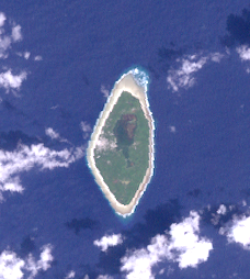
アメリカ航空宇宙局(NASA)のランドサット画像
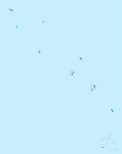
ナヌマンガ島の位置(ツバル内)
ナヌマンガ島
ナヌマンガ島
ツバルにおける位置
ツバル
面積
 • 合計 3 km2
人口
(2002)
 • 合計 589人
 • 密度 200人/km2
族称 ナヌマンガン(Nanumangan)

ナヌマンガ島(Nanumanga)もしくはナヌマガ島(Nanumaga)は、ツバルの島・環礁で、同国を構成する地区でもある。面積はおよそ3km2。2002年国勢調査時点の人口は589人であった。1986年、海中に沈んだナヌマンガ洞穴で先史時代の火の使用痕跡が見つかったことから、オセアニアの考古学者の間で話題になった。

地理

[編集]

4つの島に3つのラグーンがあり、うち最大のラグーンはヴァイアトア(Vaiatoa)と呼ばれる。マングローブや乾燥下でも生育できる植物が植わっている。南北に細長い楕円形をしていて、最北端はテ・カウパパ岬、最南端はテ・パパ岬という。

島の西部にトンガ村(308人)とトケラウ村(281人)の2村がある。

選挙区

[編集]

ナヌマンガ島には、ツバル議会の選挙区のひとつが割り振られている。定数はほかの選挙区と同じ2。直近の2024年の総選挙では、モニーズ・ラファイとハモア・ホロナが当選した[1][2]

脚注

[編集]
{{bottomLinkPreText}} {{bottomLinkText}}
ナヌマンガ島
Listen to this article

This browser is not supported by Wikiwand :(
Wikiwand requires a browser with modern capabilities in order to provide you with the best reading experience.
Please download and use one of the following browsers:

This article was just edited, click to reload
This article has been deleted on Wikipedia (Why?)

Back to homepage

Please click Add in the dialog above
Please click Allow in the top-left corner,
then click Install Now in the dialog
Please click Open in the download dialog,
then click Install
Please click the "Downloads" icon in the Safari toolbar, open the first download in the list,
then click Install
{{::$root.activation.text}}

Install Wikiwand

Install on Chrome Install on Firefox
Don't forget to rate us

Tell your friends about Wikiwand!

Gmail Facebook Twitter Link

Enjoying Wikiwand?

Tell your friends and spread the love:
Share on Gmail Share on Facebook Share on Twitter Share on Buffer

Our magic isn't perfect

You can help our automatic cover photo selection by reporting an unsuitable photo.

This photo is visually disturbing This photo is not a good choice

Thank you for helping!


Your input will affect cover photo selection, along with input from other users.

X

Get ready for Wikiwand 2.0 🎉! the new version arrives on September 1st! Don't want to wait?