ゴイアニア
| ゴイアニア Goiânia | |||
|---|---|---|---|

| |||
| |||
| 位置 | |||

| |||
| 位置 | |||
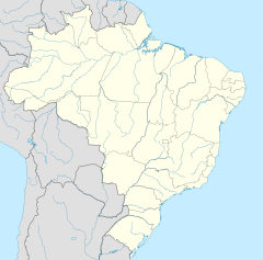
| 座標 : 南緯16度40分0秒 西経49度15分0秒 / 南緯16.66667度 西経49.25000度 | |||
| 歴史 | |||
| Founded | 1933年10月24日 | ||
| 行政 | |||
| 国 | |||
| 地方 | 中西部 | ||
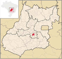
| 州 | ゴイアス州 | ||
| 市 | ゴイアニア | ||
| 地理 | |||
| 面積 | |||
| 市域 | 789 km2 | ||
| 標高 | 749 m | ||
| 人口 | |||
| 人口 | (2020年現在) | ||
| 市域 | 1,536,097人 | ||
| 備考 | 統計[1] | ||
| その他 | |||
| 等時帯 | ブラジル時間 (UTC-3) | ||
| 公式ウェブサイト : http://www.goiania.go.gov.br/ | |||
ゴイアニア(Goiânia [ɡojˈjɐniɐ])は、ブラジルのゴイアス州の州都。人口は約153万人(2020年)。首都ブラジリアの200km南西に位置する。
ブラジル高原にあり、農産物(牛肉や大豆)の集積地として建設された計画都市であり、1933年に建設された。後にブラジル内陸の拠点都市として、工業、医療、農業の中心基地として発展を遂げた。また、多くのブラジル国内大手企業が拠点を置いているなど、ブラジルを代表する経済都市として発展している。
また、市街地は切り開かれた森林地帯の中にあり、世界で2番めに居住者が多い森林地帯(1位はカナダのエドモントン)と見做されている。市街地は三方からの平原に展開し、市街地の30%が植林(伐採されずに残ったものも多い)に覆われているなど、特徴的な景観を見せている。また、泉も多く、"spring capital"の異名を持つ。
歴史
[編集]- 1933年 内陸地域の開発拠点として建設された。
- 1937年 州都がゴイアニアに移された。
- 1987年 閉鎖された病院に残されていた放射線源のセシウム137が盗まれて廃品業者に売り渡され、その結果250人もの被曝者を出してそのうち4人が死亡(ゴイアニア被曝事故)。
気候
[編集]| ゴイアニア(1961年–1990年)の気候 | |||||||||||||
|---|---|---|---|---|---|---|---|---|---|---|---|---|---|
| 月 | 1月 | 2月 | 3月 | 4月 | 5月 | 6月 | 7月 | 8月 | 9月 | 10月 | 11月 | 12月 | 年 |
| 最高気温記録 °C (°F) | 35.2 (95.4) |
34.6 (94.3) |
34.4 (93.9) |
34.0 (93.2) |
33.7 (92.7) |
32.6 (90.7) |
33.3 (91.9) |
36.2 (97.2) |
38.4 (101.1) |
40.4 (104.7) |
36.2 (97.2) |
35.4 (95.7) |
40.4 (104.7) |
| 平均最高気温 °C (°F) | 29.2 (84.6) |
29.4 (84.9) |
30.1 (86.2) |
30.0 (86) |
29.1 (84.4) |
28.7 (83.7) |
28.9 (84) |
31.2 (88.2) |
31.9 (89.4) |
31.0 (87.8) |
29.7 (85.5) |
28.9 (84) |
29.8 (85.6) |
| 日平均気温 °C (°F) | 23.8 (74.8) |
23.8 (74.8) |
24.0 (75.2) |
23.6 (74.5) |
22.2 (72) |
20.9 (69.6) |
20.9 (69.6) |
23.0 (73.4) |
24.5 (76.1) |
24.6 (76.3) |
24.1 (75.4) |
23.5 (74.3) |
23.2 (73.8) |
| 平均最低気温 °C (°F) | 19.7 (67.5) |
19.7 (67.5) |
19.5 (67.1) |
18.5 (65.3) |
16.0 (60.8) |
13.7 (56.7) |
13.2 (55.8) |
15.0 (59) |
18.1 (64.6) |
19.5 (67.1) |
19.6 (67.3) |
19.7 (67.5) |
17.7 (63.9) |
| 最低気温記録 °C (°F) | 9.1 (48.4) |
15.4 (59.7) |
14.0 (57.2) |
11.2 (52.2) |
5.7 (42.3) |
3.5 (38.3) |
0.5 (32.9) |
6.8 (44.2) |
10.4 (50.7) |
13.7 (56.7) |
14.4 (57.9) |
12.9 (55.2) |
0.5 (32.9) |
| 降水量 mm (inch) | 266.8 (10.504) |
214.8 (8.457) |
206.8 (8.142) |
118.9 (4.681) |
35.9 (1.413) |
9.2 (0.362) |
6.6 (0.26) |
13.2 (0.52) |
45.4 (1.787) |
166.9 (6.571) |
219.0 (8.622) |
267.9 (10.547) |
1,571.4 (61.866) |
| 平均降水日数 (≥1.0 mm) | 18 | 15 | 15 | 8 | 4 | 1 | 1 | 2 | 5 | 12 | 16 | 19 | 116 |
| % 湿度 | 75 | 76 | 74 | 71 | 65 | 60 | 53 | 47 | 53 | 65 | 73 | 76 | 65.7 |
| 平均月間日照時間 | 183.8 | 156.9 | 203.1 | 229.0 | 249.7 | 269.0 | 286.8 | 281.2 | 212.3 | 188.2 | 174.2 | 172.6 | 2,606.7 |
| 出典:INMET[2] | |||||||||||||
交通
[編集]- サンタ・ジェノベバ空港(en:Santa Genoveva Airport)
教育
[編集]スポーツ
[編集]姉妹都市
[編集] イダー=オーバーシュタイン、ドイツ
 ベレン、ブラジル
 マナウス、ブラジル
 ウベルランジア、ブラジル
 グロッテ・ディ・カストロ、イタリア
 リヨン、フランス
 バルキシメト、ベネズエラ
 グアダラハラ、メキシコ
 パリ、フランス
 シアトル、アメリカ合衆国
関連項目
[編集]脚注
[編集]- ^ IBGE 2020
- ^ “NORMAIS CLIMATOLÓGICAS DO BRASIL 1961–1990” (Portuguese). Instituto Nacional de Meteorologia. 2014年9月5日閲覧。
外部リンク
[編集]| 全般 | |
|---|---|
| 国立図書館 | |
| 地理 | |
Text is available under the CC BY-SA 4.0 license; additional terms may apply.
Images, videos and audio are available under their respective licenses.


