For faster navigation, this Iframe is preloading the Wikiwand page for Suðuroy.

Suðuroy

Da Wikipedia, l'enciclopedia libera.

Suðuroy
la costa ovest di Suðuroy, fra Sumba e Vágur
Geografia fisica
LocalizzazioneMare di Norvegia
Coordinate61°32′N 6°51′W
ArcipelagoIsole Fær Øer
Superficie164,7[1] km²
Altitudine massima610 m s.l.m.
Geografia politica
StatoBandiera della Danimarca Danimarca
Nazione costitutivaBandiera delle Fær Øer Fær Øer
Centro principaleTvøroyri
Demografia
Abitanti4.603 (2016)
Densità28 ab./km²
Cartografia
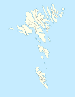
Mappa di localizzazione: Isole Fær Øer
Suðuroy
Suðuroy
voci di isole della Danimarca presenti su Wikipedia

Suðuroy (letteralmente “isola del sud”; pronuncia: [ˈsuːwʊrɔi] oppure [ˈsuːri]; in danese Suderø) è un'isola dell'arcipelago delle Isole Fær Øer. È l'isola più meridionale di tutte ed è la quarta per dimensioni, con un'estensione pari a 164.7 km. La maggior parte dei centri abitati si trova lungo i fiordi della costa orientale, come ad esempio Tvøroyri che è il cuore economico e politico dell'isola. Altri centri importanti sono Vágur, Sumba e Fámjin.

Montagna Altezza
Gluggarnir 610 m
Eystanfyri Herðablaðið 605 m
Mjóstíggjur 592 m
Borgarknappur 574 m
Borgin (Vágur) 570 m
Galvurin 569 m
Hvannafelli 560 m
Nakkur (Trungisvágur) 547 m
Glopprókin 535 m
Høgøksl 525 m
Tindur (Trungisvágur) 514 m
Tempulsklettur 493 m
Bustin (Froðba) 487 m
Laðanfelli 487 m
Kambur (Froðba) 483 m
Vágfelli 483 m
Prestfjall 471 m
Beinisvørð 470 m
Fjallið Mikla 469 m
Spáfelli 462 m
Oyrnafjall 443 m
Høguskorar 440 m
Spinarnir 439 m
Rávan 432 m
Borgin (Sandvík) 429 m
Nónfjall 427 m
Enni 424 m
Kolheyggjurin 415 m
Túgvan i Halgafelli 400 m
Rossaklettur 389 m
Tindurin (Sumba) 379 m
Skálafjall 374 m
Eggin 372 m
Glývrabergsnasi 366 m
Siglifelli 359 m
Rútafelli 356 m
Bustin (Sandvík) 353 m
Fjallið (Sandvík) 350 m
Kaguklettur 347 m
Gjógvaráfjall 345 m
Nakkar 330 m
Knúkin 329 m
Grímsfjall 327 m
Nakkur (Froðba) 325 m
Hólmsskorafjall 322 m
Uttarafjall 320 m
Tindur (Vágur) 298 m
Skálin 286 m
Skornasaklettur 286 m
Eystarafjall 285 m
Fjallið (Trungisvágur) 259 m
Vørðan 237 m
Kirvi 236 m
Lambaklettur 235 m
Kambur 206 m

Nella cultura di massa

[modifica | modifica wikitesto]

Suðuroy viene descritta nel romanzo Isola della scrittrice danese Siri Ranva Hjelm Jacobsen

  1. ^ Faroe Islands in figures 2017 (PDF), su hagstova.fo, Hagstova Føroya. URL consultato il 21 novembre 2017 (archiviato dall'url originale il 5 febbraio 2018).

Altri progetti

[modifica | modifica wikitesto]

Collegamenti esterni

[modifica | modifica wikitesto]
Controllo di autoritàVIAF (EN246272630 · LCCN (ENsh96007944 · J9U (ENHE987007561378505171
  Portale Isole: accedi alle voci di Wikipedia che trattano di isole
{{bottomLinkPreText}} {{bottomLinkText}}
Suðuroy
Listen to this article

This browser is not supported by Wikiwand :(
Wikiwand requires a browser with modern capabilities in order to provide you with the best reading experience.
Please download and use one of the following browsers:

This article was just edited, click to reload
This article has been deleted on Wikipedia (Why?)

Back to homepage

Please click Add in the dialog above
Please click Allow in the top-left corner,
then click Install Now in the dialog
Please click Open in the download dialog,
then click Install
Please click the "Downloads" icon in the Safari toolbar, open the first download in the list,
then click Install
{{::$root.activation.text}}

Install Wikiwand

Install on Chrome Install on Firefox
Don't forget to rate us

Tell your friends about Wikiwand!

Gmail Facebook Twitter Link

Enjoying Wikiwand?

Tell your friends and spread the love:
Share on Gmail Share on Facebook Share on Twitter Share on Buffer

Our magic isn't perfect

You can help our automatic cover photo selection by reporting an unsuitable photo.

This photo is visually disturbing This photo is not a good choice

Thank you for helping!


Your input will affect cover photo selection, along with input from other users.

X

Get ready for Wikiwand 2.0 🎉! the new version arrives on September 1st! Don't want to wait?