Pointe du Mountet
Da Wikipedia, l'enciclopedia libera.
| Pointe du Mountet | |
|---|---|
| Stato | |
| Cantone | |
| Altezza | 3 877 m s.l.m. |
| Prominenza | 42 m |
| Catena | Alpi |
| Coordinate | 46°03′33.8″N 7°41′07.3″E |
| Mappa di localizzazione | |
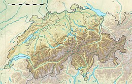 Pointe du Mountet  | |
| Dati SOIUSA | |
| Grande Parte | Alpi Occidentali |
| Grande Settore | Alpi Nord-occidentali |
| Sezione | Alpi Pennine |
| Sottosezione | Alpi del Weisshorn e del Cervino |
| Supergruppo | Catena Weisshorn-Zinalrothorn |
| Gruppo | Gruppo Obergabelhorn-Zinalrothorn |
| Codice | I/B-9.II-D.7 |
La Pointe du Mountet (3.877 m s.l.m.) è una montagna delle Alpi del Weisshorn e del Cervino nelle Alpi Pennine.
Descrizione
[modifica | modifica wikitesto]Si trova nel Canton Vallese ad ovest di Zermatt lungo la cresta che dall'Obergabelhorn conduce allo Zinalrothorn.
Salita alla vetta
[modifica | modifica wikitesto]Si può salire sulla vetta partendo dalla Cabane du Grand Mountet (2.886 m). Dal rifugio si sale prima al Col du Mountet (3.658 m) e poi si risale la cresta sud.
Altri progetti
[modifica | modifica wikitesto] Wikimedia Commons contiene immagini o altri file su Pointe du Mountet
Collegamenti esterni
[modifica | modifica wikitesto]- La Pointe du Mountet su mountain-forecast.com, su mountain-forecast.com.
Text is available under the CC BY-SA 4.0 license; additional terms may apply.
Images, videos and audio are available under their respective licenses.
Cover photo is available under {{::mainImage.info.license.name || 'Unknown'}} license.
Cover photo is available under {{::mainImage.info.license.name || 'Unknown'}} license.
Credit:
(see original file).
