Kisherend
Da Wikipedia, l'enciclopedia libera.
Questa voce o sezione sull'argomento centri abitati del Transdanubio Meridionale non cita le fonti necessarie o quelle presenti sono insufficienti.
| Kisherend comune | |
|---|---|
  | |
 | |
| Localizzazione | |
| Stato | |
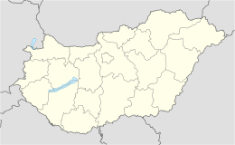
| Regione | Transdanubio Meridionale |
| Contea | |
| Territorio | |
| Coordinate | 45°57′56.56″N 18°19′57.04″E |
| Superficie | 6,92 km² |
| Abitanti | 190 (2008) |
| Densità | 27,46 ab./km² |
| Altre informazioni | |
| Cod. postale | 7763 |
| Prefisso | 72 |
| Fuso orario | UTC+1 |
| Codice KSH | 16975 |
| Cartografia | |
 Kisherend | |
Kisherend è un comune dell'Ungheria di 190 abitanti (dati 2008) situato nella contea di Baranya, nella regione Transdanubio Meridionale.
Altri progetti
[modifica | modifica wikitesto] Wikimedia Commons contiene immagini o altri file su Kisherend
Text is available under the CC BY-SA 4.0 license; additional terms may apply.
Images, videos and audio are available under their respective licenses.
Cover photo is available under {{::mainImage.info.license.name || 'Unknown'}} license.
Cover photo is available under {{::mainImage.info.license.name || 'Unknown'}} license.
Credit:
(see original file).
