Glaubenberg
Da Wikipedia, l'enciclopedia libera.
Questa voce o sezione sull'argomento valichi della Svizzera non cita le fonti necessarie o quelle presenti sono insufficienti.
| Glaubenberg | |
|---|---|
 | |
| Stato | |
| Regione | |
| Località collegate | Entlebuch Sarnen |
| Altitudine | 1 543 e 1 540 m s.l.m. |
| Coordinate | 46°53′37″N 8°06′31″E |
| Infrastruttura | strada |
| Pendenza massima | 18% |
| Lunghezza | 32 km |
| Mappa di localizzazione | |
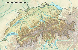 Glaubenberg | |
Il Glaubenberg è un passo di montagna tra Canton Lucerna e Canton Obvaldo, collega la località di Entlebuch con Sarnen. Scollina a un'altitudine di 1543 m s.l.m.
Altri progetti
[modifica | modifica wikitesto] Wikimedia Commons contiene immagini o altri file su Glaubenberg
Text is available under the CC BY-SA 4.0 license; additional terms may apply.
Images, videos and audio are available under their respective licenses.
Cover photo is available under {{::mainImage.info.license.name || 'Unknown'}} license.
Cover photo is available under {{::mainImage.info.license.name || 'Unknown'}} license.
Credit:
(see original file).
