Frías de Albarracín
Da Wikipedia, l'enciclopedia libera.
| Frías de Albarracín comune | |
|---|---|
 | |
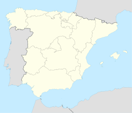
| Localizzazione | |
| Stato | |
| Comunità autonoma | |
| Provincia | |
| Territorio | |
| Coordinate | 40°20′16.08″N 1°36′55.08″W |
| Altitudine | 1 496 m s.l.m. |
| Superficie | 50,70 km² |
| Abitanti | 154 (2001) |
| Densità | 3,04 ab./km² |
| Comuni confinanti | Albarracín |
| Altre informazioni | |
| Cod. postale | 44126 |
| Prefisso | (+34)... |
| Fuso orario | UTC+1 |
| Codice INE | 44109 |
| Targa | TE |
| Cartografia | |
 Frías de Albarracín | |
| Sito istituzionale | |
Frías de Albarracín è un comune spagnolo di 154 abitanti situato nella comunità autonoma dell'Aragona.
Nel suo territorio comunale è situata la sorgente del Tago, il fiume più lungo della Penisola iberica[1].
Note
[modifica | modifica wikitesto]Altri progetti
[modifica | modifica wikitesto] Wikimedia Commons contiene immagini o altri file su Frías de Albarracín
Collegamenti esterni
[modifica | modifica wikitesto]- Sito ufficiale, su friasdealbarracin.es.
| Controllo di autorità | VIAF (EN) 151455328 · LCCN (EN) n99024795 · BNF (FR) cb13555532p (data) · J9U (EN, HE) 987007491700105171 |
|---|
Text is available under the CC BY-SA 4.0 license; additional terms may apply.
Images, videos and audio are available under their respective licenses.
Cover photo is available under {{::mainImage.info.license.name || 'Unknown'}} license.
Cover photo is available under {{::mainImage.info.license.name || 'Unknown'}} license.
Credit:
(see original file).
