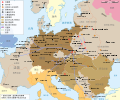
File:WW2-Holocaust-Europe.png
Da Wikipedia, l'enciclopedia libera.
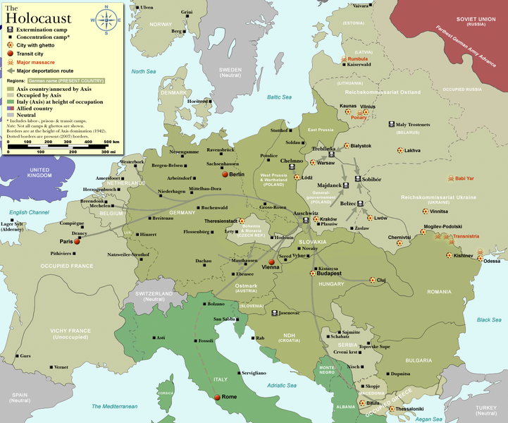
File originale (1 310 × 1 090 pixel, dimensione del file: 639 KB, tipo MIME: image/png)
Cronologia del file
Fare clic su un gruppo data/ora per vedere il file come si presentava nel momento indicato.
| Data/Ora | Miniatura | Dimensioni | Utente | Commento | |
|---|---|---|---|---|---|
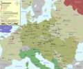
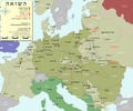
| attuale | 15:57, 29 ott 2009 |  | 1 310 × 1 090 (639 KB) | Flying Saucer | moved Vaivara to it's right place |
| 05:41, 20 dic 2007 |  | 1 310 × 1 090 (826 KB) | Dna-webmaster~commonswiki | new version without "Axis cooperating" in legend | |
| 04:00, 20 dic 2007 |  | 1 310 × 1 090 (824 KB) | Dna-webmaster~commonswiki | Now entire West Prussia and Wartheland is included in the Third Reich | |
| 18:42, 19 dic 2007 |  | 1 310 × 1 090 (828 KB) | Dna-webmaster~commonswiki | still not Da Vinci, but errors have been corrected (Germany borders West/East), West & East Prussia borders/coloring and Poland General Government corrected borders. | |
| 12:46, 17 dic 2007 |  | 1 310 × 1 090 (825 KB) | Dna-webmaster~commonswiki | new map with 1942 borders, not Da Vinci, but here it goes... | |
| 15:32, 19 ott 2007 |  | 1 310 × 1 090 (766 KB) | Dna-webmaster~commonswiki | and another update | |
| 14:21, 19 ott 2007 |  | 1 310 × 1 090 (771 KB) | Dna-webmaster~commonswiki | quick fix | |
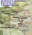
| 14:11, 19 ott 2007 |  | 1 310 × 1 090 (771 KB) | Dna-webmaster~commonswiki | ((Information |Description=Map of the Holocaust in Europe during World War II, 1939-1945. <br> This map shows all extermination camps (or ''death camps''), most major concentration camps, work camps, prison camps, ghettos, major deportation routes and maj |
Pagine che usano questo file
Le seguenti 8 pagine usano questo file:
Utilizzo globale del file
Anche i seguenti wiki usano questo file:
- Usato nelle seguenti pagine di af.wikipedia.org:
- Usato nelle seguenti pagine di ar.wikipedia.org:
- Usato nelle seguenti pagine di az.wikipedia.org:
- Usato nelle seguenti pagine di be-tarask.wikipedia.org:
- Usato nelle seguenti pagine di be.wikipedia.org:
- Usato nelle seguenti pagine di bn.wikipedia.org:
- Usato nelle seguenti pagine di ca.wikipedia.org:
- Usato nelle seguenti pagine di cs.wikipedia.org:
- Usato nelle seguenti pagine di de.wikipedia.org:
- Usato nelle seguenti pagine di el.wikipedia.org:
- Usato nelle seguenti pagine di en.wikipedia.org:
- Auschwitz concentration camp
- Extermination camp
- Sobibor extermination camp
- Drancy internment camp
- White Buses
- Vel' d'Hiv Roundup
- Template:Image frame
- German war crimes
- René Bousquet
- Holocaust trains
- Portal:Genocide/Selected article
- Portal:Genocide/Selected article/8
- Mechelen transit camp
- User:Dna-webmaster/Projects
- Jewish ghettos in Europe
- List of Jewish ghettos in Europe during World War II
- Template:Image frame/doc
- User:Jnestorius/Resources
- Wikipedia:Featured picture candidates/January-2015
- Wikipedia:Featured picture candidates/Map of the Holocaust in Europe
- The Holocaust in Hungary
- Emigration of Jews from Nazi Germany and German-occupied Europe
- Talk:The Holocaust/Archive 31
- Template:Image frame/sandbox
- Reich Security Head Office Referat IV B4
- Genocides in history (World War I through World War II)
- User:Buidhe/fork
- Usato nelle seguenti pagine di en.wikibooks.org:
- Usato nelle seguenti pagine di es.wikipedia.org:
- Usato nelle seguenti pagine di et.wikipedia.org:
- Usato nelle seguenti pagine di fa.wikipedia.org:
Visualizza l'utilizzo globale di questo file.
Text is available under the CC BY-SA 4.0 license; additional terms may apply.
Images, videos and audio are available under their respective licenses.


