For faster navigation, this Iframe is preloading the Wikiwand page for Monmouth Heritage Trail.

Monmouth Heritage Trail
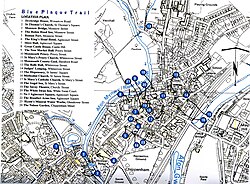
Peta Monmouth's Heritage Trail dan lokasi bangunan berplakat biru

Monmouth Heritage Trail adalah rute jalan yang menghubungkan sejumlah markah tanah ternama di kota Monmouth, Wales.[1]

Pada tahun 2009, Monmouth Civic Society mengidentifikasi 24 bangunan bersejarah & menarik di kota ini dan melakukan pembuatan & perbaikan plakat biru keramik pada banguna. Plakat-plakat tersebut dibuat oleh Ned Heywood dari Chepstow, terbuat dari batu yang dipoles biru dan berisi tulisan dalam bahasa Inggris dan Wales. Ruang untuk tulisan dibatasi. Masing-masing plakat berisikan ringkasan tentang pentingnya bangunan ini bagi kota Monmouth.

Beberapa bangunan pilihan cukup jelas, misalnya Monnow Bridge dan Shire Hall, keduanya adalah simbol kota, tetapi bangunan lain kurang dikenal, seperti The Nelson Garden atau Monmouth Methodist Church, padahal warga kota melewatinya setiap hari. Para pengunjung dan warga yang tertarik dapat mempelajari lebih lanjut dengan membeli buku panduan berisikan deskripsi dan foto masing-masing bangunan serta jalur "Heritage Trail" melintasi kota. Peta dan daftar bangunan berplakat biru ditampilkan di bawah.

Informasi panduan tersedia dalam bahasa Wales,[1] namun baik versi Wales dan Inggris akan diterbitkan di Wikipedia sebagai bagian dari proyek "MonmouthpediA" untuk menyediakan informasi kepada pengunjung mengenai segala aspek kota Monmouth menggunakan kode QR QRpedia.[2]

No. Bangunan Gambar Tanggal Lokasi
1 Drybridge House Drybridge House 1671 51°48′30″N 2°43′24″W / 51.8084°N 2.7233°W / 51.8084; -2.7233 (Drubridge House)
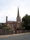
2 St Thomas the Martyr Church St Mary's Church c. 1170 51°48′34″N 2°43′13″E / 51.809497°N 2.720408°E / 51.809497; 2.720408 (St Mary's Parish)
3 Monnow Bridge Monnow Bridge 13C 51°48′32″N 2°43′12″W / 51.809°N 2.7200°W / 51.809; -2.7200 (Monnow Bridge)
4 Robin Hood Inn St Mary's Church Akhir abad pertengahan 51°48′18″N 2°43′24″W / 51.80497°N 2.7233°W / 51.80497; -2.7233 (Robin Hood Inn)
5 Roman Fort Blestium c. 55 AD 51°48′16″N 2°43′24″W / 51.80447°N 2.7233°W / 51.80447; -2.7233 (Roman Fort)
6 King's Head Hotel King's Head Hotel 51°48′42″N 2°42′58″W / 51.8118°N 2.716°W / 51.8118; -2.716 (King's Head Hotel)
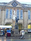
7 Shire Hall Shire Hall 51°42′34″N 2°37′24″W / 51.709497°N 2.6233°W / 51.709497; -2.6233 (Shire Hall)
8 Great Castle House Great Castle Househ 51°48′46″N 2°42′59″W / 51.8127°N 2.7164°W / 51.8127; -2.7164 (Great Castle House)
8 Market Hall Market Hall 51°42′34″N 2°37′24″W / 51.709497°N 2.6233°W / 51.709497; -2.6233 (Market Hall)
10 Monmouth Priory Monmouth Priory 51°42′34″N 2°37′24″W / 51.709497°N 2.6233°W / 51.709497; -2.6233 (Monmouth Priory)
11 St Mary’s Priory Church St Mary's Church 51°42′34″N 2°37′24″W / 51.709497°N 2.6233°W / 51.709497; -2.6233 (St Mary’s Priory Church)
12 Monmouth County Gaol County Gaol 51°49′01″N 2°42′47″W / 51.817°N 2.713°W / 51.817; -2.713 (County Gaol)
13 Rolls Hall Rolls Hall 51°48′47″N 2°42′40″W / 51.813°N 2.711°W / 51.813; -2.711 (Rolls Hall)
14 Judges' Lodgings Judges' Lodgings 51°48′47″N 2°42′43″W / 51.81306°N 2.712°W / 51.81306; -2.712 (Judges' Lodgings)
15 The Dispensary, Monmouth Dispensary 51°48′47″N 2°42′38″W / 51.8130°N 2.7106°W / 51.8130; -2.7106 (Dispensary)
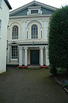
16 Monmouth Methodist Church Methodist Church 51°48′43″N 2°42′36″W / 51.812°N 2.710°W / 51.812; -2.710 (Methodist Church)
17 St Mary's Roman Catholic Church St Mary's Roman Catholic Church 51°48′44″N 2°42′47″W / 51.812306°N 2.713°W / 51.812306; -2.713 (St Mary's Roman Catholic Churc)
18 Angel Hotel Angel Hotel 51°42′34″N 2°37′24″W / 51.709497°N 2.6233°W / 51.709497; -2.6233 (Angel Hotel)
19 Savoy Theatre, Monmouth Savoy Theatre 51°42′34″N 2°37′24″W / 51.709497°N 2.6233°W / 51.709497; -2.6233 (Savoy Theatre)
20 The White Swan Inn, Monmouth White Swan Inn 51°48′32″N 2°43′23″W / 51.809°N 2.723°W / 51.809; -2.723 (White Swan Inn)
21 Agincourt House, Monmouth Agincourt House 51°48′45″N 2°42′54″W / 51.812472°N 2.715°W / 51.812472; -2.715 (Agincourt House)
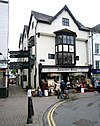
22 Beaufort Arms Hotel Beaufort Arms Hotel 51°48′43″N 2°42′54″W / 51.812°N 2.715°W / 51.812; -2.715 (Beaufort Arms Hotel)
23 Hyam's Mineral Water Works Hyam's Mineral Water Works 51°48′40″N 2°42′50″W / 51.811°N 2.714°W / 51.811; -2.714 (Hyam's Mineral Water Works)
24 The Nelson Garden Nelson Garden 51°48′40″N 2°42′56″W / 51.811°N 2.7156°W / 51.811; -2.7156 (Nelson Garden)
Peta koordinat semua menggunakan: OpenStreetMap  Unduh koordinat sebagai: KML

Catatan kaki

[sunting | sunting sumber]
  1. ^ a b Blue Plaque Trail, VisitWyeValley.com, accessed January 2012
  2. ^ Wikipedia project to cover life in Monmouth, BBC News, 30 December 2011
{{bottomLinkPreText}} {{bottomLinkText}}
Monmouth Heritage Trail
Listen to this article

This browser is not supported by Wikiwand :(
Wikiwand requires a browser with modern capabilities in order to provide you with the best reading experience.
Please download and use one of the following browsers:

This article was just edited, click to reload
This article has been deleted on Wikipedia (Why?)

Back to homepage

Please click Add in the dialog above
Please click Allow in the top-left corner,
then click Install Now in the dialog
Please click Open in the download dialog,
then click Install
Please click the "Downloads" icon in the Safari toolbar, open the first download in the list,
then click Install
{{::$root.activation.text}}

Install Wikiwand

Install on Chrome Install on Firefox
Don't forget to rate us

Tell your friends about Wikiwand!

Gmail Facebook Twitter Link

Enjoying Wikiwand?

Tell your friends and spread the love:
Share on Gmail Share on Facebook Share on Twitter Share on Buffer

Our magic isn't perfect

You can help our automatic cover photo selection by reporting an unsuitable photo.

This photo is visually disturbing This photo is not a good choice

Thank you for helping!


Your input will affect cover photo selection, along with input from other users.

X

Get ready for Wikiwand 2.0 🎉! the new version arrives on September 1st! Don't want to wait?