Hamt Picnjo
| němsce | Amt Peitz | |
| Wopon | ||
|---|---|---|
| ||
| Zakładne daty | ||
| stat | ||
| zwjazkowy kraj | ||
| wokrjes | Sprjewja-Nysa | |
| přestrjeń | 284,46 km² | |
| wobydlerstwo | 10.631 (31. dec 2021)[1] | |
| hustosć zasydlenja | 37 wob. na km² | |
| awtowa značka | SPN, FOR, GUB, SPB | |
| Politika a zarjadnistwo | ||
| adresa | Šulska 6 03185 Picnjo | |
| webstrona | peitz.de | |
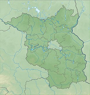
| Połoženje w Braniborskej | ||
 | ||
wikidata: Hamt Picnjo (Q149807)
| ||
Hamt Picnjo (němsce Amt Peitz) je braniborski hamt we wokrjesu Sprjewja-Nysa, kotryž je so w lěće 1992 wutworiło. Sydło zarjadnistwa je městačko Picnjo.
Wobsteji ze slědowacych wosom gmejnow:
- Drjenow (500 wobydlerjow)
- Gatojce (1.098)
- Hochoza (779)
- Janšojce (1.521)
- Móst (590)
- Picnjo (4.333)
- Turjej (700)
- Turnow-Pśiłuk (1.110)[2]
Hamt nadeńdźe so w Delnjej Łužicy sewjernje Choćebuza. Wšě gmejny słušeja do serbskeho sydlenskeho ruma.
Wuwiće wobydlerstwa
[wobdźěłać | žórłowy tekst wobdźěłać]
|
|
|
|
Žórła
[wobdźěłać | žórłowy tekst wobdźěłać]- ↑ Ludnosć w Braniborskej po gmejnach dnja 31. decembra 2021 na statistik-berlin-brandenburg.de
- ↑ staw: 31. decembra 2021; Ludnosć w Braniborskej po gmejnach dnja 31. decembra 2021 na statistik-berlin-brandenburg.de
- ↑ W tutym lěće přizamkny so Janšojski hamt Picnjanskemu, štož wujasni zwyšenje ličby.
- ↑ Historisches Gemeindeverzeichnis des Landes Brandenburg 1875 bis 2005. Landkreis Spree-Neiße. str. 12–13
- ↑ Bevölkerung im Land Brandenburg von 1991 bis 2015 nach Kreisfreien Städten, Landkreisen und Gemeinden, tabulka 7
Wotkaz
[wobdźěłać | žórłowy tekst wobdźěłać]Baršć (Forst) |
Bórkowy (Burg) |
Brjazyna (Briesen) |
Cersk (Tschernitz) |
Derbno (Döbern) |
Derbno (Schenkendöbern) |
Dešno-Strjažow (Dissen-Striesow) |
Dolina Nysy a Małksy (Neiße-Malxetal) |
Drjenow (Drehnow) |
Drjowk (Drebkau) |
Feliksowy Jazor (Felixsee) |
Gatojce (Teichland) |
Gołkojce (Kolkwitz) |
Góry (Guhrow) |
Grodk (Spremberg) |
Gubin (Gubin) |
Hochoza (Drachhausen) |
Janšojce (Jänschwalde) |
Jemjelica-Źěwink (Jämlitz-Klein Düben) |
Kopańce (Neuhausen/Spree) |
Łukojce (Wiesengrund) |
Móst (Heinersbrück) |
Picnjo (Peitz) |
Smogorjow-Prjawoz (Schmogrow-Fehrow) |
Tśěšojce-Žymjerojce (Groß Schacksdorf-Simmersdorf) |
Turjej (Tauer) |
Turnow-Pśiłuk (Turnow-Preilack) |
Wjelcej (Welzow) |
Wjerbno (Werben)
Hamty:
Bórkowy |
Derbno-kraj |
Picnjo |
Text is available under the CC BY-SA 4.0 license; additional terms may apply.
Images, videos and audio are available under their respective licenses.


