Datoteka:Suriname relief location map.jpg
Veličina ovog prikaza: 587 × 599 piksela. Ostale razlučivosti: 235 × 240 piksela | 470 × 480 piksela | 725 × 740 piksela.
Vidi sliku u punoj veličini (725 × 740 piksela, veličina datoteke: 115 KB, MIME tip: image/jpeg)
| Ova se datoteka nalazi na Zajedničkom poslužitelju i mogu je rabiti drugi projekti. Ispod je prikazan opis s njezine tamošnje stranice. |
Sažetak
| Opis |
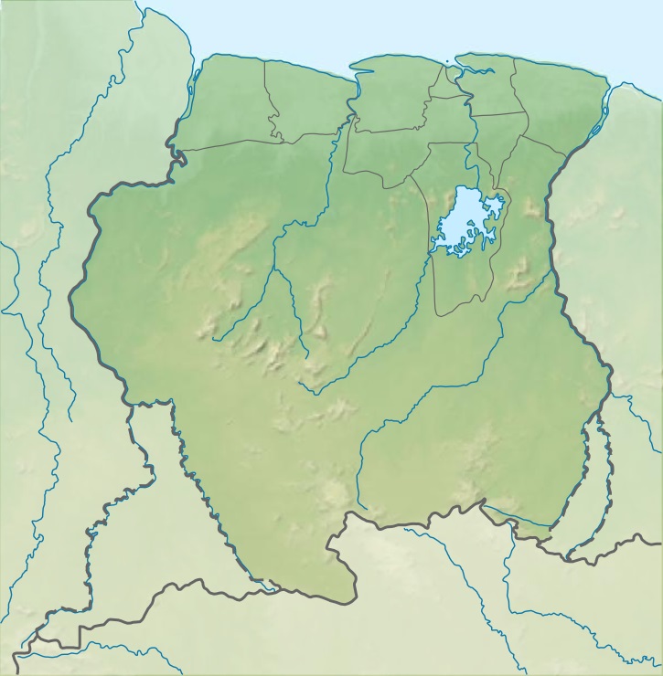
Deutsch: Positionskarte von Suriname Quadratische Plattkarte. Geographische Begrenzung der Karte:
English: Location map of Suriname Equirectangular projection. Geographic limits of the map:
|
| Datum | (UTC) |
| Izvor |
Ova je datoteka izvedena iz: |
| Autor |
|
Licencija
Ova datoteka je licencirana pod Creative Commons Imenovanje-Dijeli pod istim uvjetima 3.0 nelokaliziranom licencijom.
- Slobodno smijete:
- dijeliti – umnožavati, distribuirati i javnosti priopćavati djelo
- remiksirati – prerađivati djelo
- Pod sljedećim uvjetima:
- imenovanje autora – Morate pripisati odgovarajuće autorske zasluge, dati poveznicu na licenciju, te naznačiti jesu li načinjene promjene autorskog djela. Prethodno navedeno možete učiniti na svaki razuman način, ali ne na način koji bi sugerirao da Vi ili Vaše korištenje licencorova djela ima izravno licencorovo odobrenje.
- dijeli pod istim uvjetima – Ako ovo djelo izmijenite, preoblikujete ili stvarate na osnovu tog materijala, svoje doprinose morate distribuirati pod istom ili kompatibilnom licencijom kao što je i licencija originala.
Izvorna evidencija postavljanja
This image is a derivative work of the following images:
- File:Guiana_shield_map-fr.svg licensed with Cc-by-sa-3.0,2.5,2.0,1.0, GFDL
- File:Suriname_location_map.svg licensed with Cc-by-sa-3.0, GFDL
Uploaded with derivativeFX
Povijest datoteke
Kliknite na datum/vrijeme kako biste vidjeli datoteku kakva je tada bila.
| Datum/Vrijeme | Minijatura | Dimenzije | Suradnik | Komentar | |
|---|---|---|---|---|---|
| sadašnja | 03:52, 29. srpanj 2013. | | 725 × 740 (115 KB) | Milenioscuro | == ((int:filedesc)) == ((Information |Description=((de|Positionskarte von Suriname)) Quadratische Plattkarte. Geographische Begrenzung der Karte: * N: 6.4° N * S: 1.3° N * W: 58.6° W * O: 53.6° W ((en|Location map of [[:en:Sur... |
Uporaba datoteke
Na ovu sliku vode poveznice sa sljedećih stranica:
Globalna uporaba datoteke
Sljedeći wikiji rabe ovu datoteku:
- Uporaba na azb.wikipedia.org
- Uporaba na az.wikipedia.org
- Uporaba na bg.wikipedia.org
- Uporaba na bh.wikipedia.org
- Uporaba na bn.wikipedia.org
- Uporaba na cs.wikipedia.org
- Uporaba na da.wikipedia.org
- Uporaba na de.wikipedia.org
- Brokopondo-Stausee
- Suriname
- Wilhelminagebirge (Suriname)
- Emmakette
- Eilerts-de-Haan-Gebirge
- Julianatop
- Vorlage:Positionskarte Suriname
- Wia-Wia-Naturschutzgebiet
- Zentral-Suriname-Naturschutzgebiet
- Brownsberg-Naturpark
- Brinckheuvel-Naturschutzgebiet
- Ober-Coesewijne-Naturschutzgebiet
- Tafelberg (Suriname)
- Coppename-Mündung-Naturschutzgebiet
- Sipaliwini-Naturschutzgebiet
- Bakhuisgebirge
- Tumuk-Humak-Gebirge
- Wikipedia:Kartenwerkstatt/Positionskarten/Südamerika
- Hertenrits-Naturschutzgebiet
- Copi-Naturschutzgebiet
- Peruvia-Naturschutzgebiet
- Wanekreek-Naturschutzgebiet
- Voltzberg
- Käysergebirge
- Kasikasima
- Hendriktop
- Stoelmanseiland
- Kwana Eiland
- Goldtagebau Rosebel
- Uporaba na el.wikipedia.org
- Uporaba na en.wikipedia.org
Pogledajte globalnu uporabu ove datoteke.
Metapodatci
Text is available under the CC BY-SA 4.0 license; additional terms may apply.
Images, videos and audio are available under their respective licenses.
Cover photo is available under {{::mainImage.info.license.name || 'Unknown'}} license.
Cover photo is available under {{::mainImage.info.license.name || 'Unknown'}} license.
Credit:
(see original file).
