For faster navigation, this Iframe is preloading the Wikiwand page for साँचा:Infobox Indian Jurisdiction/Sandbox.

साँचा:Infobox Indian Jurisdiction/Sandbox

This is the sandbox for the ((Infobox Indian Jurisdiction)) template. Please test all proposed non-trivial changes here before updating the live template.


Proposed
  ?سرینگر
Srinagar
Jammu and Kashmir • India
Nickname: Paradise on Earth
View of Srinagar and Dal Lake
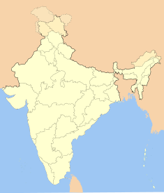
Map indicating the location of Srinagar
Location of Srinagar
Coordinates: 34°05′N 74°47′E / 34.09°N 74.79°E / 34.09; 74.79
Time zone IST (UTC+5:30)
Area
Elevation

• 1,730 मीटर (5,676 फी॰)
Climate
• Precipitation
Temperature
• Summer
• Winter
ETh (Köppen)
• 658 mm (25.9 in)

• 22 °C (72 °F)
• 4 °C (39 °F)
Distance(s)
• From Delhi
• From Mumbai

• 876 km NW (land)
• 2,275 km NE (land)
Region Kashmir
District(s) Srinagar
Population
• Density
• Metro
• Sex ratio
• Literacy rate
8,94,940[1] (2001)
• 27,220/km² (70,499/sq mi)
• 9,71,357[1]
• 1.17
• 59.18%
Language(s) Kashmiri, Urdu
Mayor Ghulam Mustafa Bhat[2]
Settled 3rd century BCE
Codes
• Pincode
• Telephone
• UN/LOCODE
• Vehicle

• 190 001
• +0194
• INSXR
• JK
Website: www.srinagar.nic.in
  1. "Population in the age group 0-6 and literates by sex—urban agglomeration/town" (PDF). Census of India 2001. भारत सरकार. 27 May 2002. अभिगमन तिथि 2007-04-14. |date= में तिथि प्राचल का मान जाँचें (मदद)
  2. "Bhat re-elected Mayor". द ट्रिब्यून. The Tribune Trust. 30 March 2006. अभिगमन तिथि 2007-04-14. |date= में तिथि प्राचल का मान जाँचें (मदद)

निर्देशांक: 34°05′N 74°47′E / 34.09°N 74.79°E / 34.09; 74.79

Current
Srinagar
سرینگر
Paradise on Earth
—  capital  —
View of Srinagar and Dal Lake
Map of Jammu and Kashmir with Srinagar marked
Location of Srinagar
समय मंडल: आईएसटी (यूटीसी+५:३०)
देश  भारत
क्षेत्र Kashmir
राज्य Jammu and Kashmir
ज़िला Srinagar
Settled 3rd century BCE
Mayor Ghulam Mustafa Bhat[1]
जनसंख्या
घनत्व
महानगर
8,94,940[2] (2001 के अनुसार )
• 27,220/किमी2 (70,499/मील2)
• 9,71,357[2]
लिंगानुपात 1.17 /
साक्षरता 59.18%%
आधिकारिक भाषा(एँ) Kashmiri, Urdu
क्षेत्रफल
ऊँचाई (AMSL)
105 कि.मी² (41 वर्ग मील)
• 1,730 मीटर (5,676 फी॰)
जलवायु
वर्षा
तापमान
• ग्रीष्म
• शीत
ETh (कॉपेन)
     658 mm (25.9 in)

     22 °C (72 °F)
     4 °C (39 °F)
आधिकारिक जालस्थल: www.srinagar.nic.in


  ?Gampalagudem
Andhra Pradesh • India
Coordinates: 16°59′00″N 80°31′00″E / 16.9833°N 80.5167°E / 16.9833; 80.5167
Time zone IST (UTC+5:30)
Area
Elevation

• 57 मीटर (187 फी॰)
District(s) Krishna
Subdistrict Gamaplagudem Mandal


{{bottomLinkPreText}} {{bottomLinkText}}
साँचा:Infobox Indian Jurisdiction/Sandbox
Listen to this article

This browser is not supported by Wikiwand :(
Wikiwand requires a browser with modern capabilities in order to provide you with the best reading experience.
Please download and use one of the following browsers:

This article was just edited, click to reload
This article has been deleted on Wikipedia (Why?)

Back to homepage

Please click Add in the dialog above
Please click Allow in the top-left corner,
then click Install Now in the dialog
Please click Open in the download dialog,
then click Install
Please click the "Downloads" icon in the Safari toolbar, open the first download in the list,
then click Install
{{::$root.activation.text}}

Install Wikiwand

Install on Chrome Install on Firefox
Don't forget to rate us

Tell your friends about Wikiwand!

Gmail Facebook Twitter Link

Enjoying Wikiwand?

Tell your friends and spread the love:
Share on Gmail Share on Facebook Share on Twitter Share on Buffer

Our magic isn't perfect

You can help our automatic cover photo selection by reporting an unsuitable photo.

This photo is visually disturbing This photo is not a good choice

Thank you for helping!


Your input will affect cover photo selection, along with input from other users.

X

Get ready for Wikiwand 2.0 🎉! the new version arrives on September 1st! Don't want to wait?