הר בירד (האי רוס)
 | |
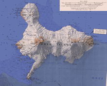
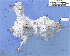
| מפת האי רוס. הר בירד ממוקם בקצה השמאלי העליון של המפה | |
| מידע כללי | |
|---|---|
| על שם |
כף בירד |
| גובה |
1,765 מ' |
| מיקום | אזור הברית האנטארקטית, |
| קואורדינטות | 77°16′00″S 166°45′00″E / 77.266666666667°S 166.75°E |
|
(למפת אנטארקטיקה רגילה) | |
הר בירד (באנגלית: Mount Bird[1][2]) הוא הר געש בקצה הצפוני של האי רוס, סמוך לארץ ויקטוריה שבאנטארקטיקה[3].
גובהו של ההר 1,765[4] מטרים מעל גובה פני הים[3]; ההר מתנשא לגובה של 899 מטרים מעל סביבתו[5].
ההר ממוקם כ-11 קילומטרים דרומית לכף בירד[3].
קרחון של וקרחון ההדום אנדוור נמצאים על מורדותיו של ההר[3].
ההר מהווה חלק מהאזור האנטארקטי המוגן במיוחד מספר 116, בשל אוכלוסיות הציפורים שבסביבתו[6], המוגן מכוח האמנה האנטארקטית.
היסטוריה
[עריכת קוד מקור | עריכה]גילוי ומיפוי ההר
[עריכת קוד מקור | עריכה]מיפוי ההר נעשה בידי המשלחת הבריטית הלאומית לאנטארקטיקה (משלחת דיסקברי)[3], אשר חקרה את אנטארקטיקה בין השנים 1901–1904, בפיקודו של רוברט פלקון סקוט[3].
מקור השם
[עריכת קוד מקור | עריכה]שמו של ההר ניתן לו על ידי סקוט[3].
ההר נקרא בשם זה בשל מיקומו – בשל קרבתו לכף בירד[3].
כף בירד (וההר) נקראו על שם לוטננט אדוארד ג'וזף בירד (Edward Joseph Bird)[7], אשר שירת עם משלחתו של רוס (אשר גילתה את האי רוס) על הספינה "ארבוס"[7] בין השנים 1839–1841[7].
לקריאה נוספת
[עריכת קוד מקור | עריכה]((cite book)): תחזוקה - ציטוט: multiple names: editors list (link)
• Mount Bird, Volcano World
קישורים חיצוניים
[עריכת קוד מקור | עריכה]- הר בירד באתר הסקר הגאולוגי של ארצות הברית
- הר בירד באתר הגאזט האנטארקטי של ממשלת ניו זילנד
- הר בירד באתר הגאזט האנטארקטי המשווה SCAR של ממשלת אוסטרליה
- תצלום הר בירד באתר אוניברסיטת מדינת אורגון
- הר בירד באתר peakbagger
- תצלום לוויין של אזור הר בירד
הערות שוליים
[עריכת קוד מקור | עריכה]- ^ ההודעה הרשמית על מתן שמות אנטארקטיים בגאזט הרשמי של ממשלת ניו זילנד
- ^ גאזט השמות האנטארקטיים הרשמי של ארצות הברית
- ^ 1 2 3 4 5 6 7 8 מידע גאוגרפי והיסטורי
- ^ לפי מקור אחר גובהו של ההר 1,799 מטרים מעל גובה פני הים
- ^ מידע גאוגרפי
- ^ ההכרזה על הקמת אזור אנטארקטי מוגן במיוחד 116, ותיאור האזור
- ^ 1 2 3 מידע היסטורי על שם הכף
| אתרי האי רוס | ||||||||||||||
|---|---|---|---|---|---|---|---|---|---|---|---|---|---|---|
מבנים ובסיסי מחקר
| ||||||||||||||
הרים, גבעות ומצוקים
| ||||||||||||||
קרחונים וגופי מים
| ||||||||||||||
אתרים לחופי האי
| ||||||||||||||
Text is available under the CC BY-SA 4.0 license; additional terms may apply.
Images, videos and audio are available under their respective licenses.


