For faster navigation, this Iframe is preloading the Wikiwand page for Fayil:Atlantic Ocean.png.

Fayil:Atlantic Ocean.png

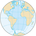
Atlantic_Ocean.png(pikisal 330 × 330, girman fayil: 26 KB, irin MIME: image/png)

Wannan hoto yazo daga Wikimedia Commons kuma za'a iya amfani dashi a wasu projects. Anan kasa an nuna asalin bayanin shi

Taƙaici

Bayani North and South Atlantic Ocean
Masomi CIA World Factbook - Atlantic Ocean (picture URL)
Marubucin CIA
Izini
(Sake amfani da wannan fayil)
Public domain
This image is in the public domain because it contains materials that originally came from the United States Central Intelligence Agency's World Factbook.

Bahasa Indonesia  čeština  Deutsch  eesti  English  español  Esperanto  français  galego  hrvatski  italiano  Nederlands  norsk nynorsk  polski  português  sicilianu  slovenščina  suomi  Türkçe  Zazaki  беларуская (тарашкевіца)  македонски  русский  српски / srpski  українська  ქართული  বাংলা  தமிழ்  മലയാളം  한국어  日本語  中文  中文(简体)  中文(繁體)  العربية  +/−

Other versions
This locator map image could be re-created using vector graphics as an SVG file. This has several advantages; see Commons:Media for cleanup for more information. If an SVG form of this image is available, please upload it and afterwards replace this template with ((vector version available|new image name)).
It is recommended to name the SVG file “Atlantic Ocean.svg”—then the template Vector version available (or Vva) does not need the new image name parameter.

Take

Add a one-line explanation of what this file represents

Abubuwan da aka nuna a cikin wannan fayil

depicts Turanci

media type Turanci

image/png

checksum Turanci

df91e3a68b1bec9304598eb3aaf5cfbac2e95409

determination method Turanci: SHA-1 Turanci

data size Turanci

26,309 byte

height Turanci

330 pixel

width Turanci

330 pixel

Tarihin fayil

Ku latsa rana/lokaci ku ga fayil yadda yake a wannan lokaci

Rana/LokaciWadar sufaKusurwowiMa'aikaciBahasi
na yanzu20:11, 27 ga Augusta, 2019Wadar sufa ta zubin 20:11, 27 ga Augusta, 2019330 × 330 (26 KB)Kaldarisame dimensions as other ocean images
20:20, 22 ga Augusta, 2009Wadar sufa ta zubin 20:20, 22 ga Augusta, 2009328 × 328 (12 KB)Serg!oups
20:16, 22 ga Augusta, 2009Wadar sufa ta zubin 20:16, 22 ga Augusta, 2009329 × 330 (14 KB)Serg!olanguage neutral map
10:13, 3 Nuwamba, 2004Wadar sufa ta zubin 10:13, 3 Nuwamba, 2004328 × 328 (12 KB)MaximaximaxNorth and South Atlantic Ocean from [http://www.cia.gov/cia/publications/factbook/geos/zh.html CIA World Factbook - Atlantic Ocean] (picture URL is [http://www.cia.gov/cia/publications/factbook/maps/zh-map.gif]). ((PD-USGov)) Category:Oceans

Amfani da fayil

Wadannan shafi na amfani wannan fayil:

Amfanin fayil a ko'ina

Wadannan sauran wikis suna amfani da fayil din anan

Duba ƙarin amfanin wannan fayil.

bayannan meta

{{bottomLinkPreText}} {{bottomLinkText}}
Fayil:Atlantic Ocean.png
Listen to this article

This browser is not supported by Wikiwand :(
Wikiwand requires a browser with modern capabilities in order to provide you with the best reading experience.
Please download and use one of the following browsers:

This article was just edited, click to reload
This article has been deleted on Wikipedia (Why?)

Back to homepage

Please click Add in the dialog above
Please click Allow in the top-left corner,
then click Install Now in the dialog
Please click Open in the download dialog,
then click Install
Please click the "Downloads" icon in the Safari toolbar, open the first download in the list,
then click Install
{{::$root.activation.text}}

Install Wikiwand

Install on Chrome Install on Firefox
Don't forget to rate us

Tell your friends about Wikiwand!

Gmail Facebook Twitter Link

Enjoying Wikiwand?

Tell your friends and spread the love:
Share on Gmail Share on Facebook Share on Twitter Share on Buffer

Our magic isn't perfect

You can help our automatic cover photo selection by reporting an unsuitable photo.

This photo is visually disturbing This photo is not a good choice

Thank you for helping!


Your input will affect cover photo selection, along with input from other users.

X

Get ready for Wikiwand 2.0 🎉! the new version arrives on September 1st! Don't want to wait?