Třemešné
Cet article est une ébauche concernant une localité tchèque.
Vous pouvez partager vos connaissances en l’améliorant (comment ?) selon les recommandations des projets correspondants.
Consultez la liste des tâches à accomplir en page de discussion.
| Třemešné | |
 Třemešné | |
 |
 |
| Administration | |
|---|---|
| Pays | |
| Région | |
| District | Tachov |
| Région historique | Bohême |
| Maire Mandat |
Kristián Ebenhöh[1],[2] 2018-2022 |
| Code postal | 348 06 — 348 08 |
| Démographie | |
| Population | 360 hab. (2022) |
| Densité | 7 hab./km2 |
| Géographie | |
| Coordonnées | 49° 37′ 22″ nord, 12° 41′ 59″ est |
| Altitude | 510 m |
| Superficie | 5 112 ha = 51,12 km2 |
| Localisation | |
| Liens | |
| Site web | www.obectremesne.cz |
| modifier |
|


Třemešné (en allemand : Zemschen) est une commune du district de Tachov, dans la région de Plzeň, en Tchéquie. Sa population s'élevait à 360 habitants en 2022[3].
Géographie
[modifier | modifier le code]Třemešné se trouve à 6 km au sud de Přimda, à 20 km au sud-sud-est de Tachov, à 51 km à l'ouest-sud-ouest de Plzeň et à 135 km à l'ouest-sud-ouest de Prague[4].
La commune est limitée par Rozvadov et Přimda au nord, par Stráž à l'est, par Bělá nad Radbuzou au sud et par l'Allemagne à l'ouest[5].

Histoire
[modifier | modifier le code]La première mention écrite de la localité date de 1532[6].
Galerie
[modifier | modifier le code]-

Bezděkov. -
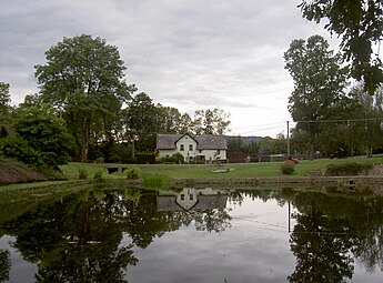
Dubec. -

Route à Pavlíkov.
.JPG)


Transports
[modifier | modifier le code]Par la route, Třemešné se trouve à 7 km de Přimda, à 24 km de Tachov, à 68 km de Plzeň et à 163 km de Prague[7].
Notes et références
[modifier | modifier le code]- (cs) Résultats des élections municipales de 2018.
- (cs) Site municipal : maire (starosta) et conseillers municipaux de la commune.
- (cs) Population des communes de la République tchèque au .
- Distances à vol d'oiseau ou distances orthodromiques.
- D'après geoportal.gov.cz.
- (cs) Site municipal : histoire de la commune.
- Selon viamichelin.fr. Distances suivant l'itinéraire le plus court.
Text is available under the CC BY-SA 4.0 license; additional terms may apply.
Images, videos and audio are available under their respective licenses.
