Suodenniemi
| Suodenniemi Suodenniemi (fi) Ancienne commune de Finlande | |
 Armoiries |
|

| |
| Administration | |
|---|---|
| Pays | |
| Région | Pirkanmaa |
| Langue(s) parlée(s) | unilingue finnois |
| Démographie | |
| Population | 1 343 hab. (01/10/2006) |
| Densité | 6,1 hab./km2 |
| Géographie | |
| Coordonnées | 61° 33′ 30″ nord, 22° 46′ 50″ est |
| Altitude | Min. 60 m Max. 120 m |
| Superficie | 22 080 ha = 220,8 km2 |
| · dont terre | 207,6 km2 (94,02 %) |
| · dont eau | 13,2 km2 (5,98 %) |
| Rang superficie | (e / 336) |
| Rang population | (e / 336) |
| Histoire | |
| Province historique | Satakunta |
| Province | Finlande occidentale |
| Fondation | 1868 |
| Fusionnée dans | Vammala () |
| Localisation | |
| modifier |
|


Suodenniemi est une ancienne municipalité du sud-ouest de la Finlande, dans la région du Pirkanmaa et la province de Finlande occidentale.
Géographie
[modifier | modifier le code]Le territoire est resté largement rurale et agricole. Si elle comptait plus de 3 000 habitants dans les années 1930, la commune a connu depuis une baisse régulière de ce chiffre et un vieillissement de sa population. Dans ses dernières années d'existence, son budget lui permettait tout juste de couvrir les dépenses sociales et de santé, sans pouvoir véritablement investir. C'est pourquoi le conseil municipal a décidé au printemps 2006 (par 13 voix contre 4) de fusionner avec la ville voisine de Vammala. La commune a donc cessé d'exister le .
L'ancien centre administratif et principal village se situe 10 km au nord de la nationale 11 Pori-Tampere. Ses seules curiosités notables sont une église néoclassique de 1831 et un petit musée ouvert en été.
Les municipalités voisines au moment de la fusion étaient Ikaalinen au nord, Hämeenkyrö au nord-est, Mouhijärvi au sud-est, et côté Satakunta Kiikoinen au sud-ouest, Lavia à l'ouest et Kankaanpää au nord-ouest.
Galerie
[modifier | modifier le code]-
 Hôtel de ville (1936)
 -
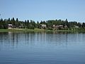 Paysage de Suodenniemi.
 -

-
 Pont en pierre sur la rivière Kiikoisjoki au village de Putaja à Suodenniemi.


Liens externes
[modifier | modifier le code]
Text is available under the CC BY-SA 4.0 license; additional terms may apply.
Images, videos and audio are available under their respective licenses.
