For faster navigation, this Iframe is preloading the Wikiwand page for Súdwest-Fryslân.

Súdwest-Fryslân

Súdwest-Fryslân
Blason de Súdwest-Fryslân
Armoiries.
Drapeau de Súdwest-Fryslân
Drapeau.
Súdwest-Fryslân
Administration
Pays Drapeau des Pays-Bas Pays-Bas
Province Drapeau de la province de Frise Frise
Bourgmestre
Mandat
Jannewietske de Vries (PvdA)
2018-
Code postal 8529 - 8774
Démographie
Population 90 873 hab. (31-01-2023)
Densité 108 hab./km2
Géographie
Coordonnées 53° 00′ 00″ nord, 5° 32′ 40″ est
Superficie 84 156 ha = 841,56 km2
Localisation
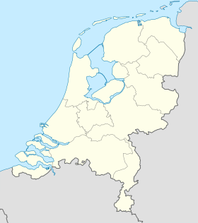
Géolocalisation sur la carte : Pays-Bas
Voir sur la carte topographique des Pays-Bas
Súdwest-Fryslân
Géolocalisation sur la carte : Pays-Bas
Voir sur la carte administrative des Pays-Bas
Súdwest-Fryslân
Géolocalisation sur la carte : Frise
Voir sur la carte administrative de la Frise
Súdwest-Fryslân
Liens
Site web www.gemeentesudwestfryslan.nl

Súdwest-Fryslân (en néerlandais : Zuidwest-Friesland) est une commune néerlandaise de la province de Frise. Son chef-lieu est la ville de Sneek.

Géographie

Westpolderbrêge, un nouveau pont - en aout 2020 - sur la Broeresleat, à Súdwest-Fryslân.

Couvrant la plus grande partie du sud-ouest de la province de Frise, la commune est baignée à la fois par l'IJsselmeer, à l'ouest, et la mer des Wadden, au nord-ouest, ces deux étendues d'eau étant séparée par l'Afsluitdijk (« digue de fermeture ») dont une partie se trouve sur le territoire de la commune. Avec une superficie de 841,56 km², dont 459,64 km² de terres, elle est la plus vaste commune de Frise. Elle est limitrophe des communes d'Harlingen, Franekeradeel et Littenseradiel au nord, Leeuwarden au nord-est et De Fryske Marren au sud et au sud-est.

Toponymie

Le nom de la commune en frison, comme son nom néerlandais de Zuidwest-Friesland[1] signifie « Frise du sud-ouest » en raison de sa situation géographique.

Villes et villages

Súdwest-Fryslân comprend six des onze villes frisonnes et 68 villages.

Nom en néerlandais Nom en frison occidental
Abbega Abbegea
Allingawier Allingawier
Arum Arum
Blauwhuis Blauhús
Bolsward Boalsert
Breezanddijk Breesândyk
Burgwerd Burchwert
Cornwerd Koarnwert
Dedgum Dedzjum
Deersum Dearsum
Exmorra Eksmoarre
Ferwoude Ferwâlde
Folsgare Folsgeare
Gaast Gaast
Gaastmeer De Gaastmar
Gauw Gau
Goënga Goaiïngea
Greonterp Greonterp
Hartwerd Hartwert
Heeg Heech
Hemelum Himmelum
Het Heidenschap It Heidenskip
Hichtum Hichtum
Hieslum Hieslum
Hindeloopen Hylpen
Nom en néerlandais Nom en frison occidental
Hommerts De Hommerts
Idsegahuizum Skuzum
Idzega Idzegea
IJlst Drylts
IJsbrechtum Ysbrechtum
Indijk Yndyk
Jutrijp Jutryp
Kimswerd Kimswert
Kornwerderzand Koarnwertersân
Koudum Koudum
Koufurderrige Koufurderrige
Loënga Loaiïngea
Lollum Lollum
Longerhouw Longerhou
Makkum Makkum
Molkwerum Molkwar
Nijhuizum Nijhuzum
Nijland Nijlân
Offingawier Offenwier
Oosthem Easthim
Oppenhuizen Toppenhuzen
Oudega Aldegea
Parrega Parregea
Piaam Piaam
Pingjum Penjum
Nom en néerlandais Nom en frison occidental
Poppingawier Poppenwier
Rauwerd Raerd
Sandfirden Sânfurd
Scharnegoutum Skearnegoutum
Schettens Skettens
Schraard Skraard
Sijbrandaburen Sibrandabuorren
Smallebrugge Smelbrêge
Sneek Snits
Stavoren Starum
Terzool Tersoal
Tirns Turns
Tjalhuizum Tsjalhuzum
Tjerkwerd Tsjerkwert
Uitwellingerga Twellingea
Warns Warns
Westhem Westhim
Witmarsum Wytmarsum
Wolsum Wolsum
Wons Wûns
Workum Warkum
Woudsend Wâldsein
Ypecolsga Ypekolsgea
Zurich Surch

Histoire

La commune est créée le par la fusion des communes de Bolsward, Nijefurd, Sneek, Wûnseradiel et Wymbritseradiel[2].

Le , son territoire s'est agrandi des villages de Dearsum, Poppenwier, Raerd, Sibrandabuorren et Tersoal, issus de la commune de Boarnsterhim, dissoute à la même date.

Le , une partie de la commune de Littenseradiel est rattachée à Súdwest-Fryslân, le reste à Leeuwarden et Waadhoeke[3].

Politique et administration

Administration municipale

Liste des maires successifs
Période Identité Étiquette Qualité
Haijo Apotheker D66 Intérim en 2011
Magda Berndsen D66 Intérim
en cours Jannewietske de Vries PvdA  

Population et société

Démographie

Au , la population de la commune s'élevait à 84 258 habitants.

Références

Lien externe

{{bottomLinkPreText}} {{bottomLinkText}}
Súdwest-Fryslân
Listen to this article

This browser is not supported by Wikiwand :(
Wikiwand requires a browser with modern capabilities in order to provide you with the best reading experience.
Please download and use one of the following browsers:

This article was just edited, click to reload
This article has been deleted on Wikipedia (Why?)

Back to homepage

Please click Add in the dialog above
Please click Allow in the top-left corner,
then click Install Now in the dialog
Please click Open in the download dialog,
then click Install
Please click the "Downloads" icon in the Safari toolbar, open the first download in the list,
then click Install
{{::$root.activation.text}}

Install Wikiwand

Install on Chrome Install on Firefox
Don't forget to rate us

Tell your friends about Wikiwand!

Gmail Facebook Twitter Link

Enjoying Wikiwand?

Tell your friends and spread the love:
Share on Gmail Share on Facebook Share on Twitter Share on Buffer

Our magic isn't perfect

You can help our automatic cover photo selection by reporting an unsuitable photo.

This photo is visually disturbing This photo is not a good choice

Thank you for helping!


Your input will affect cover photo selection, along with input from other users.

X

Get ready for Wikiwand 2.0 🎉! the new version arrives on September 1st! Don't want to wait?