Romanija Planina
| Romanija planina | ||
 Vue du plateau de Romanija. | ||
| Géographie | ||
|---|---|---|
| Altitude | 1 652 m, Grand Loupoglav | |
| Massif | Alpes dinariques | |
| Coordonnées | 43° 51′ 18″ nord, 18° 39′ 18″ est | |
| Administration | ||
| Pays | ||
| Géologie | ||
| Roches | Calcaire | |
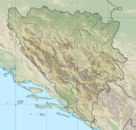
| Géolocalisation sur la carte : Bosnie-Herzégovine
| ||
| modifier |
||
La Romanija planina (cyrillique Романија Планина) est un plateau montagneux karstique du centre-est de la Bosnie-Herzégovine, comprenant les villes de Pale, Sokolac et Han Pijesak, au nord-est de Sarajevo. Le plus haut sommet est le Grand Loupoglav (1 652 m, de l'aroumain lupu « loup » et du serbo-croate glav « tête »).
Étymologie
[modifier | modifier le code]Le massif et plateau d'altitude de Romanija tire son nom d'une ancienne valachie qui s'y trouvait avant d'être assimilée par les Slaves, ce qui a d'ailleurs fait évoluer le sens du nom « valaque » d'une signification ethnique (locuteurs de langues romanes orientales) à une signification professionnelle et confessionnelle (bergers orthodoxes)[1].
Note
[modifier | modifier le code]- Ce nom fait partie de la série de toponymes des Balkans rappelant d'anciennes populations romanisées vivant d'élevage extensif et nomadisant au Moyen Âge mais disparues en grande partie au XIXe siècle par assimilation aux populations slaves voisines et communément appelées Valaques, qui ont laissé de nombreux toponymes balkaniques : Vlaška, Vlašina, Vlašić, Vlahina, Vlahoklissoura, Vlahochora, Vlahnica, Stari Vlah, Romanija Planina, Kampolong, Šeptekase, Petralata, Petrosa... (Instituto geografico de Agostini, Novara : Gli paesi della penisola balcanica, 2007, carte au 1:250 000). Romanija Planina n'est qu'une Valachie parmi bien d'autres, toutes assimilées par les populations slaves environnantes dès avant le XVIIIe siècle : Stelian Brezeanu, Palaiovlachoi - Stari Vlah - A medieval Balkan history and toponymy, Istituto Romeno’s Publications, ed. Geocities 2006 sur Palaiovlachoi - Stari Vlah. Medieval Balkan history and toponymy.
Articles connexes
[modifier | modifier le code]Text is available under the CC BY-SA 4.0 license; additional terms may apply.
Images, videos and audio are available under their respective licenses.

