Rýmařov
Cet article est une ébauche concernant une localité tchèque.
Vous pouvez partager vos connaissances en l’améliorant (comment ?) selon les recommandations des projets correspondants.
| Rýmařov | |

| |
 |
 |
| Administration | |
|---|---|
| Pays | |
| Région | |
| District | Bruntál |
| Région historique | Moravie |
| Maire Mandat |
Luděk Šimko[1],[2] 2018-2022 |
| Code postal | 792 01 — 795 01 |
| Indicatif téléphonique international | +(420) |
| Démographie | |
| Population | 8 081 hab. (2021) |
| Densité | 133 hab./km2 |
| Géographie | |
| Coordonnées | 49° 55′ 55″ nord, 17° 16′ 19″ est |
| Altitude | 590 m |
| Superficie | 6 070 ha = 60,7 km2 |
| Localisation | |
| Liens | |
| Site web | www.rymarov.cz |
| modifier |
|


Rýmařov (en allemand : Römerstadt) est une ville du district de Bruntál, dans la région de Moravie-Silésie, en Tchéquie. Sa population s'élevait à 8 081 habitants en 2021[3].
Géographie
[modifier | modifier le code]Rýmařov se trouve à 16 km au sud-ouest de Bruntál, à 73 km à l'ouest-nord-ouest d'Ostrava et à 204 km à l’est de Prague[4].
La commune est limitée par Stará Ves au nord-ouest, par Dolní Moravice au nord-est, par Malá Štáhle, Velká Štáhle et Břidličná à l'est, par Ryžoviště et Jiříkov au sud, et par Horní Město à l'ouest[5].
Histoire
[modifier | modifier le code]La première mention écrite de la localité date de 1351. Jusqu'en 1918, Römerstadt fait partie de la monarchie de Habsbourg[6]. Le bureau de poste ouvre en 1850[7].
Administration
[modifier | modifier le code]La commune se compose de sept sections :
- Rýmařov
- Edrovice
- Harrachov
- Jamartice
- Janovice
- Ondřejov
- Stránské
Galerie
[modifier | modifier le code]-

Rýmařov : place de la Paix. -
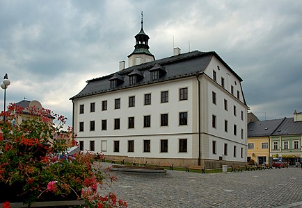
Hôtel de ville.
.jpg)

Transports
[modifier | modifier le code]Par la route, Rýmařov se trouve à 19 km de Bruntál, à 37 km de Šumperk, à 96 km d'Ostrava et à 267 km de Prague[8].
Jumelage
[modifier | modifier le code]Rýmařov est jumelée avec :
Notes et références
[modifier | modifier le code]- (en) Cet article est partiellement ou en totalité issu de l’article de Wikipédia en anglais intitulé « Rýmařov » (voir la liste des auteurs).
- (cs) Résultats des élections municipales de 2018.
- (cs) Site municipal : maire (starosta) et conseillers municipaux de la commune.
- (cs) Population des communes de la République tchèque au 1er janvier 2021.
- Distances à vol d'oiseau ou distances orthodromiques.
- D'après geoportal.gov.cz.
- (de) Wilhelm Klein, Die postalischen Abstempelungen und andere Entwertungsarten auf den österreichischen Postwertzeichen-Ausgaben 1867, 1883 und 1890, Vienne, Briefmarken-Kolbe, 1967.
- Edwin Mueller, Handbook of Austria and Lombardy-Venetia Cancellations on the Postage Stamp Issues 1850-1864, Vienne, Heinrich Geitner, 1961.
- Selon viamichelin.fr. Distances suivant l'itinéraire le plus court.
Liens externes
[modifier | modifier le code]- (cs) Site officiel
Text is available under the CC BY-SA 4.0 license; additional terms may apply.
Images, videos and audio are available under their respective licenses.
