Potok Górny (gmina)
| Gmina Potok Górny | ||||
| Administration | ||||
|---|---|---|---|---|
| Pays | ||||
| Voïvodie (Région) |
Lublin | |||
| Powiat (District) |
Biłgoraj | |||
| Siège | Potok Górny | |||
| Plaque d'immatriculation | LBL | |||
| Démographie | ||||
| Population | 5 591 hab. (2006) | |||
| Densité | 50 hab./km2 | |||
| Géographie | ||||
| Coordonnées | 50° 23′ 00″ nord, 22° 34′ 00″ est | |||
| Superficie | 11 116 ha = 111,16 km2 | |||
| Localisation | ||||
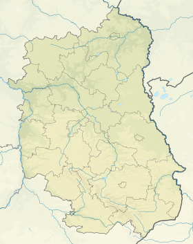
| Géolocalisation sur la carte : Voïvodie de Lublin
Géolocalisation sur la carte : Voïvodie de Lublin
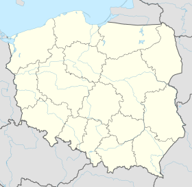
Géolocalisation sur la carte : Pologne
| ||||
| Liens | ||||
| Site web | www.potokgorny.com.pl/ | |||
| modifier |
||||
Potok Górny est une gmina rurale (gmina wiejska) de la powiat de Biłgoraj, dans la Voïvodie de Lublin, dans l'est de la Pologne.
Son siège administratif (chef-lieu) est le village de Potok Górny, qui se situe environ 22 kilomètres au sud-ouest de Biłgoraj (siège du powiat) et 96 kilomètres au sud de la capitale régionale Lublin (capitale de la voïvodie).
La gmina couvre une superficie de 111,16 km2 pour une population de 5 591 habitants[1] en 2006.
Histoire
[modifier | modifier le code]De 1975 à 1998, la gmina est attachée administrativement à la voïvodie de Zamość.
Depuis 1999, elle fait partie de la voïvodie de Lublin.
Géographie
[modifier | modifier le code]La gmina inclut les villages et localités de :

Gminy voisines
[modifier | modifier le code]La gmina de Potok Górny est voisine des gminy suivantes :
Structure du terrain
[modifier | modifier le code]D'après les données de 2002, la superficie de la commune de Potok Górny est de 111,16 kilomètres carrés, répartis comme telle :
- terres agricoles : 68%
- forêts : 27%
La commune représente 6,61% de la superficie du powiat.
Démographie
[modifier | modifier le code]Données du :
| Description | Total | Femmes | Hommes | |||
|---|---|---|---|---|---|---|
| Unité | Nombre | % | Nombre | % | Nombre | % |
| Population | 5 679 | 100 | 2 822 | 49,7 | 2 857 | 50,3 |
| Densité (hab./km²) |
51,2 | 25,4 | 25,8 | |||
Annexes
[modifier | modifier le code]Liens internes
[modifier | modifier le code]Références
[modifier | modifier le code]- (en) « Area and Population in the Territorial Profile in 2012 » [archive du ], Głowny Urząd Statystyczny
Liens externes
[modifier | modifier le code]Text is available under the CC BY-SA 4.0 license; additional terms may apply.
Images, videos and audio are available under their respective licenses.


