Montmollin
| Montmollin | ||||
 Héraldique |
||||
| Administration | ||||
|---|---|---|---|---|
| Pays | ||||
| Canton | ||||
| Région | Val-de-Ruz | |||
| Commune | Val-de-Ruz | |||
| NPA | 2037 | |||
| No OFS | 6482 | |||
| Démographie | ||||
| Population permanente |
620 hab. (avant la fusion) | |||
| Densité | 153 hab./km2 | |||
| Géographie | ||||
| Coordonnées | 46° 59′ 35″ nord, 6° 50′ 50″ est | |||
| Altitude | 1 001 m Min. 702 m Max. 1 390 m |
|||
| Superficie | 4,06 km2 | |||
| Divers | ||||
| Langue | Français | |||
| Localisation | ||||
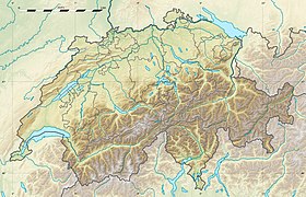
| Géolocalisation sur la carte : Suisse
Géolocalisation sur la carte : Suisse
Géolocalisation sur la carte : canton de Neuchâtel
| ||||
| modifier |
||||
Montmollin est une localité et une ancienne commune suisse du canton de Neuchâtel, située dans la région Val-de-Ruz.
Géographie
[modifier | modifier le code]
Selon l'Office fédéral de la statistique, Montmollin mesure 4,06 km2[1]. 6,0 % de cette superficie correspond à des surfaces d'habitat ou d'infrastructure, 57,8 % à des surfaces agricoles, 36,0 % à des surfaces boisées et 0,2 % à des surfaces improductives.
Histoire
[modifier | modifier le code]Le , la commune a fusionné avec celles de Boudevilliers, Cernier, Chézard-Saint-Martin, Coffrane, Dombresson, Engollon, Fenin-Vilars-Saules, Fontainemelon, Fontaines, Les Hauts-Geneveys, Les Geneveys-sur-Coffrane, Le Pâquier, Savagnier et Villiers pour former la nouvelle commune de Val-de-Ruz.
Démographie
[modifier | modifier le code]Selon l'Office fédéral de la statistique, Montmollin comptait 620 habitants fin 2022[2]. Sa densité de population atteint 153 hab./km2.
Le graphique suivant résume l'évolution de la population de Montmollin entre 1850 et 2008[3] :

Références
[modifier | modifier le code]- « Portraits régionaux 2021: chiffres-clés de toutes les communes »
 [xls], sur Office fédéral de la statistique (consulté le ).
- « Bilan démographique selon le niveau géographique institutionnel »
 , sur Office fédéral de la statistique (consulté le ).
- [zip] « Évolution de la population des communes 1850-2000 », sur Office fédéral de la statistique (consulté le )
Liens externes
[modifier | modifier le code]Text is available under the CC BY-SA 4.0 license; additional terms may apply.
Images, videos and audio are available under their respective licenses.


