Lac Tega
| Lac Tega (手賀沼) | |||
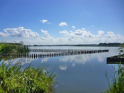
 Vue du lac. | |||
| Administration | |||
|---|---|---|---|
| Pays | Japon | ||
| Préfecture | Chiba | ||
| Villes | Kashiwa, Abiko, Shiroi | ||
| Géographie | |||
| Coordonnées | 35° 51′ 24″ N, 140° 01′ 54″ E | ||
| Superficie | 6,5 km2[1] |
||
| Altitude | 0 m[2] | ||
| Profondeur · Maximale · Moyenne |
3,8 m[1] 0,86 m[1] |
||
| Hydrographie | |||
| Bassin versant | 143,98 km2[1] | ||
| Alimentation | Ōhori River (d) et Ōtsu River (d) | ||
| Durée de rétention | 0,07 année | ||
| Divers | |||
| Site officiel | www.city.abiko.chiba.jp/event/shizennonaka/kouenryokuchi/park/citypark/teganuma.html | ||
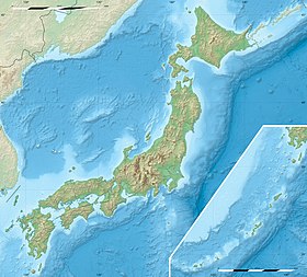
| Géolocalisation sur la carte : Japon
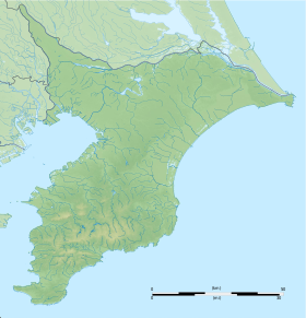
Géolocalisation sur la carte : préfecture de Chiba
| |||
| modifier |
|||
Le lac Tega (手賀沼, Tega-numa) est un lac du Japon, situé dans la préfecture de Chiba, au nord-est de Tokyo.
Géographie
[modifier | modifier le code]Situation
[modifier | modifier le code]Le lac Tega est entièrement situé dans le nord-ouest de la préfecture de Chiba, sur l'île principale de l'archipel japonais, Honshū. À vol d'oiseau, il se trouve à environ 21,5 km au nord de la baie de Tokyo, et 32 km au nord-est de l'agglomération de Tokyo.
Topographie
[modifier | modifier le code]Le lac Tega a une superficie totale de 6,5 km2 pour un périmètre de 38 km[1],[3]. Sa profondeur moyenne est de 0,86 m et sa profondeur maximale de 3,8 m[1],[3]. Il a la particularité d'être composé de deux étendues d'eau : le lac (principal) Tega et le lac Shimotega[4] (1,5 km2), reliées par la rivière Tega[5], un cours d'eau du bassin versant du fleuve Tone[3],[2].
Faune et flore
[modifier | modifier le code]Faune
[modifier | modifier le code]Le lac Tega abrite de nombreuses variétés d'oiseaux en toute saison[6].
Flore
[modifier | modifier le code]Notes et références
[modifier | modifier le code]- (ja) Mairie d'Abiko (trad. Présentation du lac Tega), « 手賀沼の概要 »(Archive.org • Wikiwix • Archive.is • Google • Que faire ?), sur www.city.abiko.chiba.jp, (consulté le ).
- (en) Geospatial Information Authority of Japan, « GSI Maps », sur maps.gsi.go.jp (consulté le ).
- (ja) Préfecture de Chiba, « 手賀沼について » [« À propos du lac Tega »] [PDF], sur pref.chiba.lg.jp, (consulté le ).
- Le lac Shimotega (下手賀沼, Shimotega-numa).
- La rivière Tega (手賀川, Tega-gawa).
- (en) Mairie d'Abiko (trad. Exposition permanente du musée des oiseaux d'Abiko), « Permanent exhibition of Abiko City Museum of Birds », sur city.abiko.chiba.jp, (consulté le ).
Voir aussi
[modifier | modifier le code]Articles connexes
[modifier | modifier le code]Text is available under the CC BY-SA 4.0 license; additional terms may apply.
Images, videos and audio are available under their respective licenses.


